Fryent Country Park
Fryent Country Park together with Barn Hill Open Space is a large park situated in the north of the London Borough of Brent. It covers 103 hectares (254 acres) [1] of rolling fields and small woods.
Fryent is also a ward of the London Borough of Brent. Its population at the 2011 Census was 13,445.[2]
Significant features
Barn Hill in the south-west of the park is a wooded hill that rises to 86m. A fish pond is found at the top of the Hill. Numerous other ponds can be seen in the rest of the park. Gotfords Hill (63m) and Beane Hill (65m) are other high points in the park. Parallel to Fryent Way is an ancient track known as Hell Lane or Eldestrete which may date back to Saxon times or earlier.[3]
Wildlife
The woodland comprises French oak, hornbeam, elm, ash and some fruit trees which also occur in the hedges along with blackthorn. The park is considered the best surviving example of Middlesex countryside in the Brent basin and has a population of the nationally rare plant the narrow-leaved bitter-cress (Cardamine impatiens).[4]
History
Barn Hill called Bardonhill in 1547 was landscaped by Humphry Repton in 1792 as part of a local landowner’s country park.[5] The Fryent Park hay meadows are small remnants of two manors one originally in the ownership of King Edward the Confessor.[6]
Access
The park is bisected by the A4140 Fryent Way that links Kingsbury with Wembley. A car park is available halfway down this road. The nearest underground is at Kingsbury Station on the Jubilee line. The 206 bus terminates a short distance from the park. The Capital Ring footpath crosses the site. However, the road Fryent Way, linking Kingsbury Circle and Salmon Street lacks a much needed bus service to transport residents and students alike around the area. The Barn Hill Open Area, or at least the summit of it, is nearer Wembley Park Station.
Awards
Fryent Country Park was awarded a Green Flag Award in 2010/2011 for being a well-managed park or open space.[7] The Green Flag Award scheme is the benchmark national standard for parks and green spaces in England and Wales.[8] It is also a Local Nature Reserve.[9][10]
In 2014 London in Bloom awarded the park a silver gilt award in its Country Park of the Year category.[11]
Sport
The Liddiard Cup cross country race is annually staged here in late October.
Gallery
 Path in woods
 Barn Hill Pond
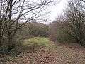 Clearing
 View north from Gotfords Hill
 View of Wembley Stadium from Barn Hill
Bibliography
Ordnance Survey. (2006). No. 173 Explorer Map: London North. Southampton: Ordnance Survey.
Snow, Len. (1990). Brent, Wembley, Willesden and Kingsbury: A pictorial history. Chichester: Phillimore & Co Ltd.
| Wikimedia Commons has media related to Fryent Country Park. |
References
- ↑ Brent Council. (2007). Fryent Country Park. Details Archived September 29, 2007, at the Wayback Machine.
- ↑ "Brent Ward population 2011". Neighbourhood Statistics. Office for National Statistics. Retrieved 20 October 2016.
- ↑ Article on Hell Lane
- ↑ Management Plan by Brent Council Archived May 13, 2006, at the Wayback Machine.
- ↑ Details of history of Barn Hill by Brent Council [Accessed 3 August 2007]. Archived September 27, 2007, at the Wayback Machine.
- ↑ Philip Grant (2004). “The hay meadows of Kingsbury: a look at their history”. Article prepared for Brent Archive.
- ↑ Fryent Country Park. Archived November 21, 2011, at the Wayback Machine.
- ↑ Green Flag.
- ↑ "Fryent Country Park". Local Nature Reserves. Natural England. 5 March 2013. Retrieved 22 January 2014.
- ↑ "Map of Fryent Country Park". Local Nature Reserves. Natural England. Retrieved 22 January 2014.
- ↑
External links
- "Fryent Country Park". Greenspace Information for Greater London. 2013.
- Brent Council's local management plan
- Barn Hill Conservation Group’s website
- Barn Hill Conservation Group’s 2007 management programme
| Royal parks |  | |
|---|---|---|
| Large urban parks |
| |
| Country parks | ||
| Commons | ||
| Marshes & Wetlands | ||
| Woodland | ||
| House gardens |
| |
| Entry-fee charging | ||
| Community gardens |
| |
| Districts |  | |
|---|---|---|
| Attractions |
| |
| Parks and open spaces |
| |
| Constituencies | ||
| Tube and rail stations |
| |
| Other topics | ||
Coordinates: 51°34′41″N 0°16′26″W / 51.578°N 0.274°W