Frontenac, Minnesota


Frontenac is an unincorporated community and census-designated place (CDP) in Florence Township, Goodhue County, Minnesota, United States, on the Mississippi River. As of the 2010 census, its population was 282.[5]
History
James Wells established a trading post in the location that would become Frontenac before 1850. He dealt mostly with Native Americans until the railroad was built in the early 1870s. In 1854, the Garrard brothers came upon the area during a hunting trip and bought large tracts of land. By 1857, the community was permanently established with the name of Westervelt in 1855 to honor the then postmaster, Evert V. Westervelt.[6]
The name was changed to Frontenac in 1860 by the Garrard brothers after Frenchman, Louis de Buade de Frontenac, who was born in 1622. He was the French colonial governor of Canada in 1672–82 and 1689–98. He died in Quebec, Canada on November 28, 1698. There is not a record of him actually traveling to the Mississippi River.[6]
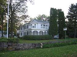
Frontenac housed a station of the Chicago, Milwaukee, St. Paul and Pacific Railroad and the picturesque scenery soon began attracting wealthy residents. It became a community of summer homes with lakeside views.[6] The railway line outside the community ran from north to south, connected the remote area with larger cities, but it was far enough away from the bluffs not to detract from the vacation destination. There are actually two communities that comprise Frontenac. The railway line attracted some residents, while the bluffs attracted others. The houses along the railway line, and later the highway, became known as Frontenac Station while the bluff residences are called Old Frontenac. Both are in Florence Township and are listed as one location in the U.S. Census.[6]
Attractions

Mount Frontenac Ski and Golf
The Mount Frontenac Ski Resort was located on the north-western edge of Frontenac Station. It had 17 named runs, 6 lifts, and 80 acres (320,000 m2) of skiable area. Its longest run was 4,000 feet (1,200 m) in length.[7] The ski runs have been closed and are now part of an 18 hole golf course.[8]
Frontenac State Park
The land between Frontenac Station and Old Frontenac, as well as much of the land to the north and some to the south, was set aside as a State Park in 1957. Frontenac State Park includes the floodplain along the Mississippi River, bluffs which are a flyway for many migratory bird species, prairies and hardwood forests. It is within the Mississippi Flyway and is also part of the Driftless Area of the north central United States.
Geography
According to the United States Census Bureau, Frontenac has an area of 1.846 miles (2.971 km); 1.844 miles (2.968 km) of this is land, and 0.002 miles (0.0032 km) is water.[2]
Demographics
At the census[5] of 2000, there were 282 people in 114 households in Frontenac.
Transportation
Frontenac is located along U.S. Highway 61, which also carries U.S. Highway 63 at that point.
Rail lines run parallel to the highway, but there is no longer a station in Frontenac.
The Frontenac Airport is located 1 mi (1.6 km) south of Frontenac Station, and is administered by a private agency.[9]
Notable people
- John F. Hager, Wisconsin State Assemblyman and businessman, was born in Frontenac.[10]
See also
- Frontenac State Park
- Minnesota Historical Society
- National Register of Historic Places (Goodhue County)
References
- 1 2 Thomas Lutz (March 21, 1973). "National Register of Historic Places Inventory — Nomination Form: Old Frontenac Historic District" (PDF). National Park Service. Retrieved 2015-04-20. Photos
- 1 2 "US Gazetteer files: 2010, 2000, and 1990". United States Census Bureau. 2011-02-12. Retrieved 2011-04-23.
- ↑ "Frontenac, Minnesota". Geographic Names Information System. United States Geological Survey.
- ↑ National Park Service (2010-07-09). "National Register Information System". National Register of Historic Places. National Park Service.
- 1 2 "American FactFinder". United States Census Bureau. Retrieved 2011-05-14.
- 1 2 3 4 Minnesota Historical Society, Minnesota Place Names database, June 2009.
- ↑ Mount Frontenac Ski and Snowboard Area. SkiEngine.com. Retrieved on 2009-6-16.
- ↑ Mount Frontenac Golf Course-official site. Retrieved on 2009-6-16.
- ↑ U.S. Geological Survey Geographic Names Information System: Frontenac Airport (Minnesota)
- ↑ 'john F. Hager, 82, Former Assemblyman, Dies in Whitehall,' Eau Claire Leader, November 4, 1955, pg. 3
Municipalities and communities of Goodhue County, Minnesota, United States | ||
|---|---|---|
| Cities | 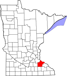 | |
| Townships | ||
| CDP | ||
| Unincorporated communities | ||
| Indian reservation | ||
| Footnotes | ‡This populated place also has portions in an adjacent county or counties | |
| Topics | |
|---|---|
| Lists by states |
|
| Lists by insular areas | |
| Lists by associated states | |
| Other areas | |
| |