Froland
| Froland kommune | |||
|---|---|---|---|
| Municipality | |||
 | |||
| |||
 Froland within Aust-Agder | |||
| Coordinates: 58°34′59″N 8°34′20″E / 58.58306°N 8.57222°ECoordinates: 58°34′59″N 8°34′20″E / 58.58306°N 8.57222°E | |||
| Country | Norway | ||
| County | Aust-Agder | ||
| District | Sørlandet | ||
| Administrative centre | Blakstad | ||
| Government | |||
| • Mayor (2003) | Sigmund Pedersen (Sp) | ||
| Area | |||
| • Total | 644.56 km2 (248.87 sq mi) | ||
| • Land | 604.93 km2 (233.56 sq mi) | ||
| • Water | 39.63 km2 (15.30 sq mi) | ||
| Area rank | 171 in Norway | ||
| Population (2010) | |||
| • Total | 5,002 | ||
| • Rank | 202 in Norway | ||
| • Density | 8.3/km2 (21/sq mi) | ||
| • Change (10 years) | 11.2 % | ||
| Demonym(s) | Frolending[1] | ||
| Time zone | CET (UTC+1) | ||
| • Summer (DST) | CEST (UTC+2) | ||
| ISO 3166 code | NO-0919 | ||
| Official language form | Neutral | ||
| Website |
www | ||
|
| |||


Froland is a municipality in Aust-Agder county, Norway. It is part of the traditional region of Sørlandet. The administrative center is the village of Blakstad, which along with Osedalen form the main population center of the municipality.
General information
The municipality of Froland was established when it was separated from the municipality of Øyestad in 1850. The new municipality had an initial population of 1,976. On 1 January 1967, the neighboring municipality of Mykland (population: 604) was merged into the municipality of Froland. The newly enlarged municipality had a population of 3,372. On 1 January 1968, the Flateland area of neighboring Åmli municipality (population: 6) was transferred to Froland.
On 1 January 1970, the two uninhabited areas of Neset and Råbudal were separated from Froland and transferred to neighboring Birkenes. Then on 1 January 1979, the uninhabited Landheia area was transferred from Froland to Birkenes municipality. On 1 January 1991, the Dalen area in Birkenes municipality (population: 60) was transferred from Birkenes to Froland municipality.[2]
Name
The municipality (originally the parish) is named after the old Froland farm (Old Norse: Fróðaland), since the first church was built there. The first element is the genitive case of the male name Fróði and the last element is land which means "land" or "farm".[3]
Coat-of-arms
The coat-of-arms is from modern times. They were granted on 17 January 1986. The arms show a squirrel as a symbol for the forests and wildlife in the municipality.[4]
History
The iron production facility, Frolands verk, was founded in 1763 and continued in production through 1867. After that the facility became a sawmill. Today the main building from 1791 is a historically protected building, and the old stables are used as a cultural center.
Geography
The municipality is bordered on the north by the municipality of Åmli, on the east by Tvedestrand, on the south by Arendal, Grimstad and Birkenes, on the west by Evje og Hornnes and Bygland.
There are many lakes in Froland, including Homstølvatnet, Nelaug, Nystølfjorden, and Uldalsåna.
Transportation
Arendalsbanen railway, from Nelaug to Arendal connects Froland and Arendal to the railway system in Norway. Froland Station is located in the village of Froland. There is also a station in Bøylestad village.
Notable residents
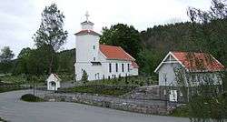
- Niels Henrik Abel, a well-known 19th century mathematician, died here in April 1829 and is buried at Froland cemetery.
References
- ↑ "Navn på steder og personer: Innbyggjarnamn" (in Norwegian). Språkrådet. Retrieved 2015-12-01.
- ↑ Jukvam, Dag (1999). "Historisk oversikt over endringer i kommune- og fylkesinndelingen" (PDF) (in Norwegian). Statistisk sentralbyrå.
- ↑ Rygh, Oluf (1905). Norske gaardnavne: Nedenes amt (in Norwegian) (8 ed.). Kristiania, Norge: W. C. Fabritius & sønners bogtrikkeri. p. 77.
- ↑ Norske Kommunevåpen (1990). "Nye kommunevåbener i Norden". Retrieved 2008-10-03.
External links
| Wikimedia Commons has media related to Froland. |
| Look up Froland in Wiktionary, the free dictionary. |
- Municipal fact sheet from Statistics Norway
 Aust-Agder travel guide from Wikivoyage
- Arendals fossekompani (Norwegian)
- Froland.org (Norwegian)
- Municipal website (Norwegian)
- Froland Curlingklubb (Norwegian)