Fredericktown, Ohio
| Fredericktown, Ohio | |
|---|---|
| Village | |
|
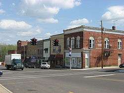
Main Street in the business district | |
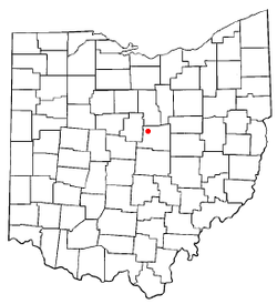 Location of Fredericktown in Ohio | |
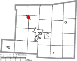 Location of Fredericktown in Knox County | |
| Coordinates: 40°28′47″N 82°33′43″W / 40.47972°N 82.56194°WCoordinates: 40°28′47″N 82°33′43″W / 40.47972°N 82.56194°W | |
| Country | United States |
| State | Ohio |
| County | Knox |
| Government | |
| • Mayor | Jerry Day |
| Area[1] | |
| • Total | 2.07 sq mi (5.36 km2) |
| • Land | 1.97 sq mi (5.10 km2) |
| • Water | 0.10 sq mi (0.26 km2) |
| Elevation | 1,090 ft (332.2 m) |
| Population (2010)[2] | |
| • Total | 2,493 |
| • Estimate (2012[3]) | 2,476 |
| • Density | 1,265.5/sq mi (488.6/km2) |
| Time zone | EST (UTC-5) |
| • Summer (DST) | EDT (UTC-4) |
| ZIP code | 43019 |
| Area code(s) | 740 |
| FIPS code | 39-28658[4] |
| GNIS feature ID | 1064680[5] |
| Website | http://www.fredericktownohio.net |


Fredericktown is a village in Knox County, Ohio, United States. The population was 2,493 at the 2010 census.
History
Fredericktown was platted in 1807, and named after Frederick, Maryland, the native home of a first settler.[6]
Geography
Fredericktown is located at 40°28′47″N 82°33′43″W / 40.47972°N 82.56194°W.
According to the United States Census Bureau, the village has a total area of 2.07 square miles (5.36 km2), of which 1.97 square miles (5.10 km2) is land and 0.10 square miles (0.26 km2) is water.[1]
The city is in the Fredericktown Community Fire District.
Demographics
| Historical population | |||
|---|---|---|---|
| Census | Pop. | %± | |
| 1830 | 161 | — | |
| 1840 | 444 | 175.8% | |
| 1850 | 712 | 60.4% | |
| 1860 | 775 | 8.8% | |
| 1870 | 690 | −11.0% | |
| 1880 | 850 | 23.2% | |
| 1890 | 847 | −0.4% | |
| 1900 | 890 | 5.1% | |
| 1910 | 1,021 | 14.7% | |
| 1920 | 1,194 | 16.9% | |
| 1930 | 1,257 | 5.3% | |
| 1940 | 1,297 | 3.2% | |
| 1950 | 1,467 | 13.1% | |
| 1960 | 1,531 | 4.4% | |
| 1970 | 1,935 | 26.4% | |
| 1980 | 2,299 | 18.8% | |
| 1990 | 2,443 | 6.3% | |
| 2000 | 2,428 | −0.6% | |
| 2010 | 2,493 | 2.7% | |
| Est. 2015 | 2,488 | [7] | −0.2% |
2010 census
As of the census[2] of 2010, there were 2,493 people, 1,050 households, and 691 families residing in the village. The population density was 1,265.5 inhabitants per square mile (488.6/km2). There were 1,133 housing units at an average density of 575.1 per square mile (222.0/km2). The racial makeup of the village was 98.0% White, 0.4% African American, 0.2% Native American, 0.3% from other races, and 1.0% from two or more races. Hispanic or Latino of any race were 0.9% of the population.
There were 1,050 households of which 33.8% had children under the age of 18 living with them, 48.0% were married couples living together, 12.8% had a female householder with no husband present, 5.0% had a male householder with no wife present, and 34.2% were non-families. 29.4% of all households were made up of individuals and 12.7% had someone living alone who was 65 years of age or older. The average household size was 2.37 and the average family size was 2.91.
The median age in the village was 37.6 years. 25.8% of residents were under the age of 18; 7.3% were between the ages of 18 and 24; 26.9% were from 25 to 44; 24.6% were from 45 to 64; and 15.4% were 65 years of age or older. The gender makeup of the village was 48.7% male and 51.3% female.
2000 census
As of the census[4] of 2000, there were 2,428 people, 1,021 households, and 681 families residing in the village. The population density was 1,719.3 people per square mile (664.9/km²). There were 1,103 housing units at an average density of 781.1 per square mile (302.0/km²). The racial makeup of the village was 98.64% White, 0.29% African American, 0.08% Native American, 0.08% Asian, 0.12% from other races, and 0.78% from two or more races. Hispanic or Latino of any race were 0.41% of the population.
There were 1,021 households out of which 32.7% had children under the age of 18 living with them, 52.3% were married couples living together, 9.8% had a female householder with no husband present, and 33.3% were non-families. 30.0% of all households were made up of individuals and 14.0% had someone living alone who was 65 years of age or older. The average household size was 2.38 and the average family size was 2.94.
In the village the population was spread out with 25.7% under the age of 18, 9.6% from 18 to 24, 28.8% from 25 to 44, 22.0% from 45 to 64, and 14.0% who were 65 years of age or older. The median age was 36 years. For every 100 females there were 94.1 males. For every 100 females age 18 and over, there were 87.6 males.
The median income for a household in the village was $36,354, and the median income for a family was $45,345. Males had a median income of $34,028 versus $21,858 for females. The per capita income for the village was $19,138. About 5.7% of families and 7.1% of the population were below the poverty line, including 9.2% of those under age 18 and 9.2% of those age 65 or over.
Events
Fredericktown hosts the annual street fair called the 'Tomato Show', typically on the first weekend in September. Major events include the Baby Crawl Contest, Bathtub Races, Little Miss Tomato Contest, Pedal Tractor Pulls, five-mile run, and more. An event put on annually by the Fredericktown Parks and Recreation District at Community Park, is the Fourth of July festival. This event consists of children's rides, free swimming at Sockman Lake, a softball tournament and fireworks.
Transportation
Fredericktown is at the junction of State Routes 13 and 95, which travel north-south and east-west respectively.
The nearest major airport is Port Columbus International Airport about 54 miles south, in Columbus.
Notable people
- Clarence Dill, served two terms in each house of Congress.[9]
- Luke Perry, popular actor from "Beverly Hills 90210" TV drama series & many movies.
- Ollie Cline, played professional football as a fullback with the Cleveland Browns, Detroit Lions in the 1940s & 1950's & starred as a collegiate player with the Ohio State University.
- Webb C. Ball, developed the Ball Watch Company related to the need for accurate scheduling for trains & is credited with the origin of the saying to "Keep on the Ball."
References
- 1 2 "US Gazetteer files 2010". United States Census Bureau. Retrieved 2013-01-06.
- 1 2 "American FactFinder". United States Census Bureau. Retrieved 2013-01-06.
- ↑ "Population Estimates". United States Census Bureau. Retrieved 2013-06-17.
- 1 2 "American FactFinder". United States Census Bureau. Retrieved 2008-01-31.
- ↑ "US Board on Geographic Names". United States Geological Survey. 2007-10-25. Retrieved 2008-01-31.
- ↑ Overman, William Daniel (1958). Ohio Town Names. Akron, OH: Atlantic Press. p. 47.
- ↑ "Annual Estimates of the Resident Population for Incorporated Places: April 1, 2010 to July 1, 2015". Retrieved July 2, 2016.
- ↑ "Census of Population and Housing". Census.gov. Retrieved June 4, 2015.
- ↑ Baby senator is old timer in experience
External links
- Fredericktown Community Portal
- Fredericktown Village Government
- Fredericktown Schools
- Fredericktown Community Fire District
- Fredericktown Historical Society
Municipalities and communities of Knox County, Ohio, United States | ||
|---|---|---|
| City |  | |
| Villages | ||
| Townships | ||
| CDPs | ||
| Unincorporated communities | ||
| Ghost town | ||
| Footnotes | ‡This populated place also has portions in an adjacent county or counties | |