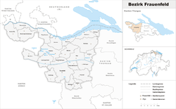
Frauenfeld District
| Frauenfeld District Bezirk Frauenfeld | |
|---|---|
| District | |
 | |
| Country |
|
| Canton |
|
| Capital | Frauenfeld |
| Area | |
| • Total | 279.6 km2 (108.0 sq mi) |
| Population (2015) | |
| • Total | 65,673 |
| • Density | 230/km2 (610/sq mi) |
| Time zone | CET (UTC+1) |
| • Summer (DST) | CEST (UTC+2) |
| Municipalities | 23 |
Frauenfeld District is one of the five districts of the canton of Thurgau, Switzerland. It has a population of 65,673 (as of 31 December 2015).[1] Its capital, and the capital of Thurgau, is the city of Frauenfeld.
The district contains the following municipalities:
| Coat of arms | Municipality | Population (31 December 2015)[2] |
Area km²[3] |
|---|---|---|---|
| | Basadingen-Schlattingen | 1,828 | 15.7 |
| | Berlingen | 861 | 4.0 |
| | Diessenhofen | 3,676 | 10.0 |
| | Eschenz | 1,725 | 12.0 |
| | Felben-Wellhausen | 2,691 | 7.3 |
| | Frauenfeld | 24,864 | 27.4 |
| | Gachnang | 3,984 | 9.7 |
| | Herdern | 1,020 | 13.7 |
| | Homburg | 1,512 | 24.1 |
| | Hüttlingen | 830 | 11.6 |
| | Hüttwilen | 1,669 | 17.6 |
| | Mammern | 626 | 5.5 |
| | Matzingen | 2,631 | 7.7 |
| | Müllheim | 2,884 | 8.7 |
| | Neunforn | 963 | 11.4 |
| | Pfyn | 1,941 | 13.0 |
| | Schlatt TG | 1,652 | 15.5 |
| | Steckborn | 3,726 | 8.8 |
| | Stettfurt | 1,164 | 6.4 |
| | Thundorf | 1,424 | 15.6 |
| | Uesslingen-Buch | 1,086 | 14.0 |
| | Wagenhausen | 1,674 | 11.2 |
| | Warth-Weiningen | 1,242 | 8.3 |
| Total (23) | 65,673 | 279.6 |
References
- ↑ Swiss Federal Statistical Office - STAT-TAB, online database – Ständige und nichtständige Wohnbevölkerung nach institutionellen Gliederungen, Geburtsort und Staatsangehörigkeit (German) accessed 30 August 2016
- ↑ Swiss Federal Statistical Office - STAT-TAB, online database – Ständige und nichtständige Wohnbevölkerung nach institutionellen Gliederungen, Geburtsort und Staatsangehörigkeit (German) accessed 30 August 2016
- ↑ Swiss Federal Statistical Office-Land Use Statistics 2009 data (German) accessed 25 March 2010
Coordinates: 47°33′N 8°53′E / 47.550°N 8.883°E
This article is issued from Wikipedia - version of the 1/4/2015. The text is available under the Creative Commons Attribution/Share Alike but additional terms may apply for the media files.