Franklin, Louisiana
| Franklin, Louisiana | |
| City | |
 Historic lampposts lining Franklin's Main Street | |
| Country | United States |
|---|---|
| State | Louisiana |
| Parish | St. Mary |
| Elevation | 10 ft (3.0 m) |
| Coordinates | 29°47′30″N 91°30′30″W / 29.79167°N 91.50833°WCoordinates: 29°47′30″N 91°30′30″W / 29.79167°N 91.50833°W |
| Area | 27.2 km2 (10.5 sq mi) |
| - land | 25.7 km2 (9.9 sq mi) |
| - water | 1.5 km2 (0.6 sq mi), 5.51% |
| Population | 7,660 (2010) |
| Density | 298.1/km2 (772.1/sq mi) |
| Incorporated | 1820 |
| Mayor | Raymond Harris, Jr. (No party) |
| Timezone | CST (UTC-6) |
| - summer (DST) | CDT (UTC-5) |
| ZIP code | 70538 |
| Area code | 337 |
 Location of Franklin in Louisiana | |
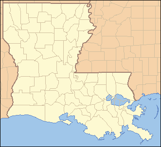
 Location of Louisiana in the United States | |
| Website: www | |
Franklin is a small city in and the parish seat of St. Mary Parish, Louisiana, United States.[1] The population was 7,660 at the 2010 census.[2] It is part of the Morgan City Micropolitan Statistical Area.
History
Franklin, named for Benjamin Franklin, was founded in 1808 as Carlin's Settlement, and became the parish seat in 1811. The town was incorporated in 1820.[3] Though early settlers included French, Acadian, German, Danish and Irish, the town's culture and architecture is heavily influenced by the unusually large numbers of English that chose to settle there after the Louisiana Purchase in 1803. Numerous large sugar plantations arose in the area, and with the development of steamboating, Franklin became an interior sugar port. Franklin's First United Methodist Church was established in 1806, making it the first Protestant church established in the state of Louisiana.
Sugar plantations
By the 1830s, Bayou Teche was the main street of Acadiana, with one plantation after another. The area's sugar cane planters were among the South's wealthiest agriculturists. This is reflected in the grand plantation homes and mansions they built in Franklin and the surrounding countryside. Most of these magnificent structures are still standing and well preserved, giving Franklin its unique architectural flavor. Franklin's Historic District is listed in the National Register of Historic Places and encompasses over 420 notable structures.[4]
Civil War
During the Civil War, the Battle of Irish Bend, also known as Nerson's Woods, was fought near Franklin on April 14, 1863. Though eventually forced to retreat, the badly outnumbered Confederate forces commanded by General Richard Taylor cost the Union troops, under General Cuvier Grover, significant losses. Four hundred men were killed or wounded in the confrontation, including Confederate Colonel James Reily, a factor in halting the Union drive to invade Texas.[4][5]
Geography
Franklin is located at 29°47′30″N 91°30′30″W / 29.79167°N 91.50833°W (29.791759, -91.508253)[6] and has an elevation of 10 feet (3.0 m).[7]
According to the United States Census Bureau, the city has a total area of 10.5 square miles (27.2 km2), of which 9.9 square miles (25.7 km2) is land and 0.58 square miles (1.5 km2), or 5.44%, is water.[2]
Demographics
| Historical population | |||
|---|---|---|---|
| Census | Pop. | %± | |
| 1850 | 891 | — | |
| 1870 | 1,265 | — | |
| 1880 | 1,702 | 34.5% | |
| 1890 | 2,127 | 25.0% | |
| 1900 | 2,692 | 26.6% | |
| 1910 | 3,857 | 43.3% | |
| 1920 | 3,504 | −9.2% | |
| 1930 | 3,271 | −6.6% | |
| 1940 | 4,274 | 30.7% | |
| 1950 | 6,144 | 43.8% | |
| 1960 | 8,673 | 41.2% | |
| 1970 | 9,325 | 7.5% | |
| 1980 | 9,584 | 2.8% | |
| 1990 | 9,004 | −6.1% | |
| 2000 | 8,354 | −7.2% | |
| 2010 | 7,660 | −8.3% | |
| Est. 2015 | 7,302 | [8] | −4.7% |
As of the census[10] of 2000, there were 8,354 people, 3,026 households, and 2,181 families residing in the city. The population density was 806.5 people per square mile (311.3/km²). There were 3,352 housing units at an average density of 323.6 per square mile (124.9/km²). The racial makeup of the city was 47.47% White, 50.00% African American, 0.63% Native American, 0.31% Asian, 0.30% from other races, and 1.28% from two or more races. Hispanic or Latino of any race were 0.79% of the population.
There were 3,026 households out of which 36.0% had children under the age of 18 living with them, 44.5% were married couples living together, 22.1% had a female householder with no husband present, and 27.9% were non-families. 25.1% of all households were made up of individuals and 11.5% had someone living alone who was 65 years of age or older. The average household size was 2.72 and the average family size was 3.26.
In the city the population was spread out with 30.4% under the age of 18, 8.0% from 18 to 24, 26.4% from 25 to 44, 21.8% from 45 to 64, and 13.4% who were 65 years of age or older. The median age was 35 years, more than a year older than the statewide median age of 34.0 years. For every 100 females there were 81.7 males. For every 100 females age 18 and over, there were 77.6 males.
The median income for a household in the city was $24,844, and the median income for a family was $30,625. Males had a median income of $32,188 versus $16,935 for females. The per capita income for the city was $12,943. About 24.5% of families and 27.6% of the population were below the poverty line, including 41.6% of those under age 18 and 15.6% of those age 65 or over.
Education
St. Mary Parish School Board operates public schools: Elementary schools:
- W. P. Foster Elementary School
- J. A. Hernandez Elementary School
- LaGrange Elementary School
Secondary schools:
- Franklin Junior High School
- Franklin Senior High School
Notable people
- Robert Angers, publisher of the Franklin Banner-Tribune and founder of Acadiana Profile magazine
- C. C. Aycock, the only three-term Lieutenant governor in modern Louisiana history; former Speaker of the Louisiana House of Representatives
- Joshua Baker, Governor of Louisiana 1868
- Spencer G. Todd, Sr., member, Louisiana House of Representatives, 1964-1966 (died in office)
- Carl W. Bauer, Member of the Louisiana House of Representatives from 1967 to 1972 and of the Louisiana State Senate from 1972 to 1976
- Margaret D. Bauer, author and professor, editor of the North Carolina Literary Review
- Ralph Norman Bauer, Speaker of the Louisiana House of Representatives from 1940 to 1948; leader of the impeachment forces in 1929 against Governor Huey Pierce, Long, Jr.
- Donelson Caffery, Louisiana State Senator, United States Senator, lieutenant in the Confederate Army
- Patrick T. Caffery, Louisiana State Representative and United States Representative grandson of Donelson Caffery
- Murphy J. Foster, Governor of Louisiana from 1892 to 1900, also a U.S. Senator
- Murphy J. Foster, Jr., Governor of Louisiana from 1996 to 2004; former member of the Louisiana State Senate
- Wallace Francis, football player, wide receiver for the Buffalo Bills and the Atlanta Falcons
- Henry Johnson, Governor of Louisiana from 1824 to 1828, also District Judge for St. Mary Parish 1811
- Sam S. Jones, state representative for St. Mary Parish since 2008
- Ernie Ladd, football player for Grambling University under Eddie Robinson, professional career San Diego Chargers, Houston Oilers and Super Bowl Champion Kansas City Chiefs (1970); professional wrestler known as "The Big Cat"
- Alvan Lafargue, Louisiana physician and politician, practiced medicine briefly in Franklin prior to 1915.[11]
- Leonard Marshall, football player for the New York Giants
- Rick Norwood, mathematician and comic book publisher
- Alexander Porter (June 24, 1785 – January 13, 1844) was an attorney, politician, and planter in St. Mary Parish who served as U.S. Senator from 1833 to 1837. He had served a term in the Louisiana House from 1816 to 1818, and on the Louisiana Supreme Court from 1821 to 1833. He built Oaklawn Manor.
- Ned Romero, actor
- Percy Saint, district attorney, state representative, judge, and Attorney General of Louisiana from 1924 to 1932
- Jared Y. Sanders, Jr., politician from Baton Rouge, born in Franklin in 1892 and only child of Governor Jared Y. Sanders, Sr.
- Jared Y. Sanders, Sr., Governor of Louisiana from 1908 to 1912
- Gaston J. Sigur, Jr., Assistant Secretary of State for East Asian and Pacific Affairs under the Reagan Administration
- Jerome Bonaparte "Black Jack" Ward, actor who appeared in over 140 Cowboy movies from 1927 to 1946
- Warren Wells, Pro football player for the Detroit Lions and Oakland Raiders
Theatre
Teche Theater (founded 1939 as a cinema and revamped for live theatre in 1993):
- Earl Long in Purgatory (2004) (John "Spud" McConnell)
- Driving Miss Daisy (2005) (Diane Wiltz, Tyra Yarber,and Ed "Tiger" Verdin)
- A Soldier's Play (2006) (Tyra Yarber, Ed "Tiger Verdin and Averis Anderson)
- Fiddler on the Roof (2006) (Larry Deslatte and Allison Jones)
- November (2009) (Ed "Tiger" Verdin and Ricky Pellerin)
Movies (filmed in the area)
- Easy Rider (1969)
- The Drowning Pool (1975)
- All the King's Men (2006)
| Wikimedia Commons has media related to Franklin, Louisiana. |
References
- ↑ "Find a County". National Association of Counties. Retrieved 2011-06-07.
- 1 2 "Geographic Identifiers: 2010 Demographic Profile Data (G001): Franklin city, Louisiana". U.S. Census Bureau, American Factfinder. Retrieved March 29, 2013.
- ↑ Louisiana Department of Culture, Recreation and Tourism. "Franklin Historical Marker".
- 1 2 www.franklin-la.org "Welcome to the City of Franklin"
- ↑ John D. Winters, The Civil War in Louisiana, Baton Rouge: Louisiana State University Press, 1963, ISBN 0-8071-0834-0, p. 229
- ↑ "US Gazetteer files: 2010, 2000, and 1990". United States Census Bureau. 2011-02-12. Retrieved 2011-04-23.
- ↑ "US Board on Geographic Names". United States Geological Survey. 2007-10-25. Retrieved 2008-01-31.
- ↑ "Annual Estimates of the Resident Population for Incorporated Places: April 1, 2010 to July 1, 2015". Retrieved July 2, 2016.
- ↑ "Census of Population and Housing". Census.gov. Retrieved June 4, 2015.
- ↑ "American FactFinder". United States Census Bureau. Retrieved 2008-01-31.
- ↑ "Lafargue, Alvan Henry". Louisiana Historical Association, A Dictionary of Louisiana Biography. Retrieved February 17, 2011.
External links
Municipalities and communities of St. Mary Parish, Louisiana, United States | ||
|---|---|---|
| Cities | 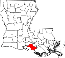 | |
| Towns | ||
| CDPs | ||
| Other unincorporated communities |
| |
| Footnotes | ‡This populated place also has portions in an adjacent parish or parishes | |