Frankfort Township, Franklin County, Illinois
| Frankfort Township | |
|---|---|
| Township | |
 Location in Franklin County | |
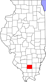 Franklin County's location in Illinois | |
| Coordinates: 37°54′07″N 88°52′09″W / 37.90194°N 88.86917°WCoordinates: 37°54′07″N 88°52′09″W / 37.90194°N 88.86917°W | |
| Country | United States |
| State | Illinois |
| County | Franklin |
| Established | November 4, 1884 |
| Area | |
| • Total | 36.9 sq mi (96 km2) |
| • Land | 36.46 sq mi (94.4 km2) |
| • Water | 0.45 sq mi (1.2 km2) 1.22% |
| Elevation | 387 ft (118 m) |
| Population (2010) | |
| • Total | 7,029 |
| • Density | 192.8/sq mi (74.4/km2) |
| Time zone | CST (UTC-6) |
| • Summer (DST) | CDT (UTC-5) |
| ZIP codes | 62812, 62890, 62896 |
| GNIS feature ID | 0429023 |
Frankfort Township is one of twelve townships in Franklin County, Illinois, USA. As of the 2010 census, its population was 7,029 and it contained 3,362 housing units.[1]
Geography
According to the 2010 census, the township has a total area of 36.9 square miles (96 km2), of which 36.46 square miles (94.4 km2) (or 98.81%) is land and 0.45 square miles (1.2 km2) (or 1.22%) is water.[1]
Cities, towns, villages
- West Frankfort (east half)
Unincorporated towns
(This list is based on USGS data and may include former settlements.)
Extinct towns
- Greenville
Cemeteries
The township contains these thirteen cemeteries: Bonner, Clayton, County, Crawford, Joplin, Lithuanian, Melvin, Neal, Neal, Oddfellow, Saint Johns, Tower Height and Trinity.
Major highways
Landmarks
- Frankfort Community Park
School districts
- Frankfort Community Unit School District 168
Political districts
- Illinois' 12th congressional district
- State House District 117
- State Senate District 59
References
- "Frankfort Township, Franklin County, Illinois". Geographic Names Information System. United States Geological Survey. Retrieved 2010-01-16.
- United States Census Bureau 2007 TIGER/Line Shapefiles
- United States National Atlas
- 1 2 "Population, Housing Units, Area, and Density: 2010 - County -- County Subdivision and Place -- 2010 Census Summary File 1". United States Census. Retrieved 2013-05-28.
External links
 |
Browning Township | Benton Township | Eastern Township | |
| Denning Township | |
Cave Township | ||
| ||||
| | ||||
| |
Municipalities and communities of Franklin County, Illinois, United States | ||
|---|---|---|
| Cities | ||
| Villages | ||
| Townships | ||
| CDP | ||
| Other unincorporated communities | ||
This article is issued from Wikipedia - version of the 12/1/2013. The text is available under the Creative Commons Attribution/Share Alike but additional terms may apply for the media files.