Fort Bridger, Wyoming
| Fort Bridger, Wyoming | |
|---|---|
| CDP | |
 Location in Uinta County and the state of Wyoming | |
 Fort Bridger, Wyoming Location in the United States | |
| Coordinates: 41°19′7″N 110°23′11″W / 41.31861°N 110.38639°WCoordinates: 41°19′7″N 110°23′11″W / 41.31861°N 110.38639°W | |
| Country | United States |
| State | Wyoming |
| County | Uinta |
| Government | |
| • Mayor | Ray Barnhill |
| Area | |
| • Total | 2.0 sq mi (5.2 km2) |
| • Land | 2.0 sq mi (5.2 km2) |
| • Water | 0.0 sq mi (0.0 km2) |
| Elevation | 6,673 ft (2,034 m) |
| Population (2010) | |
| • Total | 345 |
| • Density | 170/sq mi (66/km2) |
| Time zone | Mountain (MST) (UTC-7) |
| • Summer (DST) | MDT (UTC-6) |
| ZIP code | 82933 |
| Area code(s) | 307 |
| FIPS code | 56-27940[1] |
| GNIS feature ID | 1588631[2] |
Fort Bridger is a census-designated place (CDP) in Uinta County, Wyoming, United States. The population was 345 at the 2010 census.[3] The town takes its name from the eponymous Fort Bridger established in 1842.
History
Fort Bridger, Wyoming was established in 1843 by Jim Bridger and Louis Vasquez. It served as a trading post for those who were traveling westward along the Oregon Trail, as well as LDS Pioneers, the Pony Express, the Lincoln Highway, and the transcontinental railroad. The fort was also commonly used to trade with the local Native Americans.[4]
The fort was not very glamorous, it was even a disappointment to most travelers. It was simply two log cabins about 40 feet in length connected by a fence to hold horses. Most visitors complained about insufficient supplies and it being over priced. They did, however, have a blacksmith’s that many travelers took advantage of.[5]
By 1858, Fort Bridger became a military outpost. Today, Fort Bridger is a historic site. Jim Bridger’s trading post is reconstructed, along with other historic buildings from the military. There is also a museum with gift shops available for visitors. [6]
Geography
Fort Bridger is located at 41°19′7″N 110°23′11″W / 41.31861°N 110.38639°W (41.318716, -110.386418).[7]
According to the United States Census Bureau, the CDP has a total area of 2.0 square miles (5.2 km²), all of it land.
Demographics
As of the census[1] of 2000, there were 400 people, 158 households, and 114 families residing in the CDP. The population density was 200.6 people per square mile (77.6/km²). There were 183 housing units at an average density of 91.8/sq mi (35.5/km²). The racial makeup of the CDP was 97.00% White, 1.25% Native American, 1.25% from other races, and 0.50% from two or more races. Hispanic or Latino of any race were 2.75% of the population.
There were 158 households out of which 34.8% had children under the age of 18 living with them, 56.3% were married couples living together, 10.8% had a female householder with no husband present, and 27.8% were non-families. 24.1% of all households were made up of individuals and 3.8% had someone living alone who was 65 years of age or older. The average household size was 2.53 and the average family size was 2.96.
In the CDP the population was spread out with 28.8% under the age of 18, 7.0% from 18 to 24, 29.0% from 25 to 44, 25.0% from 45 to 64, and 10.3% who were 65 years of age or older. The median age was 35 years. For every 100 females there were 102.0 males. For every 100 females age 18 and over, there were 93.9 males.
The median income for a household in the CDP was $32,031, and the median income for a family was $33,750. Males had a median income of $36,354 versus $17,344 for females. The per capita income for the CDP was $16,662. About 11.6% of families and 11.5% of the population were below the poverty line, including 18.8% of those under age 18 and 5.9% of those age 65 or over.
Education
Public education in the community of Fort Bridger is provided by Uinta County School District #4. The district operates four campuses - Mountain View Elementary School (grades K-2), Fort Bridger Elementary School (grades 3-4), Mountain View Middle School (grades 5-8), and Mountain View High School (grades 9-12).
Events
- Fort Bridger Rendezvous, annual reenactment of trading
Notable natives and residents
- Jim Bridger — explorer and founder of Fort Bridger
- Ron Micheli — rancher and former Wyoming politician
- Kris Wilson — founder and co-writer of Cyanide & Happiness
References
- 1 2 "American FactFinder". United States Census Bureau. Retrieved 2008-01-31.
- ↑ "US Board on Geographic Names". United States Geological Survey. 2007-10-25. Retrieved 2008-01-31.
- ↑ "Fort Bridger CDP, Wyoming". US Census Bureau Quick Facts. Retrieved 11 July 2012.
- ↑ "Fort Bridger | WyoHistory.org". www.wyohistory.org. Retrieved 2016-09-27.
- ↑ "Fort Bridger | WyoHistory.org". www.wyohistory.org. Retrieved 2016-09-27.
- ↑ "Wyoming State Parks, Historic Sites & Trails - Fort Bridger Historic Site". wyoparks.state.wy.us. Retrieved 2016-09-27.
- ↑ "US Gazetteer files: 2010, 2000, and 1990". United States Census Bureau. 2011-02-12. Retrieved 2011-04-23.
Municipalities and communities of Uinta County, Wyoming, United States | ||
|---|---|---|
| City | 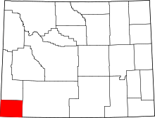 | |
| Towns | ||
| CDPs | ||
| Ghost towns | ||