Fort Bragg, California
| City of Fort Bragg | |
|---|---|
| City | |
|
Aerial view of the southern section of Fort Bragg and the mouth of the Noyo River. State Route 1 crosses the river | |
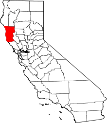
 Location in Mendocino County and the state of California | |
 City of Fort Bragg Location in the United States | |
| Coordinates: 39°26′45″N 123°48′19″W / 39.44583°N 123.80528°WCoordinates: 39°26′45″N 123°48′19″W / 39.44583°N 123.80528°W | |
| Country |
|
| State |
|
| County | Mendocino |
| Incorporated | August 5, 1889[1] |
| Area[2] | |
| • Total | 2.782 sq mi (7.207 km2) |
| • Land | 2.749 sq mi (7.120 km2) |
| • Water | 0.033 sq mi (0.086 km2) 1.20% |
| Elevation[3] | 85 ft (26 m) |
| Population (April 1, 2010)[4] | |
| • Total | 7,273 |
| • Estimate (2013)[4] | 7,250 |
| • Density | 2,600/sq mi (1,000/km2) |
| Time zone | Pacific Time Zone (UTC-8) |
| • Summer (DST) | PDT (UTC-7) |
| ZIP code | 95437[5] |
| Area code | 707 |
| FIPS code | 06-25058 |
| GNIS feature IDs | 1656027, 2410525 |
| Website |
city |
| Reference no. | 615[6] |

| Sister cities |
|---|
| Ōtsuchi, Iwate |
Fort Bragg is a coastal city along State Route 1 in Mendocino County, California. It is 24 miles (39 km) west of Willits,[7] at an elevation of 85 feet (26 m).[3] A California Historical Landmark,[6] the city was founded prior to the American Civil War as a military garrison rather than a fortification.[8] Fort Bragg is a tourist destination because of its picturesque views of the Pacific Ocean. Its population was 7,273 at the 2010 census.
History
In prehistoric days, the area now known as Fort Bragg was home to the Native Americans, most of whom belonged to the Pomo tribe. They were hunter gatherers who lived along the northern coast of California.
1855–1867
In 1855, an exploration party from the Bureau of Indian Affairs visited the area looking for a site on which to establish a reservation; and, in the spring of 1856, the Mendocino Indian Reservation was established at Noyo. It was 25,000 acres (100 km2), and its boundary extended north from what is now Simpson Lane to Abalobadiah Creek and east from the Pacific Ocean to Bald Hill.
In the summer of 1857, 1st Lt. Horatio G. Gibson, then serving at the Presidio of San Francisco, established a military post on the Reservation, approximately a mile and a half north of the Noyo River, and named it for his former commanding officer Capt. Braxton Bragg, who later became a General in the Army of the Confederacy.[9] The official date of the establishment of the fort was June 11, 1857; and its purpose was to maintain order on the reservation.
Gibson and Company M, 3rd Artillery, left Fort Bragg in January 1859 to be replaced by Company D, 6th Infantry, which stayed for two years and continued to build up the post.
In June 1862 Company D, 2nd California Infantry, were ordered to garrison the post and remained until 1864. In October of that year, the Fort Bragg garrison was loaded aboard the steamer "Panama" and completed the evacuation and abandonment of Mendocino County's first military post.
The Mendocino Indian Reservation was discontinued in March 1866; and the land was opened for settlement three years later.
The last remaining building of the Fort Bragg military post is located at 430 North Franklin Street. It may have been the Quartermaster's storehouse and commissary or surgeon's quarters or hospital.
The approximate boundaries of the fort extend from the south side of Laurel, east from the railroad depot to the alley behind Franklin, down the alley to a point 100 feet (30 m) south of Redwood Avenue, west on Redwood to just beyond the Georgia-Pacific Corporation company offices, then north to connect with the Laurel Street border at the railroad station.
1867–1892
By 1867 the reservation and military outpost at Fort Bragg were abandoned. By 1869 small lumber mills were being built at the mouth of every creek. Ranches were settled. By 1873 Fort Bragg had an established lumber port at Noyo.
In 1869, after the fort was abandoned, the land of the reservation was returned to the public and offered for sale at $1.25 per acre to settlers. In 1885 C.R. Johnson who, with partners Calvin Stewart and James Hunter had been operating a sawmill in Mill Creek on the Ten Mile River, moved their mill machinery to Fort Bragg to take advantage of the harbor for shipping.
The company incorporated in 1885 as the Fort Bragg Redwood Company. In 1891, after merging with the Noyo River Lumber Company, it was renamed the Union Lumber Company.
The Fort Bragg Railroad was founded to haul logs to the mill. The first rails were run up Pudding Creek and in 1887 reached Glen Blair. A San Francisco streetcar was purchased to carry loggers and their families on Sunday excursions to the woods.
Fort Bragg was incorporated in 1889 with C. R. Johnson as its first mayor. Calvin Stewart did the plat maps for the town.
Built in Fort Bragg for Horace Weller in 1886, the Weller House is the oldest existing house in the city. Since 1999, this house, converted into hotel, welcomes tourists from around the world.
1893–1916
The Union Lumber Company was incorporated in 1891 by absorbing some of the smaller lumber companies in the area. Some of the new company lands were in the Noyo River watershed east of town making removal of logs difficult by rail, unless a tunnel was built. Johnson hired experienced Chinese tunnel builders from San Francisco. After completion of the tunnel, most of the Chinese settled in Fort Bragg and Mendocino. A six-walled Chinese town was built at Redwood and McPherson. Older residents say that eventually most of the Chinese children moved elsewhere.
In 1901 the Union Lumber Company incorporated the National Steamship Company to carry lumber, passengers and supplies. The only link to manufactured creature comforts and staples like sugar and coffee were delivered by steamship. In 1905, the California Western Railroad and Navigation Company was established and plans were pushed to get the rail line all the way to Willits, where train connections to the Northwestern Pacific would link to San Francisco.
The 1906 earthquake resulted in a fire that threatened the saw mill and the city. Within the town itself, all brick buildings were damaged. Only two were not destroyed completely. Many frame houses were knocked off their piers. The fire downtown burned the entire block bordered by Franklin, Redwood and McPherson Streets, plus the west side of Franklin. The west Franklin block burned down to approximately one half a block beyond the intersection of Redwood and Franklin.
Within 12 months following the earthquake, most downtown reconstruction was completed. Coincidentally, the earthquake brought real prosperity to Fort Bragg as the mills furnished lumber to rebuild San Francisco, and the lumber ships returning from San Francisco were ballasted with bricks used for rebuilding Fort Bragg.[10] With the new prosperity, the rail line to Willits was completed and in 1912 the first tourists came to Fort Bragg. By 1916 Fort Bragg had become a popular place to visit—and to settle.
Since 1916
Commercial fishing has also played an important role in the economic base of the community. Once a major commercial fishing port, Fort Bragg was well known for producing quality fish products that were distributed to major metropolitan markets.
In 1969 the Union Lumber Company was purchased by Boise Cascade and John Quincy and it, in turn, became Georgia Pacific in 1973.
The emergence of the City of Fort Bragg as a diverse residential, recreational and growing commercial area had begun and the city was on the path to becoming what it is today. The Guest House Museum is the repository of artifacts and records telling the story of Fort Bragg.
Recently, Georgia Pacific Lumber Company put on the market a 400-acre (1.6 km2) piece of property within the city limits, formerly the site of a large mill facility. The mill was shut down in 2002 and has been identified as a nonperforming asset by Georgia Pacific. The mill site takes up almost the entire coastline of Fort Bragg including Fort Bragg Landing. The public of Fort Bragg has embraced the mill site as the future of Fort Bragg and has proposed many forward-thinking ideas. Some possibilities for the mill site are: a marine research center, a conference center, a world-class golf course, a smaller mill, or a branch of a college.
Geography
Fort Bragg is located at 39°26′45″N 123°48′19″W / 39.44583°N 123.80528°W with an average elevation of 85 ft (26 m) above sea level.[3]
According to the United States Census Bureau, the city has a total area of 2.8 square miles (7.3 km2), of which, 2.7 square miles (7.0 km2) of it is land and 0.04 square miles (0.10 km2) of it (1.44%) is water.
Climate
Due to Fort Bragg’s proximity to the Pacific Ocean, the city has very mild weather throughout the year compared to most inland places. Most of the rainfall occurs from November to April with some occasional drizzle or light showers during the summer. Fog and low overcast are common, especially during the night and early morning hours. The climate experienced in Fort Bragg is classified as cool-summer mediterranean climate.[11] Although formally known as dry-summer subtropical;[11] Fort Bragg has very cool summer temperatures for a subtropical climate type. Its mediterranean classification is due to the dry summers with very little rainfall.[12]
January, the coldest month, has an average maximum temperature of 55.1 °F (12.8 °C) and an average minimum temperature of 39.9 °F (4.4 °C); September, the warmest month, has an average maximum temperature of 65.8 °F (18.8 °C) and an average minimum temperature of 49.2 °F (9.6 °C). Temperatures rarely reach 90 °F (32 °C), occurring on an average of only 0.1 day annually. Freezing temperatures occur on an average of 11.1 days annually. The record maximum temperature was 94 °F (34 °C) on October 5, 1985 (exceeded by 96 °F (36 °C) on October 23, 1965, at the airport, where records were kept from 1948 to 1972). The record minimum temperature was 18 °F (−8 °C) on December 21, 1990.
Average annual precipitation is 40.24 inches (1,022 mm). The wettest year on record was 1995 with 61.90 inches (1,572 mm) and the driest year on record was 2013 with 12.31 inches (313 mm).[13] The maximum precipitation in one month was 21.60 inches (549 mm) in December 2002. The maximum 24-hour rainfall was 4.36 inches (111 mm) on December 28, 2002.[14]
Snow is virtually unknown; the only recorded snowfall was in January 1907.
The extreme maritime effect of the Pacific Ocean is demonstrated by the fact that Fort Bragg has uniquely cool summers for cities on the 39th parallel north, both domestically and internationally. In places a few miles inland, consistently hotter summer temperatures are found, a phenomenon typical of the Californian coastline.
| Climate data for Fort Bragg, California (1981-2010 normals, extremes 1895–present) | |||||||||||||
|---|---|---|---|---|---|---|---|---|---|---|---|---|---|
| Month | Jan | Feb | Mar | Apr | May | Jun | Jul | Aug | Sep | Oct | Nov | Dec | Year |
| Record high °F (°C) | 77 (25) |
80 (27) |
82 (28) |
80 (27) |
81 (27) |
84 (29) |
83 (28) |
83 (28) |
87 (31) |
91 (33) |
85 (29) |
81 (27) |
91 (33) |
| Average high °F (°C) | 52.3 (11.3) |
53.6 (12) |
55.1 (12.8) |
56.8 (13.8) |
59.6 (15.3) |
62.0 (16.7) |
64.1 (17.8) |
64.4 (18) |
63.6 (17.6) |
61.0 (16.1) |
55.7 (13.2) |
51.7 (10.9) |
58.3 (14.6) |
| Daily mean °F (°C) | 46.4 (8) |
47.3 (8.5) |
48.3 (9.1) |
49.6 (9.8) |
52.3 (11.3) |
55.0 (12.8) |
56.6 (13.7) |
56.9 (13.8) |
56.1 (13.4) |
53.6 (12) |
49.2 (9.6) |
45.9 (7.7) |
51.4 (10.8) |
| Average low °F (°C) | 40.4 (4.7) |
41.0 (5) |
41.5 (5.3) |
42.5 (5.8) |
45.1 (7.3) |
47.9 (8.8) |
49.1 (9.5) |
49.4 (9.7) |
48.6 (9.2) |
46.2 (7.9) |
42.7 (5.9) |
40.1 (4.5) |
44.5 (6.9) |
| Record low °F (°C) | 24 (−4) |
24 (−4) |
28 (−2) |
30 (−1) |
29 (−2) |
37 (3) |
38 (3) |
30 (−1) |
34 (1) |
25 (−4) |
26 (−3) |
18 (−8) |
18 (−8) |
| Average rainfall inches (mm) | 7.51 (190.8) |
6.84 (173.7) |
6.27 (159.3) |
3.32 (84.3) |
1.80 (45.7) |
0.72 (18.3) |
0.09 (2.3) |
0.21 (5.3) |
0.45 (11.4) |
2.49 (63.2) |
5.31 (134.9) |
8.46 (214.9) |
43.47 (1,104.1) |
| Average rainy days (≥ 0.01 inch) | 15.4 | 14.3 | 13.8 | 10.1 | 6.9 | 3.6 | 2.2 | 3.4 | 4.0 | 7.1 | 13.6 | 16.4 | 110.8 |
| Source #1: NOAA[15][16] | |||||||||||||
| Source #2: Western Regional Climate Center[17] | |||||||||||||
Demographics
| Historical population | |||
|---|---|---|---|
| Census | Pop. | %± | |
| 1890 | 945 | — | |
| 1900 | 1,590 | 68.3% | |
| 1910 | 2,408 | 51.4% | |
| 1920 | 2,616 | 8.6% | |
| 1930 | 3,022 | 15.5% | |
| 1940 | 3,235 | 7.0% | |
| 1950 | 3,826 | 18.3% | |
| 1960 | 4,433 | 15.9% | |
| 1970 | 4,455 | 0.5% | |
| 1980 | 5,019 | 12.7% | |
| 1990 | 6,078 | 21.1% | |
| 2000 | 7,026 | 15.6% | |
| 2010 | 7,273 | 3.5% | |
| Est. 2015 | 7,289 | [18] | 0.2% |

As of the census[20] of 2010, there were 7,273 people, 2,812 households, and 1,644 families residing in the city. The population density was 2,644.7 people per square mile (1,641.8/km²). There were 3,051 housing units at an average density of 1,119.1 per square mile (431.5/km²). The racial makeup of the city was 74.8% White, 0.7% Black or African American, 2.2% Native American, 1.5% Asian, 0.2% Pacific Islander, 16.0% from other races, and 4.6% from two or more races. 31.8% of the population were Hispanic or Latino of any race.
There were 2,840 households out of which 30.1% had children under the age of 18 living with them, 40.4% were married couples living together, 13.0% had a female householder with no husband present, and 42.1% were non-families. 35.5% of all households were made up of individuals and 15.0% had someone living alone who was 65 years of age or older. The average household size was 2.35 and the average family size was 3.04.
In the city the population was spread out with 24.6% under the age of 18, 9.3% from 18 to 24, 30.0% from 25 to 44, 22.2% from 45 to 64, and 13.9% who were 65 years of age or older. The median age was 36 years. For every 100 females there were 100.6 males. For every 100 females age 18 and over, there were 99.3 males.
The median income for a household in the city was $28,539, and the median income for a family was $36,000. Males had a median income of $25,833 versus $23,287 for females. The per capita income for the city was $15,832. About 11.9% of families and 20.4% of the population were below the poverty line, including 26.5% of those under age 18 and 10.6% of those age 65 or over.
Points of interest

Glass Beach is on the edge of town, along the ocean. In the early 20th century, Fort Bragg residents threw their household garbage over cliffs owned by the Union Lumber Company onto what is now Glass Beach, discarding glass, appliances, and even vehicles.[21] Locals referred to it as "The Dumps."[22] Fires were lit to reduce the size of the trash pile.[22] In 1967, city leaders closed the area and various cleanup programs were brought on through the years to fix the damage. Over several decades the pounding waves wore down the discarded glass into the small, smooth, pieces called sea glass that coat the beach today. The area along the beach at the end of Elm Street is now visited by tourists.[23]
The Mendocino Coast Botanical Gardens is a 47-acre (190,000 m2) garden along the coastal bluffs.
Other points of interest
Transportation
Fort Bragg is the western terminus of the California Western Railroad (otherwise known locally as the "Skunk Train", Steam passenger service was started in 1904, extended to the town of Willits in 1911, running through the Coast Redwood forests to the city of Willits, 40 miles (64 km) inland. Started in 1885 as a rail route for moving large logs to the mills, the Skunk Train now offers scenic tours through the redwoods. In 1925 self-powered, yellow "Skunk" rail cars were inaugurated. The little trains were quickly nicknamed for their original gas engines, which prompted folks to say, "You can smell 'em before you can see 'em." In 1965 the line reintroduced summer steam passenger service between Fort Bragg and Willits with Baldwin-built steam locomotives Nos. 45 and 46, calling the colorful train "The Super Skunk". That train was discontinued in 2001 owing to the embargo of the Northwestern Pacific Railroad, then revived in September 2006 as a special event train. No.45 continues to power excursion trains from Fort Bragg as far as Northspur, the CWR's midpoint, on selected weekends summer to early autumn.
State Route 1, California's Coast Highway, passes through Fort Bragg as Main Street. State Route 20 heads east, running parallel to and several miles south of the Skunk Train's route, to Willits.
The city also has a small private airport with an 1850 x 60 ft. paved runway.[24][25]
Government
Municipal government
State and federal representation
In the state legislature, Fort Bragg is in the 2nd Senate District, represented by Democrat Mike McGuire,[28] and the 2nd Assembly District, represented by Democrat Jim Wood.[29]
Federally, Fort Bragg is in California's 2nd congressional district, represented by Democrat Jared Huffman.[30]
Schools
Children in Fort Bragg attend Fort Bragg High School, Fort Bragg Middle School, Dana Gray Elementary and Redwood Elementary. In 2006, Three Rivers Learning Center, a charter school under the jurisdiction of Mattole Valley Charter School opened.
As a film location
Several major movies have been filmed at and around Fort Bragg, including The Majestic,[31] Racing with the Moon, The Russians Are Coming, the Russians Are Coming, a 1966 comedy movie about a Soviet Union submarine that accidentally runs aground off the coast of New England,[32] and the 1987 romantic comedy Overboard starring Goldie Hawn.[33]
Fort Bragg has also been home to the 2011/2012 web series Sundays.[34]
Notable people
- Tom Hawkins (writer), the probable writer of the Wanda Tinasky Letters.[35][36]
- Edward Norris, film actor who made over 70 films. Moved to Fort Bragg in 1997 and died there in 2002.[37]
- Ray Peterson, NFL player [38]
- Gregory E. Pyle, current chief of the Choctaw Nation of Oklahoma. Now lives in Durant, Oklahoma.
- Jim Ross, professional wrestling commentator and former company executive of WWE.[39]
- Cornelius Vander Starr, founder of insurance giant AIG[40] as well as the Starr Foundation, which gives money to various local causes.
- Emily Jane White, Neofolk singer.[41]
Sister city
As a youth Ken Sasaki noted that his home Ōtsuchi, Japan, is located on the same latitude as Fort Bragg and in 2001 he contacted then-Mayor Lindy Peters and visited with a delegation to open discussions on a sister city agreement. Fort Bragg students visited Otsuchi in 2002 and the Sister-City Proclamation was solidified in 2005 by following Mayor, Dave Turner. Other student exchanges were held in 2004, 2006, 2008 and 2010 and the next exchange was planned for July 2011.[42][43] Following the 2011 Tōhoku earthquake and tsunami devastation of Otsuchi, the mayor ordered that city flags be flown half staff until the end of March to honor the thousands of lives lost.[44]
References
- ↑ "California Cities by Incorporation Date" (Word). California Association of Local Agency Formation Commissions. Retrieved August 25, 2014.
- ↑ "2010 Census U.S. Gazetteer Files – Places – California". United States Census Bureau.
- 1 2 3 "Fort Bragg". Geographic Names Information System. United States Geological Survey. Retrieved November 30, 2014.
- 1 2 "Fort Bragg (city) QuickFacts". United States Census Bureau. Retrieved February 9, 2015.
- ↑ "ZIP Code(tm) Lookup". United States Postal Service. Retrieved November 20, 2014.
- 1 2 "Fort Bragg". Office of Historic Preservation, California State Parks. Retrieved 2012-10-09.
- ↑ Durham, David L. (1998). California's Geographic Names: A Gazetteer of Historic and Modern Names of the State. Clovis, Calif.: Word Dancer Press. p. 61. ISBN 1-884995-14-4.
- ↑ Hogle, Gene (1931). NAC Green Book of Pacific Coast Touring. National Automobile Club. p.43
- ↑ McGreevy, Patrick (July 17, 2015). "Black Caucus members seek name change for city of Fort Bragg". Los Angeles Times.
- ↑ Moon, Fred (Jan 7, 2010). "Fort Bragg Bakery oven rises again". SFGate.com. San Francisco, CA: Hearst Publications. Retrieved Feb 24, 2011.
- 1 2 "Fort Bragg, California Köppen Classification". Weatherbase. Retrieved 5 February 2015.
- ↑ "Fort Bragg, California, Temperature Averages". Weatherbase. Retrieved 5 February 2015.
- ↑ http://www.wrcc.dri.edu/cgi-bin/cliMAIN.pl?ca3161
- ↑ Western Regional Climate Center website <http://wrcc.dri.edu/>
- ↑ "NowData - NOAA Online Weather Data". National Oceanic and Atmospheric Administration. Retrieved July 30, 2016.
- ↑ "CA FT Bragg 5 N". National Oceanic and Atmospheric Administration. Retrieved July 30, 2016.
- ↑ "FORT BRAGG 5 N, CALIFORNIA (043161)". Western Regional Climate Center. 2014. Retrieved February 20, 2014.
- ↑ "Annual Estimates of the Resident Population for Incorporated Places: April 1, 2010 to July 1, 2015". Retrieved July 2, 2016.
- ↑ "Census of Population and Housing". Census.gov. Retrieved June 4, 2015.
- ↑ "American FactFinder". United States Census Bureau. Retrieved 2008-01-31.
- ↑ "Glass Beach". Explore. Mendocino County. 2012. Retrieved 22 December 2012.
- 1 2 Kim, Susan C. (16 February 2006). "From trash to treasure". CNN Travel. CNN. Retrieved 22 December 2012.
- ↑ http://www.findseaglass.net/sea-glass-beach-fort-bragg-california/
- ↑ "82CL - Fort Bragg Airport". AirNav. 2012-05-31. Retrieved 2012-06-29.
- ↑ "FORT BRAGG AIRPORT(82CL) | FORT BRAGG Airports". PilotOutlook. Retrieved 2012-06-29.
- 1 2 3 4 5 "Council Members". Fort Bragg, CA. Retrieved July 18, 2015.
- ↑ "City Manager's Office". Fort Bragg, CA. Retrieved November 20, 2014.
- ↑ "Senators". State of California. Retrieved March 10, 2013.
- ↑ "Members Assembly". State of California. Retrieved March 2, 2013.
- ↑ "California's 2nd Congressional District - Representatives & District Map". Civic Impulse, LLC. Retrieved March 1, 2013.
- ↑ The Majestic at the Internet Movie Database
- ↑ http://www.imdb.com/title/tt0060921/locations
- ↑ Overboard at the Internet Movie Database
- ↑ Sundays - Official web site
- ↑ Hendrix, Jenny (January 24, 2014). "Mistaken Identity". The Paris Review. Retrieved May 5, 2014.
- ↑ The Letters of Wanda Tinasky, edited by Bruce Anderson
- ↑ Internet Movie Data Base
- ↑ Ray Peterson Pro Football Reference, FOX Sports, accessed May 5, 2014
- ↑ Ross, Jim (January 5, 2008). "J.R.'s Blog Happy New Year Everyone! Lots of Feedback Answered Today... Life Goes On... and So Does Work..". JRsBarBQ.com. Retrieved 2008-01-06.
I was born on January 3, 1952 in Fort Bragg, California.
- ↑ Ronald Kent Shelp, Al Ehrbar (2006). Fallen giant: the amazing story of Hank Greenberg and the history of AIG. John Wiley and Sons. ISBN 978-0-471-91696-3.
- ↑ Archived February 6, 2012, at the Wayback Machine.
- ↑ "Help Otsuchi, a letter from our Mayor". Retrieved March 18, 2011.
- ↑ "Deep Ties Between Sister Cities of Otsuchi, Japan and Fort Bragg, California Spur Community Action and Creation of a Relief Fund". All Voices - Local to Global News. March 16, 2011. Retrieved March 18, 2011.
- ↑ "Sister city devastated". Fort Bragg Advocate News. March 17, 2011. Retrieved March 18, 2011. External link in
|newspaper=(help)
External links
| Wikivoyage has a travel guide for Fort Bragg. |
| Wikimedia Commons has media related to Fort Bragg, California. |
- Official website
- Fort Bragg website, includes history, travel information, etc.
- Mendocino Connection
- Fort Bragg, CA Travel Information
- CNN article on Glass Beach From trash to treasure: Unassuming coastal town home to glittering Glass Beach. By Susan C. Kim