Forni di Sotto
| Forni di Sotto | |
|---|---|
| Comune | |
| Comune di Forni di Sotto | |
|
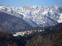
Forni di Sotto in winter | |
 Forni di Sotto Location of Forni di Sotto in Italy | |
| Coordinates: 46°24′N 12°40′E / 46.400°N 12.667°ECoordinates: 46°24′N 12°40′E / 46.400°N 12.667°E | |
| Country | Italy |
| Region | Friuli-Venezia Giulia |
| Province / Metropolitan city | Province of Udine (UD) |
| Area | |
| • Total | 93.0 km2 (35.9 sq mi) |
| Population (Dec. 2004) | |
| • Total | 701 |
| • Density | 7.5/km2 (20/sq mi) |
| Demonym(s) | Fornesi |
| Time zone | CET (UTC+1) |
| • Summer (DST) | CEST (UTC+2) |
| Postal code | 33020 |
| Dialing code | 0433 |
| Website | Official website |
Forni di Sotto is a comune (municipality) in the Province of Udine in the Italian region Friuli-Venezia Giulia, located about 120 kilometres (75 mi) northwest of Trieste and about 60 kilometres (37 mi) northwest of Udine. As of 31 December 2004, it had a population of 701 and an area of 93.0 square kilometres (35.9 sq mi).[1]
Forni di Sotto borders the following municipalities: Ampezzo, Claut, Forni di Sopra, Sauris, Socchieve, Tramonti di Sopra.
Demographic evolution

References
External links
This article is issued from Wikipedia - version of the 1/31/2015. The text is available under the Creative Commons Attribution/Share Alike but additional terms may apply for the media files.