Forest of Halatte
| Forest of Halatte French: Forêt d'Halatte | |
|---|---|
|
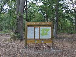
Tourist information sign at Aumont-en-Halatte | |
| Geography | |
 | |
| Location | Oise, Picardy, France |
| Coordinates | 49°14′45″N 2°34′15″E / 49.24585°N 2.57097°ECoordinates: 49°14′45″N 2°34′15″E / 49.24585°N 2.57097°E |
| Area | 43 square kilometres (17 sq mi) |
| Status | Dominial |
| Ecology | |
| Dominant tree species | Sessile oak, European beech |
The Forest of Halatte (Forêt d'Halatte) in Picardy is one of the largest remaining blocks of natural old growth forest in France. Situated in the département of Oise near Senlis and Pont-Sainte-Maxence,[1] it currently embraces 43 square kilometers.[2] Together with the Forest of Chantilly and the Forest of Ermenonville it forms the Massif des Trois Forêts. On the north it borders the Forest of Compiègne.[3] The Forest of Halatte is still a source of oak and beech timber.
The forest, a fragment separated from the ancient Silva Cotia (forêt de Cuise) cited in the 6th century CE, which became the Forest of Compiègne, bears numerous traces of its prehistoric habitation, in the form of menhirs and dolmens and late Iron Age burials.[4] In the commune of Ognon are the remains of a Gallo-Roman temple dedicated to a curative deity, built in the mid-1st century CE and abandoned during the 4th century. The temple's stones were then quarried for reuse, and the site became overgrown by the forest. the temple was discovered and excavated in 1873-74 and more professionally examined in 1996-99. The objects discovered over the course of the excavation, including coins, votive offerings, fibulae and other jewellery, are exhibited at the Art and Archeology museum of Senlis.[5]
The inexplicable name Halatte first appears in a document of 1165, as Locus Halachius.[3] A hunting accident in the Forest of Halatte claimed the life of King Philip IV of France, in November 1314. At a meeting at St-Christophe-en-Halatte, Edward III of England made his last act of homage for Gascony, to Philip VI, in April 1331.[6] The forest was in part a royal domaine and otherwise divided among clerics and nobles. To this day, boundary markers carved with coats-of-arms mark the old divisions. At the French Revolution, the whole forest was declared domaniale, a national property.
An obelisk raised to commemorate the King of Rome, Napoleon's heir, stands in the forest, south of Pont-Sainte-Maxence.[7] The Forest of Halatte is traversed by a network of walking and bicycling trails maintained by the State.[8]
Notes
- ↑ The Forest of Halatte covers parts of the communes of Pontpoint, Pont-Sainte-Maxence, Beaurepaire and Verneuil-en-Halatte.
- ↑ Its extent was given as 4500 hectares in Adolphe Joanne, Géographie du département de l'Oise avec une carte coloriée et 10 gravures 1880:4.
- 1 2 "Forêt d'Halatte hier et aujord'hui"
- ↑ Pierre Durvin, 1963. Les sépultures du second Age du Fer à Verneuil-en-Halatte (Oise)", Celticum, supplément à Ogam-Tradition Celtique 6: 103-12.
- ↑ The Gallo-Roman temple of the Forest of Halette"
- ↑ The documents are noted by Andrew Wathey, "The Marriage of Edward III and the Transmission of French Motets to England" Journal of the American Musicological Society 45.1 (Spring 1992:1-29) p. 12, note 18.
- ↑ Obelisk to the King of Rome
- ↑ The trails are covered in the guidebook Promenons-nous dans les forêts de Picardie: Chantilly, Halatte, et Ermenonville (Office National des Forêts).