Forest Knolls, Nevada County, California
| Forest Knolls | |
|---|---|
| Unincorporated community | |
 Forest Knolls  Forest Knolls Location in California | |
| Coordinates: 39°14′17″N 121°0′16″W / 39.23806°N 121.00444°WCoordinates: 39°14′17″N 121°0′16″W / 39.23806°N 121.00444°W | |
| Country | United States |
| State | California |
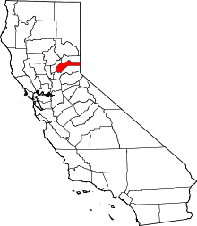
| County | Nevada County |
| Elevation | 3,169 ft (966 m) |
Forest Knolls is an unincorporated community located approximately 1.7 miles to the south of Nevada City, California. It lies about 0.75 miles north of the Nevada County Air Park. The small Banner Reservoir lies in the western part of Forest Knolls.[1] This area has a history of gold mining.[2] The community is heavily forested and the main road through the community is Banner Lava Cap Road.
References
- ↑ Maps (Map). Google Maps.
- ↑ Mining American. 1907. Retrieved 25 July 2011.
This article is issued from Wikipedia - version of the 10/22/2016. The text is available under the Creative Commons Attribution/Share Alike but additional terms may apply for the media files.