Fongen
| Fongen | |
|---|---|
| Lopmesvaerie | |
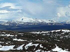 Fongen seen from Baklifjell (west), in May | |
| Highest point | |
| Elevation | 1,441 m (4,728 ft) |
| Prominence | 651 m (2,136 ft) [1] |
| Isolation | 31.1 kilometres (19.3 mi) |
| Coordinates | 63°10′50″N 11°37′50″E / 63.18056°N 11.63056°ECoordinates: 63°10′50″N 11°37′50″E / 63.18056°N 11.63056°E |
| Geography | |
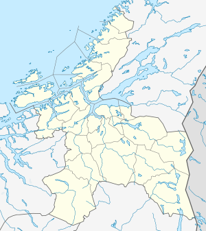 Fongen Location in Sør-Trøndelag | |
| Location | Selbu and Tydal (Sør-Trøndelag) and Meråker (Nord-Trøndelag), Norway |
| Topo map | 1721 III Tydal |
Fongen (Southern Sami: Lopmesvaerie) is a mountain on the border of the municipalities of Selbu (Sør-Trøndelag), Tydal (Sør-Trøndelag), and Meråker (Nord-Trøndelag) in Norway. The 1,441-metre (4,728 ft) summit is located inside Skarvan and Roltdalen National Park, about 15 kilometres (9.3 mi) north of Aunet in Tydal.
The closest Norwegian Trekking Association cabin is Ramsjøhytta, several kilometers east of the summit.
Name
The name is probably the finite form of fong which means "pole" (used in roundpole fence). It is common in Norway to compare the form of high and steep mountains with staffs, sticks, and poles.
References
- ↑ "Fongen 1441 moh - fakta". Toppomania. Retrieved 2011-03-01.
This article is issued from Wikipedia - version of the 5/28/2015. The text is available under the Creative Commons Attribution/Share Alike but additional terms may apply for the media files.