Fonfona
| Fonfona | |
|---|---|
| Village | |
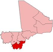
 Fonfona Location in Mali | |
| Coordinates: 12°40′15″N 5°36′33″W / 12.67083°N 5.60917°WCoordinates: 12°40′15″N 5°36′33″W / 12.67083°N 5.60917°W | |
| Country |
|
| Region | Sikasso Region |
| Cercle | Koutiala Cercle |
| Commune | Tao |
| Elevation | 289 m (948 ft) |
| Time zone | GMT (UTC+0) |
Fonfona is a village and the administrative centre (chef-lieu) of the commune of Tao in the Cercle of Koutiala in the Sikasso Region of southern Mali.[1] The village is 45 km northwest of Koutiala.
References
- ↑ Communes de la Région de Sikasso (PDF) (in French), Ministère de l’administration territoriale et des collectivités locales, République du Mali, archived from the original on 19 September 2012.
This article is issued from Wikipedia - version of the 11/26/2013. The text is available under the Creative Commons Attribution/Share Alike but additional terms may apply for the media files.