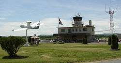
Floyd Bennett Memorial Airport
| Floyd Bennett Memorial Airport | |||||||||||||||
|---|---|---|---|---|---|---|---|---|---|---|---|---|---|---|---|
 | |||||||||||||||
| IATA: GFL – ICAO: KGFL – FAA LID: GFL | |||||||||||||||
| Summary | |||||||||||||||
| Airport type | Public | ||||||||||||||
| Owner | Warren County | ||||||||||||||
| Serves | Glens Falls, New York | ||||||||||||||
| Location | Queensbury, New York | ||||||||||||||
| Elevation AMSL | 328 ft / 100 m | ||||||||||||||
| Coordinates | 43°20′28″N 073°36′37″W / 43.34111°N 73.61028°WCoordinates: 43°20′28″N 073°36′37″W / 43.34111°N 73.61028°W | ||||||||||||||
| Map | |||||||||||||||
 GFL Location of airport in New York | |||||||||||||||
| Runways | |||||||||||||||
| |||||||||||||||
| Statistics (2011) | |||||||||||||||
| |||||||||||||||
Floyd Bennett Memorial Airport (IATA: GFL[2], ICAO: KGFL, FAA LID: GFL) is a county owned, public use airport in Warren County, New York, United States.[1] It is located three nautical miles (6 km) northeast of the central business district of Glens Falls,[1] in the town of Queensbury.[3] This airport is included in the National Plan of Integrated Airport Systems for 2011–2015, which categorized it as a general aviation facility.[4]
The airport is named in honor of Floyd Bennett.[5] It was formerly known as Warren County Airport.[6]
The annual Adirondack Balloon Festival is held at this airport.[7]
History
From 1918 to 1946, the county's only airport, Floyd Bennett Field, was located on what are now the grounds of Queensbury High School.[8] In 1941, ground was broken a few miles east at what is now the current site of the airport. The airport has been served commercially by Colonial Airlines[6] (1940s), Eastern Air Lines[6] (1950s), Mohawk Airlines[6] (1950s–1970s), Allegheny Airlines[6] (1970s), and Air North (1960s–1980s).
Facilities and aircraft
Floyd Bennett Memorial Airport covers an area of 628 acres (254 ha) at an elevation of 328 feet (100 m) above mean sea level.[1] It has two runways with asphalt surfaces: 1/19 is 5,000 by 150 feet (1,524 x 46 m) and 12/30 is 3,999 by 100 feet (1,219 x 30 m).[1]
The north-facing runway 1 is equipped with an instrument landing system and a medium intensity approach lighting system with runway alignment lights. GPS-based instrument approaches are available to all four runway ends. A VORTAC is located at the field and during the 1990s and earlier was used as the basis for IFR approaches to the main runway.
For the 12-month period ending December 31, 2011, the airport had 33,015 aircraft operations, an average of 90 per day: 85% general aviation, 12% air taxi, and 3% military. At that time there were 50 aircraft based at this airport: 92% single-engine, 4% jet, 2% multi-engine, and 2% helicopter.[1]
Incidents
On November 19, 1969, Mohawk Airlines Flight 411 crashed into Pilot Knob Mountain while attempting to land at the conclusion of a flight from Albany. All 14 passengers and crew were killed in the accident.
References
- 1 2 3 4 5 6 FAA Airport Master Record for GFL (Form 5010 PDF). Federal Aviation Administration. Effective November 15, 2012.
- ↑ "IATA Airport Code Search (GFL: Glens Falls / Warren County)". International Air Transport Association. Retrieved June 9, 2013.
- ↑ "Welcome to the Floyd Bennett Memorial Airport". Warren County Department of Public Works. Retrieved July 17, 2010.
- ↑ "2011–2015 NPIAS Report, Appendix A" (PDF, 2.03 MB). National Plan of Integrated Airport Systems. Federal Aviation Administration. October 4, 2010. External link in
|work=(help) - ↑ "Floyd Bennett". Warren County Department of Public Works. Retrieved July 17, 2010.
- 1 2 3 4 5 "A brief history of the Warren County Airport". Warren County Department of Public Works. Retrieved July 17, 2010.
- ↑ "Adirondack Balloon Festival". Adirondack Balloon Festival. Retrieved July 17, 2010.
- ↑ "54 Facts About Warren County". Warren County Historical Society. Retrieved August 9, 2010.
External links
- Floyd Bennett Memorial (GFL) at New York State DOT Airport Directory
- Aerial image as of April 1995 from USGS The National Map
- FAA Terminal Procedures for GFL, effective November 10, 2016
- Resources for this airport:
- FAA airport information for GFL
- AirNav airport information for KGFL
- ASN accident history for GFL
- FlightAware airport information and live flight tracker
- NOAA/NWS latest weather observations
- SkyVector aeronautical chart, Terminal Procedures