Floriston, California
| Floriston | |
|---|---|
| census-designated place | |
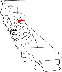
 Floriston Location in California | |
| Coordinates: 39°23′35″N 120°00′55″W / 39.39306°N 120.01528°WCoordinates: 39°23′35″N 120°00′55″W / 39.39306°N 120.01528°W | |
| Country |
|
| State |
|
| County | Nevada |
| Area[1] | |
| • Total | 0.950 sq mi (2.461 km2) |
| • Land | 0.950 sq mi (2.461 km2) |
| • Water | 0 sq mi (0 km2) 0% |
| Elevation[2] | 6,381 ft (1,945 m) |
| Population (2010) | |
| • Total | 73 |
| • Density | 77/sq mi (30/km2) |
| Time zone | Pacific (PST) (UTC-8) |
| • Summer (DST) | PDT (UTC-7) |
Floriston is a census-designated place in Nevada County, California. It is situated at an elevation of 6,381 ft (1,945 m) above sea level.[2] Floriston is located on the Truckee River, 10 miles (16.1 km) east-northeast of Truckee.[3] The population was 73 at the 2010 census.
Name
The name comes from the flowers at the place.[3] It is probably coined from the Latin or Spanish stem flor 'flower.'[4]
History
The railroad station was established in the 1870s with the name of Bronco after the name of the creek a mile to the south.[4] The Floriston post office opened in 1891.[3]
Geography
According to the United States Census Bureau, the CDP covers an area of 1.0 square miles (2.5 km²), all of it land.
Climate
The Köppen Climate System classifies Long Barn as having a Hot-summer Mediterranean climate, abbreviated as "Csb".[5]
| Climate data for Floriston, California | |||||||||||||
|---|---|---|---|---|---|---|---|---|---|---|---|---|---|
| Month | Jan | Feb | Mar | Apr | May | Jun | Jul | Aug | Sep | Oct | Nov | Dec | Year |
| Average high °C (°F) | 5 (41) |
7 (44) |
9 (49) |
14 (57) |
18 (65) |
23 (74) |
29 (84) |
28 (82) |
24 (76) |
18 (65) |
11 (52) |
6 (43) |
16 (61) |
| Average low °C (°F) | −12 (10) |
−11 (13) |
−8 (18) |
−4 (24) |
−1 (30) |
1 (34) |
3 (37) |
2 (35) |
−1 (30) |
−4 (25) |
−7 (20) |
−11 (13) |
−5 (23) |
| Average precipitation mm (inches) | 112 (4.4) |
84 (3.3) |
80 (3) |
30 (1.2) |
28 (1.1) |
15 (0.6) |
10 (0.4) |
10 (0.4) |
13 (0.5) |
30 (1.2) |
61 (2.4) |
91 (3.6) |
566 (22.3) |
| Source: Weatherbase[6] | |||||||||||||
Demographics
The 2010 United States Census[7] reported that Floriston had a population of 73. The population density was 76.8 people per square mile (29.7/km²). The racial makeup of Floriston was 67 (91.8%) White, 0 (0.0%) African American, 4 (5.5%) Native American, 0 (0.0%) Asian, 0 (0.0%) Pacific Islander, 0 (0.0%) from other races, and 2 (2.7%) from two or more races. Hispanic or Latino of any race were 0 persons (0.0%).
The Census reported that 73 people (100% of the population) lived in households, 0 (0%) lived in non-institutionalized group quarters, and 0 (0%) were institutionalized.
There were 38 households, out of which 6 (15.8%) had children under the age of 18 living in them, 14 (36.8%) were opposite-sex married couples living together, 3 (7.9%) had a female householder with no husband present, 1 (2.6%) had a male householder with no wife present. There were 5 (13.2%) unmarried opposite-sex partnerships, and 0 (0%) same-sex married couples or partnerships. 11 households (28.9%) were made up of individuals and 4 (10.5%) had someone living alone who was 65 years of age or older. The average household size was 1.92. There were 18 families (47.4% of all households); the average family size was 2.44.
The population was spread out with 9 people (12.3%) under the age of 18, 3 people (4.1%) aged 18 to 24, 23 people (31.5%) aged 25 to 44, 30 people (41.1%) aged 45 to 64, and 8 people (11.0%) who were 65 years of age or older. The median age was 49.1 years. For every 100 females there were 92.1 males. For every 100 females age 18 and over, there were 93.9 males.
There were 43 housing units at an average density of 45.3 per square mile (17.5/km²), of which 29 (76.3%) were owner-occupied, and 9 (23.7%) were occupied by renters. The homeowner vacancy rate was 0%; the rental vacancy rate was 18.2%. 58 people (79.5% of the population) lived in owner-occupied housing units and 15 people (20.5%) lived in rental housing units.
Politics
In the state legislature, Floriston is in the 1st Senate District, represented by Republican Ted Gaines,[8] and the 1st Assembly District, represented by Republican Brian Dahle.[9]
Federally, Floriston is in California's 1st congressional district, represented by Republican Doug LaMalfa.[10]
References
- ↑ U.S. Census
- 1 2 U.S. Geological Survey Geographic Names Information System: Floriston, California
- 1 2 3 Durham, David L. (1998). California's Geographic Names: A Gazetteer of Historic and Modern Names of the State. Clovis, Calif.: Word Dancer Press. p. 485. ISBN 1-884995-14-4.
- 1 2 Gudde, Erwin G. (1998). California place names : the origin and etymology of current geographical names (4th ed., rev. and enl. ed.). Berkeley: University of California Press. p. 133. ISBN 0520213165.
- ↑ Climate Summary for Floriston, California
- ↑ "Weatherbase.com". Weatherbase. 2013. Retrieved on August 23, 2013.
- ↑ "2010 Census Interactive Population Search: CA – Floriston CDP". U.S. Census Bureau. Retrieved July 12, 2014.
- ↑ "Senators". State of California. Retrieved March 10, 2013.
- ↑ "Members Assembly". State of California. Retrieved March 2, 2013.
- ↑ "California's 1st Congressional District - Representatives & District Map". Civic Impulse, LLC. Retrieved March 2, 2013.
External links
![]() Media related to Floriston, California at Wikimedia Commons
Media related to Floriston, California at Wikimedia Commons