Flomaton, Alabama
| Flomaton, Alabama | |
|---|---|
| Town | |
 Location in Escambia County and the state of Alabama | |
| Coordinates: 31°0′32″N 87°15′20″W / 31.00889°N 87.25556°W | |
| Country | United States |
| State | Alabama |
| County | Escambia |
| Area | |
| • Total | 5.3 sq mi (13.8 km2) |
| • Land | 5.3 sq mi (13.7 km2) |
| • Water | 0 sq mi (0.1 km2) |
| Elevation | 62 ft (19 m) |
| Population (2010) | |
| • Total | 1,440 |
| • Density | 271.6/sq mi (105.1/km2) |
| Time zone | Central (CST) (UTC-6) |
| • Summer (DST) | CDT (UTC-5) |
| ZIP code | 36441 |
| Area code(s) | 251 |
| FIPS code | 01-26824 |
| GNIS feature ID | 0157953 |
Flomaton is a town in Escambia County, Alabama, United States. At the 2010 census the town's population was 1,440.
Geography
Flomaton is located at 31°0′32″N 87°15′21″W / 31.00889°N 87.25583°W (31.008921, -87.255746).[1] It sits on the northern side of the border between Alabama and Florida. On the southern side of the border lies the town of Century in Florida's Escambia County.
U.S. Route 29 and U.S. Route 31 join at the town. The former, starting 45 miles (72 km) to the south in Pensacola, Florida, enters the town over the state border; the latter enters the town from the west, having originated near Mobile. The two highways continue together for about 13 miles (21 km) in a north-easterly direction, before separating at Brewton.
The town also serves as a railway junction. The town joins CSX Transportation's Montgomery–Mobile line with its line south to Pensacola and Florida's Gulf Coast.[2]
According to the U.S. Census Bureau, the town has a total area of 5.3 square miles (14 km2), all land.
History
Flomaton was incorporated as a town in 1908, having been settled on a railway junction in 1869. The name "Flomaton" was chosen as a combination of "Florida", "Alabama" and "town", reflecting the town's location on the border between the two states. In the early twentieth century, the town's economy was driven by the timber industry and the town's location at an important railway junction.[3]
Demographics
| Historical population | |||
|---|---|---|---|
| Census | Pop. | %± | |
| 1910 | 559 | — | |
| 1920 | 724 | 29.5% | |
| 1930 | 915 | 26.4% | |
| 1940 | 837 | −8.5% | |
| 1950 | 1,036 | 23.8% | |
| 1960 | 1,454 | 40.3% | |
| 1970 | 1,584 | 8.9% | |
| 1980 | 1,882 | 18.8% | |
| 1990 | 1,811 | −3.8% | |
| 2000 | 1,588 | −12.3% | |
| 2010 | 1,440 | −9.3% | |
| Est. 2015 | 1,411 | [4] | −2.0% |
| U.S. Decennial Census[5] 2013 Estimate[6] | |||
As of the 2010 census, the town's population was 1,440.[7] In the 2000 census the population had been measured at 1,588.[8]
The 2010 census counted 593 households, including 398 families. The population density was 271.6 people per square mile (105.1/km²). There were 689 housing units at an average density of 130.0 per square mile (50.0/km²). The racial makeup of the town was 69.5% White (a decrease since the 2000 census), 27.2% Black or African American (an increase), 1.6% Native American and 1.32% from two or more races. 2.3% of the population were Hispanic or Latino of any race.
Of the 593 households, 31.7% had children under the age of 18 living with them, 45.7% were married couples living together, 16.9% had a female householder with no husband present, and 32.9% were non-families. 29.3% of all households were made up of individuals and 12.6% had someone living alone who was 65 years of age or older. The average household size was 2.43 and the average family size was 2.98.
The median age was 37.4 years (an increase from 36 in the 2000 census). There were 670 males and 770 females.
In the 2000 census, the median income for a household in the town was $25,875, and the median income for a family was $34,141. Males had a median income of $30,083 versus $15,292 for females. The per capita income for the town was $14,360. About 16.5% of families and 21.8% of the population were below the poverty line, including 31.0% of those under age 18 and 18.5% of those age 65 or over.
Politics
Flomaton has an elected mayor and city council.
Notable person
- Sidney E. Manning, World War I soldier and Medal of Honor recipient.
References
- ↑ "US Gazetteer files: 2010, 2000, and 1990". United States Census Bureau. 2011-02-12. Retrieved 2011-04-23.
- ↑ Guide to North American Railroad Hot Spots. Kalmbach Publishing. 2001. p. 11.
- ↑ "Flomaton". Encyclopedia of Alabama. Retrieved 27 September 2014.
- ↑ "Annual Estimates of the Resident Population for Incorporated Places: April 1, 2010 to July 1, 2015". Retrieved July 2, 2016.
- ↑ "U.S. Decennial Census". Census.gov. Retrieved June 6, 2013.
- ↑ "Annual Estimates of the Resident Population: April 1, 2010 to July 1, 2013". Retrieved June 3, 2014.
- ↑ "American Factfinder". United States Census Bureau. Retrieved 27 September 2014.
- ↑ "American FactFinder". United States Census Bureau. Retrieved 2008-01-31.
External links
- Flomaton page of Escambia County Industrial Development Authority website
- Coastal Gateway Regional Economic Development Alliance
Coordinates: 31°00′32″N 87°15′21″W / 31.008921°N 87.255746°W
Municipalities and communities of Escambia County, Alabama, United States | ||
|---|---|---|
| Cities | 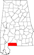 | |
| Towns | ||
| Unincorporated communities | ||
| Indian reservation | ||