Flatbush Avenue–Brooklyn College (IRT Nostrand Avenue Line)
| Flatbush Avenue–Brooklyn College | |||||||||
|---|---|---|---|---|---|---|---|---|---|
| New York City Subway rapid transit station | |||||||||
|
Looking down the platform | |||||||||
| Station statistics | |||||||||
| Address |
Flatbush Avenue & Nostrand Avenue Brooklyn, NY 11210 | ||||||||
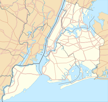
| Borough | Brooklyn | ||||||||
| Locale | Flatbush | ||||||||
| Coordinates | 40°37′56.5″N 73°56′50.95″W / 40.632361°N 73.9474861°WCoordinates: 40°37′56.5″N 73°56′50.95″W / 40.632361°N 73.9474861°W | ||||||||
| Division | A (IRT) | ||||||||
| Line | IRT Nostrand Avenue Line | ||||||||
| Services |
2 5 | ||||||||
| Transit connections |
| ||||||||
| Structure | Underground | ||||||||
| Platforms | 2 side platforms | ||||||||
| Tracks | 2 | ||||||||
| Other information | |||||||||
| Opened | August 23, 1920 | ||||||||
| Accessible |
| ||||||||
| Traffic | |||||||||
| Passengers (2015) |
6,487,608[1] | ||||||||
| Rank | 68 out of 422 | ||||||||
| Station succession | |||||||||
| Next north |
Newkirk Avenue: 2 | ||||||||
| Next south |
(Terminal): 2 | ||||||||
|
| |||||||||
| Next |
Church Avenue: 2 | ||||||||
| Next |
none: 2 | ||||||||
| |||||||||
| |||||||||


Flatbush Avenue–Brooklyn College is the southern terminal station on the IRT Nostrand Avenue Line of the New York City Subway. It is located at the intersection of Flatbush and Nostrand Avenues in Flatbush, Brooklyn, locally called "The Junction".[2] Served by the 2 train at all times and the 5 train on weekdays, it is also the closest subway station to Brooklyn College and Midwood High School.
History
The Dual Contracts, which were signed on March 19, 1913, were contracts for the construction and/or rehabilitation and operation of rapid transit lines in the City of New York. The Dual Contracts promised the construction of several lines in Brooklyn. As part of Contract 4, the IRT agreed to build a subway line along Nostrand Avenue in Brooklyn.[3][4][5] The construction of the subway along Nostrand Avenue spurred real estate development in the surrounding areas.[6] The Nostrand Avenue Line opened on August 23, 1920, and the Flatbush Avenue station opened as its terminal.[7]
This underground station is the only "dead-end" terminal station in the subway system that does not have an island platform. It was built with two side platforms and two tracks to allow for a planned, but not carried out extension of the IRT Nostrand Avenue Line south towards Voorhies Avenue in Sheepshead Bay.[8] In various plans discussed over the years, the IRT Nostrand Avenue Line would be extended along Flatbush Avenue to Avenue U, or along Nostrand Avenue to Voorhies Avenue.[9][10] 21st Street–Queensbridge on the IND 63rd Street Line was also built like this before being connected to the IND Queens Boulevard Line in December 2001.[11]
In 1968, and again in 1989, the MTA gave consideration to extending the Nostrand Avenue Line approximately 1,000 feet (300 m) beyond the station to provide room for turnaround facilities to eliminate the operational restrictions caused by the current layout.[12]
In 1981, the MTA listed the station among the 69 most deteriorated stations in the subway system.[13] The station was renovated at the cost of $6,000,000 from December 1993 to 1995, when it received its elevator and kept its platform directional signs. The 1920s-style "Flatbush Avenue" name tablets, containing red backgrounds with blue borders, were restored on both platforms. The top and bottom of the platform walls contain a blue solid line with a colorful border trim. This results in a tiling scheme with blue tiles that create a wavy pattern that comes farther up whenever there is a "F" tile - which stands for Flatbush - in the station's trimline.[14][15]
Station layout
| G | Street Level | Exits / Entrances |
| P Platform level |
East Mezzanine | Fare control, station agent |
| Side platform, doors will open on the left | ||
| Track 3 | ← | |
| Track 2 | ← ← | |
| Side platform, doors will open on the right | ||
| West Mezzanine | Fare control | |


The platforms are connected at the south end just past the bumper blocks (forming a "U" shape), mitigating what is otherwise an inefficient terminal design, in which passengers must know which track a train is departing from before going to one of the two platforms.[9]
The IRT Nostrand Avenue Line tunnels continue beyond the bumper blocks at Flatbush Avenue and Nostrand Avenue. They extend for several hundred feet to Avenue H.[16] Up until about 2006, passengers could see the cemented over gratings extending down Nostrand Avenue. When a new building went up, the grates were removed. Prior to the building of the exit at the south end of the station, there was only a temporary wooden ramp connecting the platforms and the tunnels were actually visible to passengers.[17][18]
At this end, there is an unstaffed exit containing two HEET turnstiles and one exit-only turnstile. The single staircase here goes up to the west side of Nostrand Avenue north of Avenue H. The station's main entrance is on the Track 3 (eastern) platform.[14] Street stairs from either eastern corners of Nostrand and Flatbush Avenues lead to where the full-time token booth and two separate banks of turnstiles are. The single elevator from street level down to fare control is at the southeast corner. There is another entrance on the platform of Track 2 (west side). This entrance has two sets of street stairs adjacent to each other at the northwest corner of Flatbush Avenue and Nostrand Avenue. The token booth and turnstile bank are open weekdays only. A single HEET turnstile provides access to this entrance other times.
Although 2 and 5 trains will both arrive on either platform, on weekdays when 5 trains serve the station, all Manhattan-bound 2 trains depart from Track 3, and all Manhattan-bound 5 trains depart from Track 2. When the 5 does not serve the station, 2 trains depart from both tracks. Depending on the schedule, and the actual order that trains arrive in, a train that arrives as a 2 train may depart as a 5 train, and vice versa. At all three entrances beyond fare control, train arrival message boards indicate which train is the next to depart from the station.
The station platforms have a lot of doors for various non-public uses, including crew quarters. A 2 train crew office is on the Track 3 side, and a 5 train crew office is on the Track 2 side. There are public restrooms along Track 3 just within the station's main entrance. The columns separating the two tracks are painted light-blue.[14]
The 1996 cast bronze relief artwork here is called Flatbush Floogies by Muriel Castanis.[8][14]
Exits

Track 3 (eastern platform) and Track 2 (western platform) are connected at the southern end of the station, so all exits technically serve both platforms.
| Exit location | Exit type | Number of exits | Platform served |
|---|---|---|---|
| NE corner of Nostrand Avenue and Flatbush Avenue | Staircase | 2 | Track 3 |
| SE corner of Nostrand Avenue and Flatbush Avenue | Staircase | 2 | Track 3 |
| Elevator |
1 | Track 3 | |
| NW corner of Nostrand Avenue and Flatbush Avenue | Staircase | 2 | Track 2 |
| NW corner of Nostrand Avenue and Avenue H | Staircase | 1 | Both tracks |
Notes
References
- ↑ "Facts and Figures: Annual Subway Ridership". Metropolitan Transportation Authority. Retrieved 2016-04-19.
- ↑ Blau, Reuven (September 30, 2013). "Proposal to widen traffic lanes would be a decongestant for clogged Flatbush Ave. passage". NY Daily News. Retrieved May 12, 2014.
...and at the major Nostrand Ave. intersection [with Flatbush Avenue], known as the Junction...
- ↑ "Terms and Conditions of Dual System Contracts". nycsubway.org. Retrieved 16 February 2015.
- ↑ "The Dual System of Rapid Transit (1912)". nycsubway.org.
- ↑ "Most Recent Map of the Dual Subway System WhIch Shows How Brooklyn Borough Is Favored In New Transit Lines". Brooklyn Daily Eagle. September 9, 1917. Retrieved August 23, 2016 – via Brooklyn Newspapers.
- ↑ "Big Eastern Parkway Deal". Brooklyn Daily Eagle. July 1, 1915. Retrieved August 23, 2016 – via Brooklyn Newspapers.
- ↑ "Brooklyn Tube Extensions Open: I.R.T. Begins Service on Eastern Parkway and Nostrand Avenue Lines". New York Times. August 23, 1920. Retrieved 2010-02-28.
- 1 2 "Station: Flatbush Avenue (IRT Brooklyn Line)". nycsubway.org. Retrieved September 17, 2012.
- 1 2 "Full text of "Metropolitan transportation, a program for action. Report to Nelson A. Rockefeller, Governor of New York."". Internet Archive. November 7, 1967. Retrieved October 1, 2015.
- ↑ "1968 NYCTA Expansion Plans (Picture)". Second Avenue Sagas. Retrieved December 2013. Check date values in:
|access-date=(help) - ↑ The Subway Nut — 21st Street–Queensbridge Pictures
- ↑ Feinman, Mark S. "The New York Transit Authority in the 1980s". nycsubway.org. Retrieved September 16, 2012.
- ↑ Gargan, Edward A. (June 11, 1981). "AGENCY LISTS ITS 69 MOST DETERIORATED SUBWAY STATIONS". The New York Times. Retrieved 13 August 2016.
- 1 2 3 4 Cox, Jeremiah (July 29, 2009). "Flatbush Avenue (2,5) - The SubwayNut". subwaynut.com. Retrieved September 17, 2012.
- ↑ "POSTINGS: $6 Million Restoration for IRT Stop; Flatbush Ave. Station Gets New Old Look". The New York Times. 1994-03-06. ISSN 0362-4331. Retrieved 2016-09-04.
- ↑ "Number One Transportation Progress An Interim Report". thejoekorner.com. Metropolitan Transportation Authority. December 1968. Retrieved August 19, 2016.
- ↑ Fischler, Stan (2000-01-01). The Subway: A Trip Through Time on New York's Rapid Transit. H & M Productions. p. 163. ISBN 9781882608232.
- ↑ "A history of futility for Utica, Nostrand extension plans". Second Ave. Sagas. 2010-09-07. Retrieved 2016-04-26.
External links
| Wikimedia Commons has media related to Flatbush Avenue – Brooklyn College (IRT Nostrand Avenue Line). |
- nycsubway.org – Brooklyn IRT: Flatbush Avenue
- nycsubway.org — Flatbush Floogies Artwork by Muriel Castanis (1996)
- Station Reporter — 2 Train
- The Subway Nut — Flatbush Avenue–Brooklyn College Pictures
- MTA's Arts For Transit — Brooklyn College–Flatbush Avenue (IRT Nostrand Avenue Line)
- Flatbush Avenue entrance from Google Maps Street View
- Avenue H entrance from Google Maps Street View