Fish Hook River
| Fish Hook River | |
| River | |
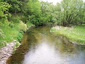 The Fish Hook River in Park Rapids in 2007 | |
| Country | United States |
|---|---|
| State | Minnesota |
| Tributaries | |
| - right | Straight River |
| Source | Fish Hook River Reservoir |
| - location | Park Rapids, Hubbard County |
| - elevation | 1,424 ft (434 m) [1] |
| - coordinates | 46°55′10″N 95°03′10″W / 46.91944°N 95.05278°W [2] |
| Mouth | Shell River |
| - location | Hubbard Township, Hubbard County |
| - elevation | 1,362 ft (415 m) [1] |
| - coordinates | 46°49′49″N 95°01′55″W / 46.83028°N 95.03194°WCoordinates: 46°49′49″N 95°01′55″W / 46.83028°N 95.03194°W [2] |
| Length | 8.54 mi (14 km) [3] |
 Location of the mouth of the Fish Hook River | |
The Fish Hook River, also spelled Fishhook River, is a tributary of the Shell River, 9 miles (14 km) long, in north-central Minnesota in the United States. The river's source, Fish Hook Lake, collects short tributaries known as the Portage River and the Potato River. Via the Shell and Crow Wing rivers, the Fish Hook River is part of the watershed of the Mississippi River. The river flows for its entire length in southwestern Hubbard County; its watershed extends into northeastern Becker County.[4]
Its name is a translation of the Ojibwe name for the river and Fish Hook Lake, Pugidabani.[5]
Geography
The Fish Hook River is considered to begin in the city of Park Rapids, at a dam forming the 2-mile-long (3 km) Fish Hook River Reservoir, which was constructed to supply hydropower at the site of rapids on the river.[2][5][6] From Park Rapids the Fish Hook River flows south-southeastwardly through Todd, Straight River, and Hubbard townships, collecting the Straight River from the west. It flows into the Shell River from the north in Hubbard Township.[4]
The Fish Hook River Reservoir flows from Fish Hook Lake, which collects the river's northern watershed. The Portage and Potato rivers flow short distances to the lake from Portage and Potato Lakes, respectively. Potato Lake collects Hay Creek, which flows from northeastern Becker County, draining a region of lakes.[4][7][8][9][10][11][12]
The Fish Hook River flows in the Northern Lakes and Forests ecoregion, which is characterized by conifer and hardwood forests on flat and rolling till plains and outwash plains.[13] The river's fish population is dominated by suckers, but walleye and northern pike are also present.[14]
See also
References
- 1 2 Google Earth elevation for GNIS coordinates. Retrieved on 2007-06-24.
- 1 2 3 "Geographic Names Information System entry for Fishhook River (Feature ID #643710)". Geographic Names Information System. United States Geological Survey. Retrieved 2007-06-24.
- ↑ "National Assessment Database: Assessment Data for the State of Minnesota Year 2004.". United States Environmental Protection Agency. pp. Crow Wing Watershed. Retrieved 2007-06-24.
- 1 2 3 Minnesota Atlas & Gazetteer. Yarmouth, Me.: DeLorme. 1994. pp. 60–61. ISBN 0-89933-222-6.
- 1 2 Upham, Warren. "Minnesota Place Names: A Geographical Encyclopedia.". Minnesota Historical Society. pp. Hubbard County: Park Rapids. Retrieved 2007-06-24.
- ↑ "Geographic Names Information System entry for Fish Hook River Reservoir (Feature ID #1776302)". Geographic Names Information System. United States Geological Survey. Retrieved 2007-06-24.
- ↑ "Geographic Names Information System entry for Fishhook Lake (Feature ID #643708)". Geographic Names Information System. United States Geological Survey. Retrieved 2007-06-24.
- ↑ "Geographic Names Information System entry for Portage River (Feature ID #649672)". Geographic Names Information System. United States Geological Survey. Retrieved 2007-06-24.
- ↑ "Geographic Names Information System entry for Potato River (Feature ID #649690)". Geographic Names Information System. United States Geological Survey. Retrieved 2007-06-24.
- ↑ "Geographic Names Information System entry for Portage Lake (Feature ID #1776215)". Geographic Names Information System. United States Geological Survey. Retrieved 2007-06-24.
- ↑ "Geographic Names Information System entry for Potato Lake (Feature ID #1776217)". Geographic Names Information System. United States Geological Survey. Retrieved 2007-06-24.
- ↑ "Geographic Names Information System entry for Hay Creek (Feature ID #644769)". Geographic Names Information System. United States Geological Survey. Retrieved 2007-06-24.
- ↑ "Upper Mississippi River Basin.". Minnesota Pollution Control Agency. 2000. pp. Upper Mississippi River Basin Water Quality Plan, Headwaters to the Rum River - Anoka, Section III: Upper Mississippi River Basin. Retrieved 2007-06-17.
- ↑ Waters, Thomas F. (2006). "The Crow Wing: Oxcart to Canoe". The Streams and Rivers of Minnesota. Minneapolis: University of Minnesota Press. pp. 184–194. ISBN 0-8166-0960-8.