First Battle of Rappahannock Station
| ||||||||||||||||||||||||||||||

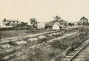
The First Battle of Rappahannock Station, also known as Waterloo Bridge, White Sulphur Springs, Lee Springs, or Freeman's Ford, took place from August 22 to August 25, 1862, in Culpeper County and Fauquier County, Virginia, as part of the Northern Virginia Campaign of the American Civil War.[2][1][3]
Background
In early August, Confederate Gen. Robert E. Lee determined that Union Maj. Gen. George B. McClellan's army was being withdrawn from the Virginia Peninsula to reinforce Maj. Gen. John Pope. He sent Maj. Gen. James Longstreet's wing from Richmond to join Thomas J. "Stonewall" Jackson's wing of the army near Gordonsville and arrived to take command himself on August 15. On August 20 and 21, Pope withdrew to the line of the Rappahannock River. On August 23, Maj. Gen. J.E.B. Stuart's cavalry made a daring raid on Pope's headquarters at Catlett Station, showing that the Union right flank was vulnerable to a turning movement.[1]
Skirmishes
Over the next several days, August 22 to August 25, the two armies fought a series of minor actions along the Rappahannock River, including Waterloo Bridge, Lee Springs, Freeman's Ford, and Sulphur Springs, resulting in a few hundred casualties combined. Together, these skirmishes primed Pope's army along the river, while Jackson's wing marched via Thoroughfare Gap to capture Bristoe Station and destroy Federal supplies at Manassas Junction, far in the rear of Pope's army.[1]
Beverly Ford
On the afternoon of August 22nd, two Confederate batteries arrived in the vicinity of Rappahannock Station and Beverly Ford, across the Rappahannock river, and was ordered to make a reconnoissance of the enemy’s position, who, with considerable artillery, held the opposite bank, also the railroad bridge. Under orders from Maj. Gen. James Longstreet, the enemy was to be driven from his positions on both sides of the river with artillery. At daylight on the 23rd an artillery duel began and by nightfall the enemy the withdrew from all positions.[4]
Reinterment of a Soldier
A Smithsonian Institution archaeological team uncovered the remains of a Confederate soldier in 1989 while excavating the ruins of St. James Episcopal Church to access the site's eligibility for the National Register of Historic Places. The team identified the soldier as a native of New Orleans and member of the Washington Artillery killed during the Battle of Rappahannock Station on August 23, 1862. The reinterment of the soldier was conducted at the St. James Cemetery, Brandy Station, Virginia.[5][6]
References
- 1 2 3 4 5 6 National Park Service battle description
- ↑ The Campaign in Virginia, of July and August 1862: Official Report of Major General John Pope. Milwaukee: Jermain & Brightman, Printers. 1863. pp. 12–16.
- ↑ "Map of the First Battle of Rappahannock Station". Civil War Trust. Retrieved 22 August 2016.
- ↑ Owen & Walton (1885). In Camp and Battle with the Washington Artillery of New Orleans: A Narrative of Events During the Late Civil War from Bull Run to Appomattox and Spanish Fort. Ticknor & Company. pp. 105–107.
- ↑ "Archaeologists Locate Casualties of Civil War: A Confederate Soldier and an Episcopal Church Building". Episcopal News Service. 26 October 1989. Retrieved 22 August 2016.
- ↑ "Civil War Soldier to Be Reinterred at Church Site". Episcopal News Service. 13 May 1992. Retrieved 22 August 2016.
External links
- National Park Service battle description
- CWSAC Report Update
- Map of the First Battle of Rappahannock Station Civil War Trust
Further reading
- Owen, Wm. Miller In Camp and Battle with the Washington Artillery of New Orleans: A Narrative of Events During the Late Civil War from Bull Run to Appomattox and Spanish Fort Chapter VI, Ticknor & Company, 1885.
Coordinates: 38°31′38″N 77°49′49″W / 38.5272°N 77.8302°W