Fet
| Fet kommune | |||
|---|---|---|---|
| Municipality | |||
 | |||
| |||
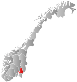
 Fet within Akershus | |||
| Coordinates: 59°52′47″N 11°13′14″E / 59.87972°N 11.22056°ECoordinates: 59°52′47″N 11°13′14″E / 59.87972°N 11.22056°E | |||
| Country | Norway | ||
| County | Akershus | ||
| District | Romerike | ||
| Administrative centre | Fetsund | ||
| Government | |||
| • Mayor (2005) | Lisbet Lofthus Gabrielsen (Ap) | ||
| Area | |||
| • Total | 176 km2 (68 sq mi) | ||
| • Land | 137 km2 (53 sq mi) | ||
| Area rank | 347 in Norway | ||
| Population (2004) | |||
| • Total | 9,485 | ||
| • Rank | 108 in Norway | ||
| • Density | 69/km2 (180/sq mi) | ||
| • Change (10 years) | 10.5 % | ||
| Demonym(s) | Fetsokning[1] | ||
| Time zone | CET (UTC+1) | ||
| • Summer (DST) | CEST (UTC+2) | ||
| ISO 3166 code | NO-0227 | ||
| Official language form | Bokmål | ||
| Website |
www | ||
|
| |||

Fet is a municipality in Akershus county, Norway. It is part of the Romerike traditional region. The administrative centre of the municipality is the village of Fetsund.
Fet was established as a municipality on 1 January 1838 (see formannskapsdistrikt). The new municipality of Rælingen was separated from Fet on 1 July 1929. The part of Enebakk municipality lying east of lake Øyeren was transferred to Fet in 1962.
General information
Name
The name (Old Norse: Fit) is first recorded in 1321 ("a Fit"). It is the word fit which means "vigorous meadow".
Coat-of-arms
The coat-of-arms is from modern times. They were granted on 19 December 1986. The arms show a logging hook, which in the area was used to haul the logs, cut in the surrounding forests. The logs were transported over the streams and lakes to the sawmills. The people use long poles with hooks to haul the logs. The colours of the arms are green and silver, because the name is derived from an old word describing a field (green) near a lake (silver).[2]
| Ancestry | Number |
|---|---|
| | 360 |
| | 159 |
| | 94 |
| | 81 |
| | 57 |
| | 56 |
| | 54 |
| | 52 |
Geography

Fet is located on the eastern side of Lake Øyeren and includes the point at which the River Glomma enters the lake. The inland river delta that has formed is the largest in Europe and reaches the opposite shore of the lake, across its short axis. Until 1985, logs floated down the river were brought onshore here before the river entered its delta, and were then transported onwards by rail. Today, many of Fet's floating buildings have been preserved and converted into a museum and cultural centre.
Notable residents
- Jacob Aall Ottesen (1825-1904) - Norwegian American minister, theologian and church leader. [4]
References
- ↑ "Navn på steder og personer: Innbyggjarnamn" (in Norwegian). Språkrådet. Retrieved 2015-12-01.
- ↑ Norske Kommunevåpen (1990). "Nye kommunevåbener i Norden". Retrieved 2008-12-18.
- ↑ "Immigrants and Norwegian-born to immigrant parents, by immigration category, country background and percentages of the population". ssb.no. Retrieved 29 June 2015.
- ↑ Jacob Aall Ottesen (Store norske leksikon)
External links
 Media related to Fet at Wikimedia Commons
 The dictionary definition of Fet at Wiktionary
- Municipal fact sheet from Statistics Norway
 Akershus travel guide from Wikivoyage
- Øyeren information centre (INØ) (Norwegian)