Festus, Missouri
| Festus, Missouri | |
|---|---|
| City | |
|
Festus Balloon Festival | |
 Location of Festus, Missouri | |
| Coordinates: 38°13′10″N 90°24′3″W / 38.21944°N 90.40083°WCoordinates: 38°13′10″N 90°24′3″W / 38.21944°N 90.40083°W | |
| Country | United States |
| State | Missouri |
| County | Jefferson |
| Incorporated | 1887 |
| Government | |
| • Mayor | Cpt. Mike Cage |
| Area[1] | |
| • Total | 5.71 sq mi (14.79 km2) |
| • Land | 5.71 sq mi (14.79 km2) |
| • Water | 0 sq mi (0 km2) |
| Elevation | 425 ft (130 m) |
| Population (2010)[2] | |
| • Total | 11,602 |
| • Estimate (2012[3]) | 11,740 |
| • Density | 2,031.9/sq mi (784.5/km2) |
| Time zone | Central (CST) (UTC-6) |
| • Summer (DST) | CDT (UTC-5) |
| ZIP code | 63028 |
| Area code(s) | 636 |
| FIPS code | 29-24094[4] |
| GNIS feature ID | 0736296[5] |

Festus is a city in Jefferson County, Missouri, United States. The population was 11,602 at the 2010 census.[6] Festus and its neighbor Crystal City are often collectively known as the "Twin Cities"; however, they are incorporated separately.
Geography
Festus is located at 38°13′10″N 90°24′3″W / 38.21944°N 90.40083°W (38.219490, -90.400936).[7]
According to the United States Census Bureau, the city has a total area of 5.71 square miles (14.79 km2), all of it land.[1]
History
Festus was first called Tanglefoot, and under the latter name was platted in 1878.[8] A post office called Festus has been in operation since 1883.[9]
Demographics
| Historical population | |||
|---|---|---|---|
| Census | Pop. | %± | |
| 1890 | 1,335 | — | |
| 1900 | 1,250 | −6.4% | |
| 1910 | 2,556 | 104.5% | |
| 1920 | 3,348 | 31.0% | |
| 1930 | 4,085 | 22.0% | |
| 1940 | 4,620 | 13.1% | |
| 1950 | 5,199 | 12.5% | |
| 1960 | 7,021 | 35.0% | |
| 1970 | 7,530 | 7.2% | |
| 1980 | 7,574 | 0.6% | |
| 1990 | 8,105 | 7.0% | |
| 2000 | 9,660 | 19.2% | |
| 2010 | 11,602 | 20.1% | |
| Est. 2015 | 12,065 | [10] | 4.0% |
2010 census
As of the census[2] of 2010, there were 11,602 people, 4,636 households, and 3,036 families residing in the city. The population density was 2,031.9 inhabitants per square mile (784.5/km2). There were 4,972 housing units at an average density of 870.8 per square mile (336.2/km2). The racial makeup of the city was 93.5% White, 3.4% African American, 0.2% Native American, 0.8% Asian, 0.2% from other races, and 1.9% from two or more races. Hispanic or Latino of any race were 1.2% of the population.
There were 4,636 households of which 37.0% had children under the age of 18 living with them, 46.2% were married couples living together, 14.5% had a female householder with no husband present, 4.8% had a male householder with no wife present, and 34.5% were non-families. 28.7% of all households were made up of individuals and 12.1% had someone living alone who was 65 years of age or older. The average household size was 2.47 and the average family size was 3.04.
The median age in the city was 34.9 years. 26.8% of residents were under the age of 18; 8.1% were between the ages of 18 and 24; 27.7% were from 25 to 44; 23.5% were from 45 to 64; and 13.9% were 65 years of age or older. The gender makeup of the city was 48.3% male and 51.7% female.
2000 census
As of the census[4] of 2000, there were 9,660 people, 1,000 households, and 2,606 families residing in the city. The population density was 2,020.2 people per square mile (780.3/km²). There were 4,040 housing units at an average density of 844.9 per square mile (326.3/km²). The racial makeup of the city was 93.66% White, 3.93% African American, 0.30% Native American, 0.72% Asian, 0.04% Pacific Islander, 0.37% from other races, and 0.96% from two or more races. Hispanic or Latino of any race were 1.04% of the population.
There were 3,861 households out of which 33.3% had children under the age of 18 living with them, 49.7% were married couples living together, 13.5% had a female householder with no husband present, and 32.5% were non-families. 28.0% of all households were made up of individuals and 12.7% had someone living alone who was 65 years of age or older. The average household size was 2.45 and the average family size was 2.97.
In the city the population was spread out with 5.8% under the age of 18, 9.5% from 18 to 24, 28.3% from 25 to 44, 20.5% from 45 to 64, and 15.9% who were 65 years of age or older. The median age was 36 years. For every 100 females there were 88.9 males. For every 100 females age 18 and over, there were 84.6 males.
The median income for a household in the city was $4,687, and the median income for a family was $2,940. Males had a median income of $36,159 versus $25,108 for females. The per capita income for the city was $19,035. About 7.0% of families and 10.2% of the population were below the poverty line, including 13.6% of those under age 18 and 6.1% of those age 65 or over.
In popular culture
Festus, MO is the home of alt-country legends, The Bottle Rockets.
The town is mentioned in the 1974 country song "(We're Not) The Jet Set," in which George Jones and Tammy Wynette sing about road tripping around the Midwestern and Southern part of the United States in a Chevrolet while falling in love.
No we're not the jet set
We're the old Chevrolet set
There's no Riviera
In Festus, Missouri
The town's anthem is "Festus Forever."
Festus is the greatest place, the greatest place on earth!
Festus is a good old place where we all had our birth!
From east to west, from north to south, right up to Gannon Drive
Festus is the place where we (pause) work and live and thrive!
Education
- Festus R-VI School District (K-12)
- Jefferson R-VII School District (K-12)
- St. Pius X High School
- Our Lady Catholic School (K-8)]
- Twin City Christian Academy (K-12)
News & Media
- Jefferson County Leader
- KJFF AM 1400
Transportation
See also
References
- 1 2 "US Gazetteer files 2010". United States Census Bureau. Retrieved 2012-07-08.
- 1 2 "American FactFinder". United States Census Bureau. Retrieved 2012-07-08.
- ↑ "Population Estimates". United States Census Bureau. Retrieved 2013-05-30.
- 1 2 "American FactFinder". United States Census Bureau. Retrieved 2008-01-31.
- ↑ "US Board on Geographic Names". United States Geological Survey. 2007-10-25. Retrieved 2008-01-31.
- ↑ "Festus, Missouri". U.S. Census Bureau. Retrieved 2012-02-23.
- ↑ "US Gazetteer files: 2010, 2000, and 1990". United States Census Bureau. 2011-02-12. Retrieved 2011-04-23.
- ↑ "Jefferson County Place Names, 1928–1945 (archived)". The State Historical Society of Missouri. Retrieved 19 October 2016.
- ↑ "Post Offices". Jim Forte Postal History. Retrieved 19 October 2016.
- ↑ "Annual Estimates of the Resident Population for Incorporated Places: April 1, 2010 to July 1, 2015". Retrieved July 2, 2016.
- ↑ "Census of Population and Housing". Census.gov. Retrieved June 4, 2015.
External links
- City of Festus
- City-data.com - Festus
- Historic maps of Festus in the Sanborn Maps of Missouri Collection at the University of Missouri
Municipalities and communities of Jefferson County, Missouri, United States | ||
|---|---|---|
| Cities | 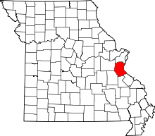 | |
| Villages | ||
| Townships | ||
| CDPs |
| |
| Unincorporated communities | ||