Firozpur Cantonment
| Firozpur Cantonment ਫ਼ਿਰੋਜ਼ਪੁਰ ਛਾਉਣੀ | |
|---|---|
| town | |
|
Narrow gauge loco outside Firozpur cantt Railway station | |
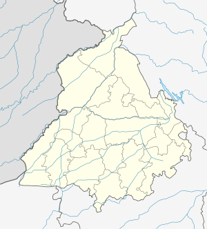 Firozpur Cantonment Location in Punjab, India | |
| Coordinates: 30°56′31″N 74°37′06″E / 30.94193°N 74.618343°ECoordinates: 30°56′31″N 74°37′06″E / 30.94193°N 74.618343°E | |
| Country |
|
| State | Punjab |
| District | Firozpur |
| Government | |
| • Deputy Commissioner | D.P.S. Kharbanda |
| Population (2001) | |
| • Total | 57,418 |
| Languages | |
| • Official | Punjabi |
| • Other | Hindi and English |
| Time zone | IST (UTC+5:30) |
| PIN | 152001 |
| Website | http://www.cbfzr.org/ |

Firozpur Cantonment (Punjabi: ਫ਼ਿਰੋਜ਼ਪੁਰ ਛਾਉਣੀ) is a cantonment town in Firozpur district in the state of Punjab, India. It is located adjacent to and south of the city of Firozpur.
During the First Anglo-Sikh War, Firozpur Cantonment played a key role for the British Indian Army. Today, it is the Headquarters for a Division of the Indian Army.
The district's key administrative offices and residences (such as the district courts and the commissioner's office ) are in the Cantonment rather than the city.
The Mall road is the main road in the Cantonment and runs through most of the its length. All key offices and institutions as well as residences are located on or in close proximity to the Mall Road.
Demographics
As of 2001 India census,[1] Firozpur Cantonment had a population of 57,418. Males constitute 60% of the population and females 40%. Firozpur Cantonment has an average literacy rate of 75%, higher than the national average of 74.04%: male literacy is 80%, and female literacy is 68%. In Firozpur Cantonment, 11% of the population is under 6 years of age.
History
Firozpur Cantonment was establishment in the year 1839 when Capt. HM Lawrance was posted as the Assistant Political Agent of N.W. Frontier. It is situated about 5 Miles East of River Satluj & about 2 Miles South of Firozpur City. Firozpur City and Cantonment being situated on the Indo-Pak Border have not witnessed much of industrial & commercial development. Firozpur Cantonment is a Class I Cantonment. The Cantonment is connected to the City by Jhoke Road and to the River Sutlej by GT Road.

Historically this was an important Cantonment for the British, it was a base for the Anglo-Sikh Wars in the 1840s. And continued as an important cantonment that was a base for supporting forward positions in modern-day Pakistan. Till World War II, it was one of the largest Cantonments in this region. After Partition the cantt's importance declined. There is an abandoned airstrip of British Vintage in the Cantt.
The Battle of Saragarhi Gurudwara is a part of the Cantonment's military history as the men in the battle were mostly from adjoining areas.

Profile
[3] Firozpur Cantonment Board is constituted under the provisions of the Cantonments Act, 1924 which was enacted by the Central Government. This Board is under administrative control of Government of India through the Ministry of Defence. GOC-in-Chief, Western Command, Chandimandir, acts as the local Govt. The Officer Commanding the Station is the President of the Board. The administration of the Cantonment Board is supervised by the Defence Estates Organisation. An officer of the Indian Defence Estates Service(IDES) is posted as Chief Executive Officer. Principal Director, Defence Estates, of the level of Additional Secretary at the Centre, is posted in each Command, who apart from being advisor to the GOC-in-C, is answerable to the Director General Defence Estates and through him to the Ministry of Defence.
Schools & Colleges
|
References
- ↑ "Census of India 2001: Data from the 2001 Census, including cities, villages and towns (Provisional)". Census Commission of India. Archived from the original on 2004-06-16. Retrieved 2008-11-01.
- ↑ http://www.cbfzr.org/
- ↑ http://www.cbfzr.org/