Feorlin
National grid reference NR95389707
| Feorlin | |
|---|---|
 | |
| Location | Minard, Scotland |
| Coordinates | 56°07′30″N 5°17′20″W / 56.1249°N 5.2888°WCoordinates: 56°07′30″N 5°17′20″W / 56.1249°N 5.2888°W |
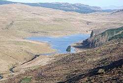
| Type | Reservoir |
| Basin countries | Scotland, United Kingdom |
| Surface area | 63794 sq. metres |
| Surface elevation | 159 metres |
Feorlin is an impounding reservoir located 2 kilometres west of Minard. The loch is part of the Lochgair Hydroelectric Scheme. The rockfill dam is 4.19 metres high and was completed in 1964.
See also
Sources
This article is issued from Wikipedia - version of the 10/18/2016. The text is available under the Creative Commons Attribution/Share Alike but additional terms may apply for the media files.