Fenwood, Wisconsin
| Fenwood, Wisconsin | |
|---|---|
| Village | |
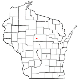 Location of Fenwood, Wisconsin | |
| Coordinates: 44°51′56″N 90°0′50″W / 44.86556°N 90.01389°WCoordinates: 44°51′56″N 90°0′50″W / 44.86556°N 90.01389°W | |
| Country | United States |
| State | Wisconsin |
| County | Marathon |
| Area[1] | |
| • Total | 0.99 sq mi (2.56 km2) |
| • Land | 0.99 sq mi (2.56 km2) |
| • Water | 0 sq mi (0 km2) |
| Elevation[2] | 1,296 ft (395 m) |
| Population (2010)[3] | |
| • Total | 152 |
| • Estimate (2012[4]) | 152 |
| • Density | 153.5/sq mi (59.3/km2) |
| Time zone | Central (CST) (UTC-6) |
| • Summer (DST) | CDT (UTC-5) |
| Area code(s) | 715 & 534 |
| FIPS code | 55-25650[5] |
| GNIS feature ID | 1564913[2] |
Fenwood is a village in Marathon County, Wisconsin, United States. It is part of the Wausau, Wisconsin Metropolitan Statistical Area. The population was 152 at the 2010 census.[6]
History
Fenwood was platted by the railroad in 1891.[7] It was named from woods near the townsite at a fen, or marshy area.[7] A post office was established at Fenwood in 1892, and remained in operation until it was discontinued in 1984.[8]
Geography
Fenwood is located at 44°51′56″N 90°0′50″W / 44.86556°N 90.01389°W (44.865483, -90.013757).[9]
According to the United States Census Bureau, the village has a total area of 0.99 square miles (2.56 km2), all of it land.[1]
Demographics
| Historical population | |||
|---|---|---|---|
| Census | Pop. | %± | |
| 1910 | 220 | — | |
| 1920 | 178 | −19.1% | |
| 1930 | 136 | −23.6% | |
| 1940 | 156 | 14.7% | |
| 1950 | 139 | −10.9% | |
| 1960 | 147 | 5.8% | |
| 1970 | 147 | 0.0% | |
| 1980 | 165 | 12.2% | |
| 1990 | 214 | 29.7% | |
| 2000 | 174 | −18.7% | |
| 2010 | 152 | −12.6% | |
| Est. 2015 | 152 | [10] | 0.0% |
2010 census
As of the census[3] of 2010, there were 152 people, 64 households, and 43 families residing in the village. The population density was 153.5 inhabitants per square mile (59.3/km2). There were 67 housing units at an average density of 67.7 per square mile (26.1/km2). The racial makeup of the village was 97.4% White, 0.7% from other races, and 2.0% from two or more races. Hispanic or Latino of any race were 2.6% of the population.
There were 64 households of which 31.3% had children under the age of 18 living with them, 54.7% were married couples living together, 4.7% had a female householder with no husband present, 7.8% had a male householder with no wife present, and 32.8% were non-families. 26.6% of all households were made up of individuals and 9.4% had someone living alone who was 65 years of age or older. The average household size was 2.38 and the average family size was 2.84.
The median age in the village was 41 years. 19.7% of residents were under the age of 18; 8.6% were between the ages of 18 and 24; 25% were from 25 to 44; 38.1% were from 45 to 64; and 8.6% were 65 years of age or older. The gender makeup of the village was 52.6% male and 47.4% female.
2000 census
As of the census[5] of 2000, there were 174 people, 61 households, and 46 families residing in the village. The population density was 176.7 people per square mile (68.6/km²). There were 63 housing units at an average density of 64.0 per square mile (24.8/km²). The racial makeup of the village was 100.00% White.
There were 61 households out of which 39.3% had children under the age of 18 living with them, 67.2% were married couples living together, 4.9% had a female householder with no husband present, and 23.0% were non-families. 19.7% of all households were made up of individuals and 14.8% had someone living alone who was 65 years of age or older. The average household size was 2.85 and the average family size was 3.32.
In the village the population was spread out with 25.3% under the age of 18, 17.8% from 18 to 24, 25.9% from 25 to 44, 14.9% from 45 to 64, and 16.1% who were 65 years of age or older. The median age was 32 years. For every 100 females there were 104.7 males. For every 100 females age 18 and over, there were 106.3 males.
The median income for a household in the village was $44,000, and the median income for a family was $48,750. Males had a median income of $32,500 versus $17,679 for females. The per capita income for the village was $15,920. None of the population or families were below the poverty line.
References
- 1 2 "US Gazetteer files 2010". United States Census Bureau. Retrieved 2012-11-18.
- 1 2 "US Board on Geographic Names". United States Geological Survey. 2007-10-25. Retrieved 2008-01-31.
- 1 2 "American FactFinder". United States Census Bureau. Retrieved 2012-11-18.
- ↑ "Population Estimates". United States Census Bureau. Retrieved 2013-06-24.
- 1 2 "American FactFinder". United States Census Bureau. Retrieved 2008-01-31.
- ↑ "Profile of General Population and Housing Characteristics: 2010 Demographic Profile Data (DP-1): Fenwood village, Wisconsin". U.S. Census Bureau, American Factfinder. Retrieved September 7, 2012.
- 1 2 Chicago and North Western Railway Company (1908). A History of the Origin of the Place Names Connected with the Chicago & North Western and Chicago, St. Paul, Minneapolis & Omaha Railways. p. 70.
- ↑ "Marathon County". Jim Forte Postal History. Retrieved 17 March 2015.
- ↑ "US Gazetteer files: 2010, 2000, and 1990". United States Census Bureau. 2011-02-12. Retrieved 2011-04-23.
- ↑ "Annual Estimates of the Resident Population for Incorporated Places: April 1, 2010 to July 1, 2015". Retrieved July 2, 2016.
- ↑ "Census of Population and Housing". Census.gov. Retrieved June 4, 2015.
Municipalities and communities of Marathon County, Wisconsin, United States | ||
|---|---|---|
| Cities | 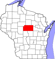 | |
| Villages | ||
| Towns |
| |
| CDPs | ||
| Unincorporated communities |
| |
| Ghost towns/ neighborhoods | ||
| Footnotes | ‡This populated place also has portions in an adjacent county or counties | |