Fanafjorden
| Fanafjorden | |
|---|---|
 View of the fjord and Fanahammeren | |
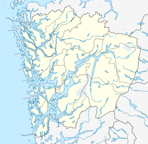 Fanafjorden Location in Hordaland county | |
| Location | Hordaland county, Norway |
| Coordinates | 60°15′18″N 5°18′47″E / 60.2551°N 5.3131°ECoordinates: 60°15′18″N 5°18′47″E / 60.2551°N 5.3131°E |
| Primary outflows | Korsfjorden |
| Basin countries | Norway |
| Max. length | 8.5 kilometres (5.3 mi) |
| Max. depth | 160 metres (520 ft) |
| Settlements | Fanahammeren |
Fanafjorden is a fjord in the city-municipality of Bergen in Hordaland conuty, Norway. The 8.5-kilometre (5.3 mi) long fjord is a fjord arm that branches off of the Korsfjorden fjord and cuts into the large Bergen Peninsula. The deepest point in the fjord reaches 160 metres (520 ft) below sea level. The fjord is located between the small Krokeide peninsula (on the south) and the village area of Milde in Ytrebygda, and forms a natural boundary between the city boroughs of Fana and Ytrebygda. The urban area of Fanahammeren lies at the eastern end of the fjord.[1]
References
- ↑ Store norske leksikon. "Fanafjorden" (in Norwegian). Retrieved 2014-09-01.
This article is issued from Wikipedia - version of the 10/28/2014. The text is available under the Creative Commons Attribution/Share Alike but additional terms may apply for the media files.