Fairwater, Torfaen
| Fairwater | |
| Welsh: Fairwater | |
 Fairwater Primary School |
|
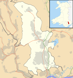 Fairwater |
|
| Area | 5.24 km2 (2.02 sq mi) [1] |
|---|---|
| Population | 11,632 (2011)[2] |
| – density | 2,220/km2 (5,700/sq mi) |
| OS grid reference | ST 276 945 |
| Community | Fairwater |
| Principal area | Torfaen |
| Ceremonial county | Gwent |
| Country | Wales |
| Sovereign state | United Kingdom |
| Post town | CWMBRAN |
| Postcode district | NP44 |
| Dialling code | 01633 |
| Police | Gwent |
| Fire | South Wales |
| Ambulance | Welsh |
| EU Parliament | Wales |
| UK Parliament | Torfaen |
| Welsh Assembly | Torfaen |
Coordinates: 51°38′41″N 3°02′52″W / 51.64462°N 3.04773°W
Fairwater is a community and suburb of Cwmbran in the county borough of Torfaen, in south east Wales, and was built by the Cwmbran Development Corporation between 1963 and 1966.
Development
Cwmbran was the only new town in Wales designated by the New Towns Act 1946.[3] Cwmbran Development Corporation was formed in 1949 to develop the new town and building of seven new residential areas (Coed Eva, Croesyceiliog North and South, Greenmeadow, Oakfield, Pontnewydd, and St Dials) began in 1951, later followed by Llanyrafon.[4][5]
By 1962, when Gordon Redfern took over as chief architect of the corporation, the increased use of cars had to be accommodated in the layout of further housing estates, and Redfern adopted the Radburn system, used most rigidly in Fairwater (built between 1963 and 1966).[5]
Notable buildings
The remains of Llanderfel Chapel, a medieval chapel important as a stopping point on a pilgrims' route to Penrhys, are in Fairwater.[6][7] The pilgrim route is now part of the modern long distance Cistercian Way footpath.[8] The remains are a scheduled monument.[6]
Near the site of the chapel is Llanderfel Farm, a 16th-17th century Grade II listed building.[9] Also nearby is Ty'r Ywen Farmhouse and barn which are both 17th century Grade II listed buildings.[10][11]
Education
There are three primary (infant and junior) schools in Fairwater community:
Cwmbran High (one of two secondary schools in Cwmbran, the other is Croesyceiliog School) is also located in Fairwater.[15][16]
Governance
The community of Fairwater also includes the estates of Coed Eva, Greenmeadow, and Ty Canol, Torfaen, and includes three electoral wards for Torfaen County Borough Council:[17][18]
- Coed Eva, which returns 1 councillor[19]
- Fairwater, which returns 2 councillors[20]
- Greenmeadow, which returns two councillors[21]
References
- ↑ "2011 Census:Quick Statistics:Population Density for Fairwater". Office for National Statistics. Retrieved 29 Nov 2013.
- ↑ "2011 Census:Key Statistics:Key Figures for Fairwater". Office for National Statistics. Retrieved 25 Nov 2013.
- ↑ Newman, John; Lynch, Frances; Manning, William; Hughes, Stephen (2002). "Cwmbran/Cwmbrân". Gwent/Monmouthshire. Pevsner Architectural Guides (The Buildings of Wales). New Haven & London: Yale University Press. p. 194. ISBN 978-0-300-09630-9. OCLC 45327986.
- ↑ Barber, Chris (1999). "The Afon Llwyd (example)". Eastern Valley - The Story of Torfaen (1st ed.). Llanfoist, Gwent: Blorenge Books. p. 181. ISBN 1-872730-23-X. OCLC 43459623.
- 1 2 Newman et al 2002, p. 205.
- 1 2 Leighton, D.; Driver, T. (5 October 2015). "Llanderfel Chapel". National Monuments Record of Wales (NMRW). Royal Commission on the Ancient and Historical Monuments of Wales (RCAHMW). NPRN 91617. Retrieved 29 April 2016 – via coflein (online database of the NMRW).
- ↑ Gray, Madeleine (2006). "St Derfel's Chapel, Llandderfel". The Cistercian Way. Newport, Wales: Alliance of Religions and Conservation. Archived from the original on 4 February 2015. Retrieved 29 April 2016.
- ↑ Gray, Madeleine (2006). "Llantarnam to Risca". The Cistercian Way. Newport, Wales: Alliance of Religions and Conservation. Archived from the original on 4 February 2015. Retrieved 29 April 2016.
- ↑ "Llanderfel Farmhouse". Statutory List of Buildings. Cadw. 29 January 2003 [Listed 1987]. Cadw Building ID 3148. Retrieved 29 April 2016 – via Historic Wales.
- ↑ "Ty'r Ywen Farmhouse". Statutory List of Buildings. Cadw. 29 January 2003 [Listed 2002]. Cadw Building ID 27059. Retrieved 29 April 2016 – via Historic Wales.
- ↑ "Barn at Ty'r Ywen Farm". Statutory List of Buildings. Cadw. 29 January 2003 [Listed 2002]. Cadw Building ID 27060. Retrieved 29 April 2016 – via Historic Wales.
- ↑ "Coed Eva Primary". Education & Learning. Pontypool: Torfaen County Borough Council. Retrieved 29 April 2016.
- ↑ "Henllys Church in Wales Primary". Education & Learning. Pontypool: Torfaen County Borough Council. Retrieved 29 April 2016.
- ↑ "Nant Celyn Primary". Education & Learning. Pontypool: Torfaen County Borough Council. Retrieved 29 April 2016.
- ↑ "Cwmbran High". Education & Learning. Pontypool: Torfaen County Borough Council. Retrieved 29 April 2016.
- ↑ "Croesyceiliog School". Education & Learning. Pontypool: Torfaen County Borough Council. Retrieved 29 April 2016.
- ↑ "Fairwater Community ID 64398". MapIt: UK. London: mySociety. Retrieved 29 April 2016.
- ↑ "Areas covered by Fairwater Community". MapIt: UK. London: mySociety. Retrieved 29 April 2016.
- ↑ "Results by ward: Coed Eva". Find Councillor. Pontypool: Torfaen County Borough Council. Retrieved 29 April 2016.
- ↑ "Results by ward: Fairwater". Find Councillor. Pontypool: Torfaen County Borough Council. Retrieved 29 April 2016.
- ↑ "Results by ward: Greenmeadow". Find Councillor. Pontypool: Torfaen County Borough Council. Retrieved 29 April 2016.
| Principal settlements |  | |
|---|---|---|
| Electoral wards | ||
| Communities | ||
| Places of interest | ||
| Rivers and canals | ||
| Topics | ||