Férin
For the village in Iran, see Ferin, Iran.
| Férin | ||
|---|---|---|
 | ||
| ||
 Férin | ||
|
Location within Hauts-de-France region  Férin | ||
| Coordinates: 50°19′41″N 3°04′26″E / 50.328°N 3.074°ECoordinates: 50°19′41″N 3°04′26″E / 50.328°N 3.074°E | ||
| Country | France | |
| Region | Hauts-de-France | |
| Department | Nord | |
| Arrondissement | Douai | |
| Canton | Douai-Sud | |
| Intercommunality | Douaisis | |
| Government | ||
| • Mayor (2001–2008) | Jean-Pierre Leignel | |
| Area1 | 5.52 km2 (2.13 sq mi) | |
| Population (1999)2 | 1,351 | |
| • Density | 240/km2 (630/sq mi) | |
| Time zone | CET (UTC+1) | |
| • Summer (DST) | CEST (UTC+2) | |
| INSEE/Postal code | 59228 / 59169 | |
| Elevation |
27–45 m (89–148 ft) (avg. 34 m or 112 ft) | |
|
1 French Land Register data, which excludes lakes, ponds, glaciers > 1 km² (0.386 sq mi or 247 acres) and river estuaries. 2 Population without double counting: residents of multiple communes (e.g., students and military personnel) only counted once. | ||
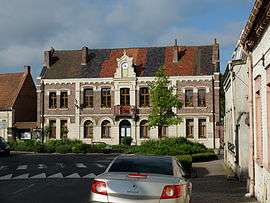
Férin is a commune in the Nord department in northern France.
It is 4 km (2.5 mi) south of Douai.
Heraldry
.svg.png) |
The arms of Férin are blazoned : Or, an eagle sable dimidiated with Azure semy de lys Or. The latter being France Ancient (Dechy, Férin and Saint-Saulve use the same arms.) |
See also
References
| Wikimedia Commons has media related to Férin. |
This article is issued from Wikipedia - version of the 11/16/2016. The text is available under the Creative Commons Attribution/Share Alike but additional terms may apply for the media files.