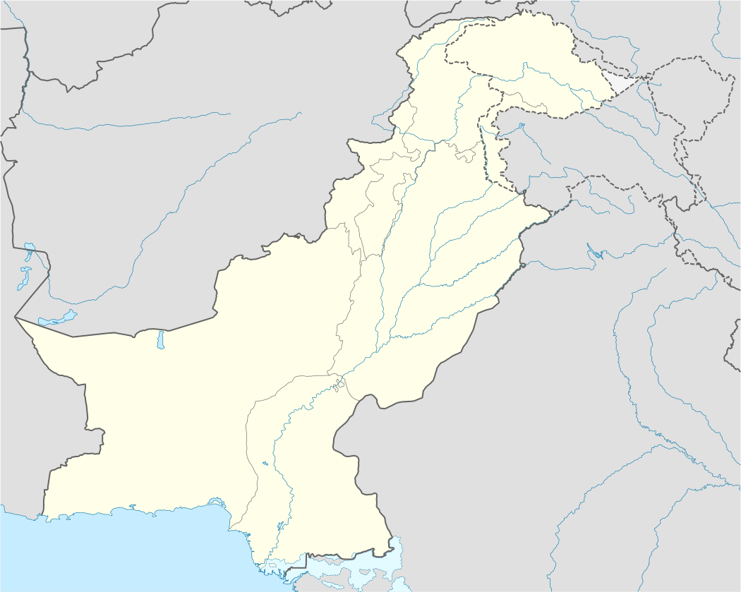
Extreme points of Pakistan
Main article: Geography of Pakistan
Here is a list of the extreme points and extreme elevations in Pakistan.[1]
K2 (Disputed)
Baba Ghundi Chipursan
Sir Creek
Karokoram pass (disputed)
Pakistan, Iran and Afghanistan tripoint
Extreme points of Pakistan
Extreme points
| Heading | Location | Administrative entity | Bordering entity | Coordinates[nb 1] |
|---|---|---|---|---|
| North (disputed) | Baba Ghundi Chipursan in Gilgit–Baltistan a little to the west of the Khunjerab Pass. | Gilgit–Baltistan (formerly known as Northern Areas.) | Xinjiang, People's Republic of China | 37°05′01″N 74°41′26″E / 37.0837°N 74.6906°E |
| South | Near Sir Creek, Thatta | Sindh | Arabian Sea, Gujarat-India. | 23°41′41″N 68°07′59″E / 23.6948°N 68.1331°E |
| East (disputed) | A little east of the Karakoram Pass, Hetian | Gilgit–Baltistan | Xinjiang, People's Republic of China | 35°26′50″N 77°53′35″E / 35.4472°N 77.8931°E |
| West | The point where Pakistan, Iran and Afghanistan meet in Balochistan, near Maki. | Balochistan | Iran, Afghanistan | 29°51′31″N 60°52′29″E / 29.8585°N 60.8746°E |
Extreme altitude

K2 in Gilgit–Baltistan is the second-highest mountain on Earth. With a peak elevation of 8,611 metres (28,251 ft), it is part of the Karakoram range
| Extremity | Name | Altitude | Location | Province/Territory | Coordinates |
|---|---|---|---|---|---|
| Highest | K2[2] | 8,611 m (28,251 ft) | Border between Gilgit–Baltistan and Xinjiang | Gilgit–Baltistan | 35°52′57″N 76°30′48″E / 35.88250°N 76.51333°E |
| Lowest | Near Sir Creek, Thatta | 0 m (0.0 ft) | Thatta District | Sindh | 23°41′42″N 68°08′56″E / 23.695°N 68.149°E |
See also
Notes
- ↑ Coordinates obtained from Google Earth. Google Earth makes use of the WGS84 geodetic reference system.
References
| |||||||||||||||||||||||||||||||||
| |||||||||||||||||||||||||||||||||
| |||||||||||||||||||||||||||||||||
| |||||||||||||||||||||||||||||||||
| |||||||||||||||||||||||||||||||||
| |||||||||||||||||||||||||||||||||
This article is issued from Wikipedia - version of the 11/27/2016. The text is available under the Creative Commons Attribution/Share Alike but additional terms may apply for the media files.