Everthorpe

Coordinates: 53°46′32″N 0°37′27″W / 53.775533°N 0.624051°W
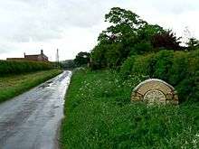
Everthorpe is a hamlet in the East Riding of Yorkshire, England. It is situated approximately 11 miles (18 km) west of Hull city centre and 10 miles (16 km) east of the market town of Howden, midway between North Cave and South Cave. It lies 1 mile (1.6 km) north of the A63 road and 1 mile west of the A1034 road.
Everthorpe forms part of the civil parish of North Cave.
In 1823 Everthorpe was in the parish of North Cave and in the Wapentake of Harthill. Population was 177, which included Drewton, a hamlet less than 1 mile to the north-east. Occupations included three farmers, a corn miller, and the landlord of Duke of York public house.[1]
The area is home to two prisons - HMP Everthorpe and HMP Wolds.
References
- ↑ Baines, Edward (1823): History, Directory and Gazetteer of the County of York, p. 203
- Gazetteer — A–Z of Towns Villages and Hamlets. East Riding of Yorkshire Council. 2006. p. 5.
| Wikimedia Commons has media related to Everthorpe. |