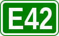
European route E42
| |
|---|---|
 | |
| Route information | |
| Length: | 680 km (420 mi) |
| Major junctions | |
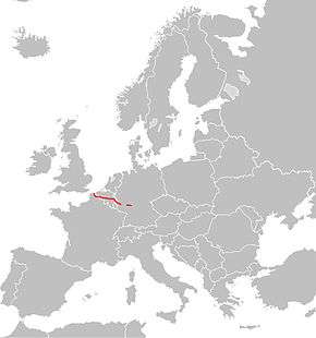
| From: | Dunkerque (France) |
| To: | Aschaffenburg (Germany) |
| Location | |
| Countries: | France, Belgium, Germany |
| Highway system | |
| International E-road network | |
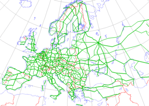
The European route E 42 is a road in Europe and a part of the United Nations International E-road network. It connects Dunkerque, a major ferry and container port at the northern end of the French coast with Aschaffenburg on the north western tip of Bavaria. Along the way it also passes through Wallonia in Belgium and the German Länder of Rhineland-Palatinate and Hessen. The full length of the route is approximately 680 kilometers (420 mi).
Language challenge
The western end of the route runs close to the Franco-Dutch language border. As a consequence, traffic signs might use Dutch exonyms for French or Walloon cities, and French exonyms for Dutch-speaking places. When a city lies in France, both names will be displayed in Flanders (e.g. Rijsel will be followed by Lille in italics).

France
The western end between Dunkerque and Lille follows a four lane dual carriageway toll free highway. Much of this has recently been resurfaced, but parts remain of subautoroute standard in terms of such details as junction lay-out and speed limits. Lille itself is at the centre of a major industrial area and is the meeting point of major routes. The passage of the E 42 along the urban highway is marked by several sharp bends and, especially for westbound traffic, unavoidable lane changes as well as speed cameras. Delays during peak commuting times are frequent.
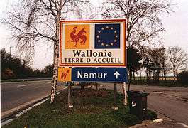
Belgium
The route follows no fewer than six different autoroutes in succession during its passage through southern Belgium (Wallonia), linking all its major cites, from the provincial capital Mons, to Charleroi and Namur, along with the major commercial and university city of Liège and its important cargo airport further to the east. The most easterly portion within Belgium was fully upgraded to autoroute standard only with the completion of the A27 at the end of the 20th century: before that happened the main road included (subject to diversions on race days) a brief stretch that used the Formula One racing circuit at Spa. The final kilometers before the German frontier include towns and villages transferred from Germany to Belgium under the provisions of the 1919 Treaty of Versailles endorsed in 1925 by a referendum process not universally regarded as fair: over three quarters of a century later sign boards showing place names in French and German frequently have the French versions deleted by graffiti artists.
Germany
The eastern portion of the E 42 in Germany follows the BAB 60. Despite considerable progress in recent years, the building of the Autobahn was delayed during the final decade of the 20th century, and the road in this area is still missing several important doubled road viaducts, so that at various points the road is reduced to a single two lane road. The landscape here is relatively mountainous: a recent development has been the appearance on the surrounding horizons of modern windmill groupings.