Adige
| Adige | |
| Etsch, Àdexe, Adesc, Athesis | |
| River | |
| Country | Italy |
|---|---|
| Cities | Glurns, Merano, Bolzano, Auer, Trento, Rovereto, Verona |
| Source | Reschen Pass |
| - location | Graun im Vinschgau, South Tyrol, Italy |
| - elevation | 1,520 m (4,987 ft) |
| - coordinates | 46°50′04″N 10°30′53″E / 46.83444°N 10.51472°E |
| Mouth | Adriatic Sea |
| - coordinates | 45°8′59″N 12°19′13″E / 45.14972°N 12.32028°ECoordinates: 45°8′59″N 12°19′13″E / 45.14972°N 12.32028°E |
| Length | 410 km (255 mi) |
| Basin | 12,100 km2 (4,672 sq mi) |
| Discharge | |
| - average | 235 m3/s (8,299 cu ft/s) |
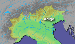 Map of Adige River
| |
The Adige (Italian pronunciation: [ˈaːdidʒe]; German: Etsch [ɛtʃ]; Venetian: Àdexe; Romansh: ![]() Adisch ; Ladin: Adesc; Latin: Athesis; Ancient Greek: Ἄθεσις) is a river with its source in the Alpine province of South Tyrol near the Italian border with Austria and Switzerland. At 410 kilometres (250 mi) in length, it is the second longest river in Italy, after the Po river at 652 kilometres (405 mi).
Adisch ; Ladin: Adesc; Latin: Athesis; Ancient Greek: Ἄθεσις) is a river with its source in the Alpine province of South Tyrol near the Italian border with Austria and Switzerland. At 410 kilometres (250 mi) in length, it is the second longest river in Italy, after the Po river at 652 kilometres (405 mi).
Description
The river sources near the Reschen Pass (1,504 metres (4,934 ft)) close to the borders with Austria and Switzerland above the Inn valley. It flows through the artificial alpine Lake Reschen. The lake is known for the church tower that marks the site of the former village of Alt Graun ("Old Graun"); it was evacuated and flooded in 1953 after the dam was finished. Near Glurns, the Rom river joins from the Swiss Val Müstair.
The Adige runs eastbound through the Vinschgau to Merano, where it is met by the Passer river from the north. The section between Merano and Bolzano, is called Etschtal, meaning Adige Valley. South of Bolzano, the river is joined by the Eisack and turns south through a valley which has always been one of the major routes through the Alps, connecting the Reschen and the Brenner passes, at 1,370 metres (4,490 ft) considered the easiest of the main Alpine passes.
The Chiusa di Salorno narrows at Salorno mark the southernmost part of the predominantly German-speaking province of South Tyrol. The Adige was mentioned in the "Lied der Deutschen" of 1841 as the southern border of the German language area (which it still is). In 1922 Germany adopted the song as its national anthem, although by that time Italy had taken control of all of the Adige.
Near Trento, the Avisio, Noce, and Fersina rivers join. The Adige crosses Trentino and later Veneto, flowing past the city of Verona and the towns of Rovereto and Adria through the Lagarina Valley and the north-eastern part of the Po Plain into the Adriatic Sea. The Adige and the Po run parallel in the river delta without properly joining.
The Adige is connected to Lake Garda by the Mori-Torbole tunnel, an artificial underground canal built for flood prevention.
Ecology
Fauna
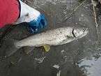
The Adige is a home to the Marble trout (Salmo marmoratus), but at far lower populations than in the past. Fish stocking is one of the most significant causes of the sharp reduction in the original (autochthonous) fish population of this subspecies. It will spawn with and interbreed with brown trout, which are regularly stocked in the river and its tributaries.[1]
Gallery
-
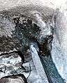
The true source of Adige inside a bunker of the Alpine Wall
-
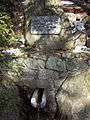
The false source
-

Graun, the bell tower in the Reschensee.
-
The Adige between Laas and Göflan in the Vinschgau.
-
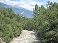
The Adige flowing through Vallagarina.
-

The Adige flowing through Verona.
-
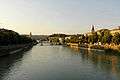
The Adige flowing through Verona.
-
The Adige flowing through Verona seen from Castel San Pietro.
-
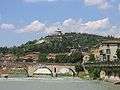
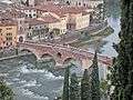
Adige river and Ponte Pietra in Verona.
-
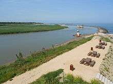
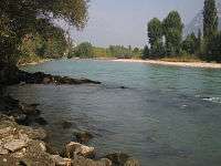
The mouth of the Adige at Rosolina Mare
References
- ↑ Karel Kovar "Hydrology, Water Resources and Ecology in Headwaters". p. 505
External links
| Wikimedia Commons has media related to Adige. |