Ethan, South Dakota
| Ethan, South Dakota | |
|---|---|
| Town | |
| Motto: Where friends and family come together | |
 Location in Davison County and the state of South Dakota | |
| Coordinates: 43°32′45″N 97°59′0″W / 43.54583°N 97.98333°WCoordinates: 43°32′45″N 97°59′0″W / 43.54583°N 97.98333°W | |
| Country | United States |
| State | South Dakota |
| County | Davison |
| Platted | 1883[1] |
| Area[2] | |
| • Total | 0.25 sq mi (0.65 km2) |
| • Land | 0.25 sq mi (0.65 km2) |
| • Water | 0 sq mi (0 km2) |
| Elevation | 1,342 ft (409 m) |
| Population (2010)[3] | |
| • Total | 331 |
| • Estimate (2012[4]) | 333 |
| • Density | 1,324.0/sq mi (511.2/km2) |
| Time zone | Central (CST) (UTC-6) |
| • Summer (DST) | CDT (UTC-5) |
| ZIP code | 57334 |
| Area code(s) | 605 |
| FIPS code | 46-20060[5] |
| GNIS feature ID | 1254961[6] |
| Website | http://www.ethansd.com http://www.ethanvoice.com |
Ethan is a town in Davison County, South Dakota, United States. It is part of the Mitchell, South Dakota Micropolitan Statistical Area. The population was 331 at the 2010 census. Ethan is a small community just 10 miles south of Mitchell.
Geography
Ethan is located at 43°32′45″N 97°59′0″W / 43.54583°N 97.98333°W (43.545878, -97.983283).[7]
According to the United States Census Bureau, the town has a total area of 0.25 square miles (0.65 km2), all of it land.[2]
Ethan has been assigned the ZIP code 57334.
History
Ethan was laid out in 1883, and named in honor of Ethan Allen, a patriot in the Revolutionary War.[8]
Demographics
| Historical population | |||
|---|---|---|---|
| Census | Pop. | %± | |
| 1910 | 312 | — | |
| 1920 | 416 | 33.3% | |
| 1930 | 369 | −11.3% | |
| 1940 | 324 | −12.2% | |
| 1950 | 319 | −1.5% | |
| 1960 | 297 | −6.9% | |
| 1970 | 309 | 4.0% | |
| 1980 | 351 | 13.6% | |
| 1990 | 312 | −11.1% | |
| 2000 | 330 | 5.8% | |
| 2010 | 331 | 0.3% | |
| Est. 2015 | 323 | [9] | −2.4% |
2010 census
As of the census[3] of 2010, there were 331 people, 130 households, and 92 families residing in the town. The population density was 1,324.0 inhabitants per square mile (511.2/km2). There were 142 housing units at an average density of 568.0 per square mile (219.3/km2). The racial makeup of the town was 97.9% White, 1.2% Native American, and 0.9% from two or more races. Hispanic or Latino of any race were 0.3% of the population.
There were 130 households of which 36.2% had children under the age of 18 living with them, 55.4% were married couples living together, 11.5% had a female householder with no husband present, 3.8% had a male householder with no wife present, and 29.2% were non-families. 24.6% of all households were made up of individuals and 10% had someone living alone who was 65 years of age or older. The average household size was 2.55 and the average family size was 3.01.
The median age in the town was 33.9 years. 28.4% of residents were under the age of 18; 8.5% were between the ages of 18 and 24; 29.1% were from 25 to 44; 19.8% were from 45 to 64; and 14.2% were 65 years of age or older. The gender makeup of the town was 50.2% male and 49.8% female.
2000 census
As of the census[5] of 2000, there were 330 people, 129 households, and 91 families residing in the town. The population density was 1,350.6 people per square mile (530.9/km²). There were 138 housing units at an average density of 564.8 per square mile (222.0/km²). The racial makeup of the town was 99.09% White, 0.61% from other races, and 0.30% from two or more races. Hispanic or Latino of any race were 0.91% of the population.
There were 129 households out of which 38.8% had children under the age of 18 living with them, 59.7% were married couples living together, 9.3% had a female householder with no husband present, and 28.7% were non-families. 24.8% of all households were made up of individuals and 12.4% had someone living alone who was 65 years of age or older. The average household size was 2.56 and the average family size was 3.08.
In the town the population was spread out with 30.0% under the age of 18, 8.5% from 18 to 24, 29.1% from 25 to 44, 19.1% from 45 to 64, and 13.3% who were 65 years of age or older. The median age was 33 years. For every 100 females there were 89.7 males. For every 100 females age 18 and over, there were 86.3 males.
The median income for a household in the town was $37,917, and the median income for a family was $43,125. Males had a median income of $30,208 versus $19,688 for females. The per capita income for the town was $14,897. About 6.4% of families and 8.4% of the population were below the poverty line, including 7.9% of those under age 18 and 26.3% of those age 65 or over.
References
- ↑ "SD Towns" (PDF). South Dakota State Historical Society. Retrieved 2010-02-11.
- 1 2 "US Gazetteer files 2010". United States Census Bureau. Archived from the original on January 24, 2012. Retrieved 2012-06-21.
- 1 2 "American FactFinder". United States Census Bureau. Retrieved 2012-06-21.
- ↑ "Population Estimates". United States Census Bureau. Archived from the original on June 17, 2013. Retrieved 2013-05-29.
- 1 2 "American FactFinder". United States Census Bureau. Archived from the original on September 11, 2013. Retrieved 2008-01-31.
- ↑ "US Board on Geographic Names". United States Geological Survey. 2007-10-25. Retrieved 2008-01-31.
- ↑ "US Gazetteer files: 2010, 2000, and 1990". United States Census Bureau. 2011-02-12. Retrieved 2011-04-23.
- ↑ Federal Writers' Project (1940). South Dakota place-names, v.1-3. University of South Dakota. p. 37.
- ↑ "Annual Estimates of the Resident Population for Incorporated Places: April 1, 2010 to July 1, 2015". Retrieved July 2, 2016.
- ↑ "Census of Population and Housing". Census.gov. Archived from the original on May 11, 2015. Retrieved June 4, 2015.
External links
Municipalities and communities of Davison County, South Dakota, United States | ||
|---|---|---|
| City | 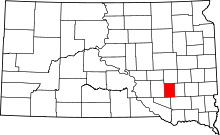 | |
| Town | ||
| CDP | ||