Etar Snowfield
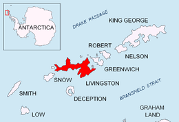

Etar Snowfield (Bulgarian: Ледник Етър \'led-nik 'e-t&r\, Lednik Etar) is a roughly crescent-shaped snowfield on western Livingston Island in the South Shetland Islands, Antarctica situated west of Urdoviza, Medven and Berkovitsa Glaciers, and northwest of Verila Glacier. It drains the west slopes of Oryahovo Heights and the north slopes of Rotch Dome, and flows into Barclay Bay between Mercury Bluff and Rowe Point. The feature extends 5 km (3 mi) inland, and 15 km (9 mi) in south-southwest to north-northeast direction. Bulgarian mapping in 2005 and 2009.
The glacier was named after the settlement of Etar in the central Balkan Mountains, Bulgaria.
Maps
- L.L. Ivanov et al. Antarctica: Livingston Island and Greenwich Island, South Shetland Islands. Scale 1:100000 topographic map. Sofia: Antarctic Place-names Commission of Bulgaria, 2005.
- L.L. Ivanov. Antarctica: Livingston Island and Greenwich, Robert, Snow and Smith Islands. Scale 1:120000 topographic map. Troyan: Manfred Wörner Foundation, 2009.
Location
The snowfield is located at 62°34′07″S 60°46′27″W / 62.56861°S 60.77417°WCoordinates: 62°34′07″S 60°46′27″W / 62.56861°S 60.77417°W. Bulgarian mapping in 2005 and 2009.
External links
This article includes information from the Antarctic Place-names Commission of Bulgaria which is used with permission.