Enfield Lock
| Enfield Lock | |
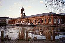
 Enfield Lock |
|
| Population | 16,469 (2011 Census. Ward)[1] |
|---|---|
| OS grid reference | TQ365985 |
| London borough | Enfield |
| Ceremonial county | Greater London |
| Region | London |
| Country | England |
| Sovereign state | United Kingdom |
| Post town | ENFIELD |
| Postcode district | EN3 |
| Dialling code | 01992 / 020 |
| Police | Metropolitan |
| Fire | London |
| Ambulance | London |
| EU Parliament | London |
| UK Parliament | Enfield North |
| London Assembly | Enfield and Haringey |
Coordinates: 51°40′07″N 0°01′34″W / 51.6686°N 0.026°W
Enfield Lock is an area in the London Borough of Enfield, north London. It is approximately located east of the Hertford Road between Turkey Street and the Holmesdale Tunnel overpass, and extends to the River Lee Navigation, including the Enfield Island Village.[2] The locality gains its name from the lock on the River Lee Navigation. Today's Enfield Lock was rebuilt in 1922.[3] The area forms part of the Lee Valley Park and the Enfield Lock Conservation Area.[4] On its eastern boundary Enfield Lock has marshland formerly used as a testing site between the Royal Small Arms Factory and the Gunpowder Mills. To the south is Brimsdown, the north Waltham Cross and to the west Bullsmoor and Freezywater. Enfield Lock forms part of the London boundary.
Etymology
Enfield Lock is recorded thus in 1710, earlier as Norhtlok (1355), The Locke (1657), i.e. 'the (northern) lock or river barrier (near Enfield)', from Middle English lok.[5]
History

The area was first developed from about 1812 when a government-owned rifle factory, which was later known as the Royal Small Arms Factory (RSAF), Enfield, was built. The factory was built towards the end of the Napoleonic War on the instructions of the Board of Ordnance on marshland at Enfield Lock on the banks of both the River Lea and the River Lee Navigation. The RSAF was closed in the late 1980s, shortly after privatisation, and the majority of the former site has now been redeveloped into a large housing development: Enfield Island Village. The original machine shop frontage and the older part of the rear structure has been retained and was converted into workshops and retail units by the Enfield Enterprise Agency. Until the construction of the M25 in the 1980s, and the later building of the A1055, the area was much like a village with only a small population and consisting of only a few roads in the locality. Roads such as Ordnance Road, Salisbury Road and Medcalf Road are still populated by families who have lived in the Enfield Lock area for several generations.
2011 riots
After rioting had spread from neighbouring Tottenham on 8 August 2011, the Sony DADC/PIAS distribution centre on the Innova Business Park was looted and destroyed by fire.[6] The Home Secretary, Theresa May, was shown the destroyed distribution centre by chief police officers and firefighters on 12 August 2011.[7] In September 2012, the Prime Minister, David Cameron, opened the rebuilt warehouse.[8]

Demography
The Enfield Lock ward, which also covers Enfield Island Village, is 54% white (38% British, 15% Other, 1% Irish) as of the 2011 census. 23% of the population is black (15% African, 8% Caribbean, 4% Other).[9]
Transport and locale
Nearest places
Nearest railway stations
Politics
The local MP (for Enfield North) is Joan Ryan Labour, who ousted the previous Conservative MP, Nick de Bois, in the general election of 7 May 2015. Nick de Bois had previously beaten Joan Ryan, who had served as the Enfield North MP between 1997 and 2010.
Schools
- Primary schools: Chesterfield Infant School, Chesterfield Junior School, Keys Meadow Primary, Prince of Wales Primary School
- Secondary Schools: Oasis Academy Enfield
Recreation
Section 18 of the London LOOP, a long distance footpath, can be accessed at Enfield Lock railway station. The path connects with the Lea Valley Walk above Enfield Lock at Ordnance Road.
Angling is allowed on the River Lee Navigation upstream and downstream of Enfield Lock. Information from the River Lea Anglers Club.[10]
National Cycle Route 1 follows the River Lea towpath to Gunpowder Park.
Gunpowder Park, which lies to the east of Enfield Lock, is a large open space consisting mostly of marshland and lakes. The land is owned and managed by the Lee Valley Regional Park and is open to the public.[11]
References
- ↑ "Enfield Ward population 2011". Neighbourhood Statistics. Office for National Statistics. Retrieved 21 October 2016.
- ↑ http://www.enfield.gov.uk/362/Enfield%20Lock.pdf Local Government Boundaries map
- ↑ Enfield Lock - a history Retrieved 26 August 2010
- ↑ Enfield Lock Conservation Area Retrieved 20 November 2013
- ↑ Mills. A. D. Oxford Dictionary of London Place Names (2001) p76 ISBN 0-19-860957-4 Retrieved 21 October 2008
- ↑ News report
- ↑ News report Retrieved 14 August 2011
- ↑ Sony Innova Way Retrieved 25 September 2012
- ↑ .http://www.ukcensusdata.com/enfield-lock-e05000199
- ↑ River Lea Anglers Club Retrieved 2 December 2014
- ↑ Lee Valley Park-Gunpowder Park Retrieved 3 August 2015
External links
| Wikimedia Commons has media related to Enfield Lock. |
| Districts |
|  |
|---|---|---|
| Attractions | ||
| Parks and open spaces | ||
| Constituencies | ||
| Tube and rail stations | ||
| Other topics | ||
| Section 17: | London Outer Orbital Path | Section 18: |
|---|---|---|
| Cockfosters | Enfield Lock | Chingford |