Empalme Olmos
| Empalme Olmos | |
|---|---|
| Village | |
|
Train station at Empalme Olmos | |
 Empalme Olmos Location in Uruguay | |
| Coordinates: 34°42′0″S 55°54′0″W / 34.70000°S 55.90000°WCoordinates: 34°42′0″S 55°54′0″W / 34.70000°S 55.90000°W | |
| Country |
|
| Department | Canelones Department |
| Population (2011) | |
| • Total | 4,199 |
| Time zone | UTC -3 |
| Postal code | 91002 |
| Dial plan | +598 2 (+7 digits) |

Empalme Olmos is a village in the Canelones Department of southern Uruguay.
Empalme Olmos is also the name of the municipality to which the town belongs.
Location
The village is located at the junction of Route 8 with Routes 82 and 34, about 6 kilometres (3.7 mi) northeast of the city of Pando.
History
Its status was elevated to "Pueblo" (village) on 3 November 1952 by the Act of Ley Nº 11.877.[1]
Population
In 2011 Empalme Olmos had a population of 4,199.[2] In 2010, the Intendencia de Canelones had recorded a population of 5,497 for the municipality during the elections.[3]

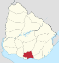
Location map of the Municipality of Empalme Olmos
| Year | Population |
|---|---|
| 1963 | 1,973 |
| 1975 | 2,108 |
| 1985 | 3,144 |
| 1996 | 3,815 |
| 2004 | 3,978 |
| 2011 | 4,199 |
Source: Instituto Nacional de Estadística de Uruguay[4]
Places of worship
- St. Rose of Lima Parish Church (Roman Catholic)
References
- ↑ "LEY N° 11.877". República Oriental del Uruguay, Poder Legislativo. 1952. Retrieved 7 September 2012.
- ↑ "Censos 2011 Cuadros Canelones". INE. 2012. Retrieved 25 August 2012.
- ↑ "Elecciones - Canelones". El Observador. Retrieved 2 February 2012.
- ↑ "Statistics of urban localities (1963–2004)" (PDF). INE. 2012. Retrieved 7 September 2012.
Images
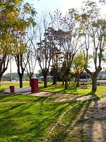
Plaza 30 de noviembre near the train station at Empalme Olmos.
External links
| Wikimedia Commons has media related to Empalme Olmos. |
Capital: Canelones | ||
| Towns and villages |
|  |
| Resorts of the Ciudad de la Costa | ||
| Sights |
| |
This article is issued from Wikipedia - version of the 11/4/2014. The text is available under the Creative Commons Attribution/Share Alike but additional terms may apply for the media files.