Emmet, Arkansas
| Emmet, Arkansas | |
|---|---|
| City | |
 Location in Nevada County and the state of Arkansas | |
| Coordinates: 33°43′35″N 93°28′17″W / 33.72639°N 93.47139°WCoordinates: 33°43′35″N 93°28′17″W / 33.72639°N 93.47139°W | |
| Country | United States |
| State | Arkansas |
| Counties | Nevada, Hempstead |
| Area | |
| • Total | 1.5 sq mi (3.9 km2) |
| • Land | 1.5 sq mi (3.9 km2) |
| • Water | 0 sq mi (0 km2) |
| Elevation | 318 ft (97 m) |
| Population (2010) | |
| • Total | 518 |
| • Density | 337.3/sq mi (129.7/km2) |
| Time zone | Central (CST) (UTC-6) |
| • Summer (DST) | CDT (UTC-5) |
| ZIP code | 71835 |
| Area code(s) | 870 |
| FIPS code | 05-21610 |
| GNIS feature ID | 0048893 |
Emmet is a city that spans both Hempstead and Nevada counties in the U.S. state of Arkansas.[1] It is located at the intersection of U.S. Highway 67 and Arkansas Highway 299 in the Ark-La-Tex region of Arkansas Timberlands, in Southwest Arkansas.
History
The area around Emmet had long been inhabited by the Native American Caddo, prior to European colonization of the Americas.[2][3] It consisted of gently rolling hills and prairies, interspersed with dense timber and fertile lowlands.
By the time of the Louisiana Purchase, the natural fauna was being removed in favor of more profitable crops. Wildlife that had been an important sustenance for Natives was also being removed and over time, the Caddo population was greatly diminished.
In the years following Arkansas statehood, settlers began flowing steadily into Arkansas. Some were following the Southwest Trail to Fulton, on the Red River, while others saw opportunity in the area where Emmet would be established.
In 1837, Martin Edwards secured one of the first Land Patents in Arkansas. His property encompassed the area that would include the community of Burkville; precursor to the City of Emmet.
Geography
Emmet is located at 33°43′35″N 93°28′17″W / 33.72639°N 93.47139°W (33.726411, -93.471340).[4]
The city is situated near the headwaters of the Terre Rouge Creek watershed which meanders northeastward for 17 mi, before joining the Little Missouri River at a point 11 mi east of Prescott and 6 mi northwest of Reader. The Prairie d'Ane is 8 mi northeast of Emmet, and the Prairie de Roan is 8 mi to the southwest. Both prairies were noted by Robert T. Hill, during the Arkansas Geological Survey of 1888.[5]
According to the United States Census Bureau, Emmet has a total area of 1.5 square miles (3.9 km2), all of it land.
Demographics
| Historical population | |||
|---|---|---|---|
| Census | Pop. | %± | |
| 1900 | 277 | — | |
| 1910 | 270 | −2.5% | |
| 1920 | 420 | 55.6% | |
| 1930 | 387 | −7.9% | |
| 1940 | 465 | 20.2% | |
| 1950 | 482 | 3.7% | |
| 1960 | 474 | −1.7% | |
| 1970 | 433 | −8.6% | |
| 1980 | 475 | 9.7% | |
| 1990 | 446 | −6.1% | |
| 2000 | 506 | 13.5% | |
| 2010 | 518 | 2.4% | |
| Est. 2015 | 486 | [6] | −6.2% |
2014 Estimate[8] | |||
As of the census[9] of 2000, there were 506 people, 186 households, and 129 families residing in the city. The population density was 333.4 people per square mile (128.5/km²). There were 220 housing units at an average density of 145.0/sq mi (55.9/km²). The racial makeup of the city was 77.67% White, 20.16% Black or African American, 0.40% Native American, 0.20% from other races, and 1.58% from two or more races. 0.40% of the population were Hispanic or Latino of any race.
There were 186 households out of which 39.8% had children under the age of 18 living with them, 46.8% were married couples living together, 16.7% had a female householder with no husband present, and 30.6% were non-families. 26.3% of all households were made up of individuals and 10.8% had someone living alone who was 65 years of age or older. The average household size was 2.72 and the average family size was 3.31.
In the city the population was spread out with 32.2% under the age of 18, 7.5% from 18 to 24, 30.4% from 25 to 44, 18.8% from 45 to 64, and 11.1% who were 65 years of age or older. The median age was 32 years. For every 100 females there were 98.4 males. For every 100 females age 18 and over, there were 85.4 males.
The median income for a household in the city was $22,386, and the median income for a family was $26,250. Males had a median income of $24,107 versus $22,250 for females. The per capita income for the city was $11,726. About 30.0% of families and 33.4% of the population were below the poverty line, including 47.4% of those under age 18 and 20.0% of those age 65 or over.
Education
Public education for elementary and secondary school students is available from the Blevins School District, which leads to graduation from Emmet High School.[10][11]
Notable Places
National Register
- Emmet Methodist Church - one of the few Akron Plan church buildings in Arkansas.
- Ephesus Cemetery - burial site for many of Emmet's early settlers.
Commerce
- B & P Pattern Lumber Sales - custom materials provider.[12][13]
- CenterPoint Energy (Ark-La Gas Company) - regional offices.[14][15]
- Flaherty's Fish Farm - fish hatchery.[16][17]
Ark-La Village
In 1959, Arkansas Louisiana Gas Company opened a western themed tourist attraction at the direction of Wilton R. Stephens, founder of Stephens Inc.[18] and Arkla Village.[19][20] Ark-La Village was a re-creation of an 1880s western settlement where patrons could participate in the 'daily life' of early pioneers. It was located on the companies property inside Emmet's northern city limits.
When first constructed, the 'village' featured a saloon and general store, a livery stable, and a museum. Other attractions included a miniature train ride, a paddle wheel boat ride, a bowling alley, a restaurant, and a 'jail' where comical, behind-the-bars photos could be taken.[21] Connected with the village was a factory that built horse-drawn carriages and horse saddles.[22]
In 1961, a shooting roundup was held and 'Harold M. Terry' was the invited marksman.[23]
Though popular with tourists and local citizens, it was the traffic along U.S. Highway 67 between Little Rock and Dallas that provided Ark-La Village with most of its patrons.[24] That customer base was lost when the final section of Interstate 30 was completed in 1972. As a result, the 'village' was closed in the early 1970s, with the restaurant and bowling alley closing a few years later.
In the following years, some portions of the property have been donated to the City of Emmet. Re-development has included a new city park and a building for public meetings.
Media
Emmet is served by the Hope Star, and the Nevada County Picayune-Times.[25] Both owned by Gatehouse Media. Larger newspapers that serve the area include the Arkansas Democrat-Gazette, the Texarkana Gazette, and the Shreveport Times.
Local television service is provided by KTSS-LP(50 UHF), and local radio stations include KHPA (104.9 MHz FM) and KTPA (1370 kHz AM). In addition, the city is served by radio and television stations from Little Rock, and Shreveport.
A variety of Telephone, Cable-TV, and Internet providers are available to subscribers in Emmet, including 'Hope-Prescott.com', a local internet-news web site.[26]
Infrastructure
Notable person
- Tom Hughes - (born 1907, Emmet) - MLB Outfielder, 1930 Detroit Tigers.
References
- ↑ "Emmet". Arkansas Municipal League - Local.Arkansas.Gov.
- ↑ "Life different when Caddo Indians were here". John Miller, Nevada County Picayune, Wednesday, March 3, 2004.
- ↑ "Archaelogical site". Nevada County Depot and Museum - DeoptMuseum.org.
- ↑ "US Gazetteer files: 2010, 2000, and 1990". United States Census Bureau. 2011-02-12. Retrieved 2011-04-23.
- ↑ "Lexicon of Geologic names of the United States". United States Department of the Interior - R.T. Hill, 1888 (Ark. Geol. Surv. Ann. Rept. 1888, vol. 2, pp. 32-33, 46-47, 188).
- ↑ "Annual Estimates of the Resident Population for Incorporated Places: April 1, 2010 to July 1, 2015". Retrieved July 2, 2016.
- ↑ "Census of Population and Housing". Census.gov. Retrieved June 4, 2015.
- ↑ "Annual Estimates of the Resident Population for Incorporated Places: April 1, 2010 to July 1, 2014". Retrieved June 4, 2015.
- ↑ "American FactFinder". United States Census Bureau. Retrieved 2008-01-31.
- ↑ "2009-2010 Emmet Elementary School ACSIP Plan" (PDF). Blevins School District.
- ↑ "2009-2010 Emmet High School ACSIP Plan" (PDF). Blevins School District.
- ↑ "B&P Lumber Sales LLC". B&P Lumber Sales, LLC - BAndPLumberSalesLLC.com. Retrieved April 9, 2016.
- ↑ "B & P Pattern Lumber Sales, LLC". B & P Pattern Lumber Sales, LLC - EmmetLumber.com. Retrieved April 9, 2016.
- ↑ "Company Overview of CenterPoint Energy Arkla". Bloomberg L.P. - Investing.BusinessWeek.com.
- ↑ "Emmet (Nevada and Hempstead Counties)". Steven Teske - The Encyclopedia of Arkansas History & Culture (paragraph #6).
- ↑ "MarketMaker Business Profile: Flahertys Fish Farm". Riverside Research - AR.FoodMarketMaker.com. Retrieved April 9, 2016.
- ↑ "Welcome To Flaherty's Fish Farm!". Flaherty's Fish Farm - FlahertyFishFarm.com. Retrieved April 9, 2016.
- ↑ "W. R. Stephens, Political Leader And Arkansas Investor, Dies at 84". Kurt Eichenwald - The New York Times Company, December 4, 1991.
- ↑ "W. R. Stephens Builds a Western Town at Emmet". Arkansas Gazette, July 12, 1959, p. 3C.
- ↑ "ARKLA, INC.". Company-Histories.com.
- ↑ "Arkla Village". ArkansasAcer.Tripod.com. Retrieved September 26, 2014.
- ↑ "Down In Arkansas, Horse-And-Buggy Town". Horace Sutton, Shirley and Bob Sloane, St. Petersburg Times - March 27, 1960 (p.12-D).
- ↑ "Arkla Village Roundup to Feature Crack Shot Capt. Harold M. Terry". Hope Star. Retrieved September 26, 2014.
- ↑ "A Journey Through Arkansas: Historic U.S. Highway 67". Ray Hanley, Steve Hanley, Arcadia Publishing, 1999 (p.112).
- ↑ "Nevada County Picayune-Times". Gatehouse Media, LLC - Picayune-Times.com.
- ↑ "Hope-Prescott.com". Hope-Prescott.com.
External links
Historic photographs
- 1900 - 1930 Emmet School Nevada County Depot and Museum - DeoptMuseum.org
- Hood's Cotton Gin at Emmet, early 1900s Nevada County Depot and Museum - DeoptMuseum.org
- Ark-La Village (Storefronts) Nevada County Depot and Museum - DeoptMuseum.org
- Ark-La Village (Blacksmith & Stable) Nevada County Depot and Museum - DeoptMuseum.org
Municipalities and communities of Nevada County, Arkansas, United States | ||
|---|---|---|
| Cities | 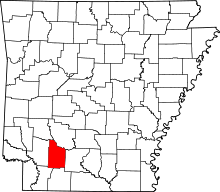 | |
| Towns | ||
| CDP | ||
| Unincorporated communities | ||
| Footnotes | ‡This populated place also has portions in an adjacent county or counties | |
Municipalities and communities of Hempstead County, Arkansas, United States | ||
|---|---|---|
| Cities |  | |
| Towns | ||
| Unincorporated communities | ||
| Footnotes | ‡This populated place also has portions in an adjacent county or counties | |