Emigrant Gap, California
| Emigrant Gap | |
|---|---|
| Unincorporated community | |
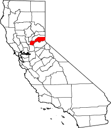
 Emigrant Gap Location in California | |
| Coordinates: 39°17′49″N 120°40′22″W / 39.29694°N 120.67278°WCoordinates: 39°17′49″N 120°40′22″W / 39.29694°N 120.67278°W | |
| Country |
|
| State |
|
| County | Placer County |
| Elevation[1] | 5,190 ft (1,582 m) |
Emigrant Gap (formerly, Wilsons Ranch)[2] is an unincorporated community in Placer County, California.[1] Emigrant Gap is located 0.25 miles (0.4 km) southwest of Emigrant Gap.[2] It lies at an elevation of 5190 feet (1582 m).[1]
The Wilsons Ranch post office opened in 1865, changed its name to Emigrant Gap in 1868.[2] The name Wilsons Ranch honored a stage stop operator.[2]
Climate
According to the Köppen Climate Classification system, Emigrant Gap has a warm-summer Mediterranean climate, abbreviated "Csb" on climate maps.[3]
| Climate data for Emigrant Gap, California | |||||||||||||
|---|---|---|---|---|---|---|---|---|---|---|---|---|---|
| Month | Jan | Feb | Mar | Apr | May | Jun | Jul | Aug | Sep | Oct | Nov | Dec | Year |
| Average high °C (°F) | 7 (44) |
8 (47) |
10 (50) |
14 (57) |
18 (64) |
23 (74) |
27 (81) |
29 (85) |
24 (75) |
18 (65) |
11 (52) |
7 (45) |
16 (61) |
| Average low °C (°F) | −4 (24) |
−4 (25) |
−3 (26) |
−1 (30) |
2 (36) |
6 (42) |
8 (47) |
7 (45) |
6 (42) |
2 (36) |
−2 (29) |
−4 (25) |
1 (34) |
| Average precipitation cm (inches) | 33 (13) |
28 (11) |
25 (10) |
13 (5) |
8 (3) |
3 (1) |
0.5 (0.2) |
0.8 (0.3) |
2.8 (1.1) |
9.7 (3.8) |
20.6 (8.1) |
29 (11.4) |
176.5 (69.5) |
| Source: Weatherbase [4] | |||||||||||||
References
- 1 2 3 U.S. Geological Survey Geographic Names Information System: Emigrant Gap, California
- 1 2 3 4 Durham, David L. (1998). California's Geographic Names: A Gazetteer of Historic and Modern Names of the State. Clovis, Calif.: Word Dancer Press. p. 482. ISBN 1-884995-14-4.
- ↑ Climate Summary for Emigrant Gap, California
- ↑ "Weatherbase.com". Weatherbase. 2013. Retrieved on August 22, 2013.
This article is issued from Wikipedia - version of the 9/19/2016. The text is available under the Creative Commons Attribution/Share Alike but additional terms may apply for the media files.