Ellern
| Ellern | ||
|---|---|---|
| ||
 Ellern | ||
Location of Ellern within Rhein-Hunsrück-Kreis district _in_SIM.svg.png) | ||
| Coordinates: 49°59′06″N 7°38′40″E / 49.98500°N 7.64444°ECoordinates: 49°59′06″N 7°38′40″E / 49.98500°N 7.64444°E | ||
| Country | Germany | |
| State | Rhineland-Palatinate | |
| District | Rhein-Hunsrück-Kreis | |
| Municipal assoc. | Rheinböllen | |
| Government | ||
| • Mayor | Dietmar Tuldi (SPD) | |
| Area | ||
| • Total | 9.36 km2 (3.61 sq mi) | |
| Population (2015-12-31)[1] | ||
| • Total | 835 | |
| • Density | 89/km2 (230/sq mi) | |
| Time zone | CET/CEST (UTC+1/+2) | |
| Postal codes | 55497 | |
| Dialling codes | 06764 | |
| Vehicle registration | SIM | |
_COA.png)


Ellern is an Ortsgemeinde – a municipality belonging to a Verbandsgemeinde, a kind of collective municipality – in the Rhein-Hunsrück-Kreis (district) in Rhineland-Palatinate, Germany. It belongs to the Verbandsgemeinde of Rheinböllen, whose seat is in the like-named town.
Geography
Location
The municipality lies in the middle of the Hunsrück at the foot of the Soonwald (forest). Ellern lies some 10 km from the district seat of Simmern. Within quick reach is the Rhine valley with Bacharach, the Loreley, Oberwesel and Boppard.
The area within municipal limits comprises 10 km². Bordering right on Ellern’s municipal limits (but within Argenthal’s) is the “Kloppwiesen” Nature Conservation Area.
Climate
Yearly precipitation in Ellern amounts to 788 mm, falling into the middle third of the precipitation chart for all Germany. At 60% of the German Weather Service’s weather stations, lower figures are recorded. The driest month is September. The most rainfall comes in June. In that month, precipitation is twice what it is in September. Precipitation varies only slightly. At only 15% of the weather stations are lower seasonal swings recorded.
History
In 1347, Ellern had its first documentary mention. At the time when the church in Mörschbach was consecrated in 1006, Ellern’s current location was the Wüste Elira (Wüste literally means “desert” in German). It is therefore known that Ellern’s founding fell sometime between 1006 and 1347. After the time of the Reformation, Ellern became mainly Evangelical. Beginning in 1794, Ellern lay under French rule. In 1814 it was assigned to the Kingdom of Prussia at the Congress of Vienna. Since 1946, it has been part of the then newly founded state of Rhineland-Palatinate.
Population development
What follows is a table of the municipality’s population figures for selected years since the early 19th century (each time at 31 December):
| Historical population | |||||||||||||||||||||||||||||||||||||||||||||||||||||||||||||||||
|---|---|---|---|---|---|---|---|---|---|---|---|---|---|---|---|---|---|---|---|---|---|---|---|---|---|---|---|---|---|---|---|---|---|---|---|---|---|---|---|---|---|---|---|---|---|---|---|---|---|---|---|---|---|---|---|---|---|---|---|---|---|---|---|---|---|
|
|
| |||||||||||||||||||||||||||||||||||||||||||||||||||||||||||||||
| Source: Statistisches Landesamt Rheinland-Pfalz | |||||||||||||||||||||||||||||||||||||||||||||||||||||||||||||||||
Politics
Municipal council
The council is made up of 12 council members, who were elected by proportional representation at the municipal election held on 7 June 2009, and the honorary mayor as chairman.
The municipal election held on 7 June 2009 yielded the following results:[2]
| SPD | CDU | WG | Total | |
|---|---|---|---|---|
| 2009 | 4 | 3 | 5 | 12 seats |
| 2004 | 4 | 3 | 5 | 12 seats |
Mayor
Ellern’s mayor is Dietmar Tuldi.[3]
Coat of arms
The municipality’s arms might be described thus: Argent in base a hillock with grass vert upon which a tree of the same, hanging by a riband of the same from a branch in sinister an inescutcheon quarterly, first sable a lion rampant Or, second lozengy argent and azure, third bendy lozengy of the same and fourth gules a mound banded and ensigned with a cross of the fourth.
The example shown here has a white background, which makes the edge of the shield impossible to see, but there is an escutcheon there. A further example of Ellern’s arms can be seen at Heraldry of the World.[4] This one seems to have exactly the same charges, but not quite the same tinctures, with the grassy hillock and tree being shown “proper” (that is, in their natural colours, with the tree’s trunk shown in brown and the grass and leaves in green).
Town partnerships
Ellern fosters partnerships with the following places:
 Sünna, Unterbreizbach, Wartburgkreis, Thuringia[5]
Culture and sightseeing

Buildings
The following are listed buildings or sites in Rhineland-Palatinate’s Directory of Cultural Monuments:[6]
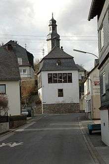
- Evangelical church, Simmerner Straße 7 – Classicist aisleless church, 1827-1829, architect Ferdinand Nebel, Koblenz
- Bahnhofstraße 50/52, 55 – no. 50/52: villa, partly slated, about 1910/1920, park with attendant’s house; no. 55: timber-frame commercial wing, marked 1936, administration building with hipped roof, partly timber-frame; whole complex of buildings
- Im Haferacker 4 – timber-frame Quereinhaus (a combination residential and commercial house divided for these two purposes down the middle, perpendicularly to the street), partly solid, marked 1736
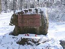
- Rheinböllener Straße, Alter Friedhof (“Old Graveyard”) – warriors’ memorial, tombs, priest’s tomb, about 1881, stele; Höltz tomb, stele
- Rheinböllener Straße 4 – former inn “Zur Post”; stately timber-frame Quereinhaus, plastered, hipped mansard roof, about 1800, stable/barn 19th century
- Simmerner Straße 2 – Altes Rathaus (“Old Town Hall”); building with hipped mansard roof, timber framing plastered or slated, 18th century
- Simmerner Straße 6 – bakehouse; one-floor quarrystone building, 19th century
Sport and leisure
Ellern is part of the Naturpark Soonwald-Nahe and offers a great many hiking trails and cycle paths.
Regular events
Given the wealth earned from the forest (see below), a few years ago the municipality launched the Holzkerb, or “Wood Fair”, giving Ellern the opportunity to exhibit wood and various wooden articles in a thematized fashion. The Soonwaldfee (“Soonwald Fairy”), who is chosen on the occasion of the Holzkerb, personifies and underscores how near the municipality is to the woods and their use. The Holzkerb is held each year on the fourth weekend in August.
Economy and infrastructure
Transport
Ellern’s location is favourable for quickly reaching the Autobahn A 61, and there is a good road link to Frankfurt-Hahn Airport over Bundesstraße 50.
Earning the municipality a considerable income from the nearby forest is the local wood industry. For some 100 years, there has been a sawmill, which offers many jobs.
References
- ↑ "Gemeinden in Deutschland mit Bevölkerung am 31. Dezember 2015" (PDF). Statistisches Bundesamt (in German). 2016.
- ↑ Municipal election results for Ellern
- ↑ Ellern’s mayor
- ↑ Ellern’s arms at Heraldry of the World
- ↑ Ellern’s partnership with Sünna
- ↑ Directory of Cultural Monuments in Rhein-Hunsrück district
External links
| Wikimedia Commons has media related to Ellern (Hunsrück). |
- Municipality’s official webpage (German)
- Verbandsgemeinde of Rheinböllen (German)