Elkhorn River
| Elkhorn River[1] | |
|---|---|
 The Elkhorn River in Antelope County, Nebraska | |
| Basin | |
| Main source |
Confluence of North Fork and South Fork 2,162 ft (659 m) 42°36′36″N 099°11′00″W / 42.61000°N 99.18333°W |
| River mouth |
Confluence with Platte 1,070 ft (330 m) 41°07′12″N 096°18′42″W / 41.12000°N 96.31167°WCoordinates: 41°07′12″N 096°18′42″W / 41.12000°N 96.31167°W |
| Progression | Platte—Missouri—Mississippi |
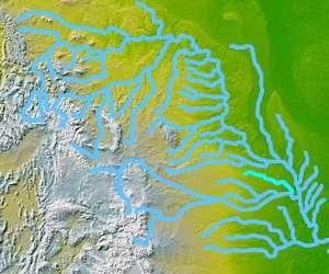
The Elkhorn River originates in the eastern Sandhills of Nebraska and is one of the largest tributaries of the Platte River, flowing 290 miles (470 km)[2] and joining the Platte just southwest of Omaha, approximately 1 mile (2 km) south and 3 miles (5 km) west of Gretna.
Located in northeast and north-central Nebraska, the Elkhorn River basin encompasses approximately 7,000 mi² (18,000 km²). The Elkhorn has several tributaries, including its own North and South forks, Logan Creek, Rock Creek and Maple Creek.
History
The Lewis and Clark Expedition encountered the Elkhorn River near its confluence with the Platte, and referred to it as the "Corne de Cerf". Located a few miles north of the confluence is the Elkhorn Crossing Recreation Area. This public park, operated by the Papio-Missouri River Natural Resources District, marks the location where thousands of immigrants in the nineteenth century, bound for the west, camped while waiting to cross the river.[3]
For years Logan Fontenelle and Joseph LaFlesche, young mixed-race men who worked with the Omaha people, owned the ferry that carried people, wagons and animals between the two river banks. LaFlesche had been adopted by Omaha chief Big Elk and named as his successor. Fontenelle, of Omaha-French descent, served the tribe as an interpreter in relations with the US Indian agent and negotiations with the government over cession of lands.
See also
References
- ↑ "Elkhorn River". Geographic Names Information System. United States Geological Survey. Retrieved 2011-02-14.
- ↑ "The National Map". U.S. Geological Survey. Retrieved Feb 10, 2011.
- ↑ "Platte and Elkhorn River". Papio NRD Website. Retrieved 31 March 2011.