Elk Mound, Wisconsin
| Elk Mound, Wisconsin | |
|---|---|
| Village | |
 Location of Elk Mound, Wisconsin | |
| Coordinates: 44°54′10″N 91°42′29″W / 44.90278°N 91.70806°WCoordinates: 44°54′10″N 91°42′29″W / 44.90278°N 91.70806°W | |
| Country | United States |
| State | Wisconsin |
| County | Dunn |
| Area[1] | |
| • Total | 2.29 sq mi (5.93 km2) |
| • Land | 2.29 sq mi (5.93 km2) |
| • Water | 0 sq mi (0 km2) |
| Elevation[2] | 1,017 ft (310 m) |
| Population (2010)[3] | |
| • Total | 878 |
| • Estimate (2012[4]) | 876 |
| • Density | 383.4/sq mi (148.0/km2) |
| Time zone | Central (CST) (UTC-6) |
| • Summer (DST) | CDT (UTC-5) |
| Area code(s) | 715 & 534 |
| FIPS code | 55-23350[5] |
| GNIS feature ID | 1583152[2] |
Elk Mound is a village in Dunn County, Wisconsin, United States. The population was 878 at the 2010 census. The village is surrounded by the Town of Elk Mound.
History
A post office called Elk Mound has been in operation since 1870.[6] Elk Mound was laid out in 1871.[7] The village was named for nearby Elk Mound.[8]
Geography
Elk Mound is located at 44°52′23″N 91°41′23″W / 44.87306°N 91.68972°W (44.873216, -91.689885).[9]
According to the United States Census Bureau, the village has a total area of 2.29 square miles (5.93 km2), all of it land.[1]
The village of Elk Mound is located in the Chippewa Valley, between the cities of Eau Claire, Menomonie, and Chippewa Falls.
Demographics
| Historical population | |||
|---|---|---|---|
| Census | Pop. | %± | |
| 1880 | 48 | — | |
| 1910 | 302 | — | |
| 1920 | 357 | 18.2% | |
| 1930 | 376 | 5.3% | |
| 1940 | 338 | −10.1% | |
| 1950 | 390 | 15.4% | |
| 1960 | 379 | −2.8% | |
| 1970 | 471 | 24.3% | |
| 1980 | 737 | 56.5% | |
| 1990 | 765 | 3.8% | |
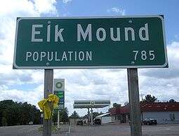
| 2000 | 785 | 2.6% | |
| 2010 | 878 | 11.8% | |
| Est. 2015 | 875 | [10] | −0.3% |
2010 census
As of the census[3] of 2010, there were 878 people, 334 households, and 225 families residing in the village. The population density was 383.4 inhabitants per square mile (148.0/km2). There were 358 housing units at an average density of 156.3 per square mile (60.3/km2). The racial makeup of the village was 90.8% White, 0.6% African American, 0.7% Native American, 5.0% Asian, 0.5% from other races, and 2.5% from two or more races. Hispanic or Latino of any race were 2.5% of the population.
There were 334 households of which 41.6% had children under the age of 18 living with them, 45.2% were married couples living together, 15.6% had a female householder with no husband present, 6.6% had a male householder with no wife present, and 32.6% were non-families. 21.9% of all households were made up of individuals and 6% had someone living alone who was 65 years of age or older. The average household size was 2.63 and the average family size was 3.07.
The median age in the village was 30.9 years. 30.6% of residents were under the age of 18; 10.9% were between the ages of 18 and 24; 28.4% were from 25 to 44; 22.9% were from 45 to 64; and 7.2% were 65 years of age or older. The gender makeup of the village was 50.3% male and 49.7% female.
2000 census
As of the census[5] of 2000, there were 785 people, 300 households, and 225 families residing in the village. The population density was 345.3 people per square mile (133.5/km²). There were 311 housing units at an average density of 136.8 per square mile (52.9/km²). The racial makeup of the village was 96.18% White, 0.38% Native American, 2.17% Asian, and 1.27% from two or more races. 0.64% of the population were Hispanic or Latino of any race.
There were 300 households out of which 41.3% had children under the age of 18 living with them, 54.0% were married couples living together, 16.3% had a female householder with no husband present, and 24.7% were non-families. 16.0% of all households were made up of individuals and 5.3% had someone living alone who was 65 years of age or older. The average household size was 2.62 and the average family size was 2.95.
In the village the population was spread out with 29.0% under the age of 18, 11.1% from 18 to 24, 33.1% from 25 to 44, 18.3% from 45 to 64, and 8.4% who were 65 years of age or older. The median age was 31 years. For every 100 females there were 90.5 males. For every 100 females age 18 and over, there were 96.8 males.
The median income for a household in the village was $36,513, and the median income for a family was $39,318. Males had a median income of $28,693 versus $21,780 for females. The per capita income for the village was $16,156. About 5.6% of families and 6.4% of the population were below the poverty line, including 9.5% of those under age 18 and none of those age 65 or over.
Economy
Although farming has been the dominant occupation within the district, in recent years several small businesses have been established in the community. Industry, businesses and services are available in the neighboring cities. Many housing developments have been established both within and outside the village, and these developments continue to expand.
Education
The school district of Elk Mound is located within the village of Elk Mound. The district has an approximate enrollment of 928 students distributed between three schools. The elementary school houses preschool through 4th grade. The middle school houses 5th through 8th grades. The high school houses 9th-12th grades. Enrollment at the elementary has shown an upward trend, and district-wide enrollment has increased slightly over the past several years.
In 2009, community residents passed a referendum authorizing significant facility upgrades to all three school district buildings. Each building added much needed classroom and special use space to accommodate a growing population.
Churches
Elk Mound is home to several churches covering a range of denominations.
Historic Memorial Park
Mound Hill Park and its attendant "castle" are dedicated to the deceased rural letter carriers of Dunn County. It is believed to be the only such dedicated monument in America.
References
- 1 2 "US Gazetteer files 2010". United States Census Bureau. Retrieved 2012-11-18.
- 1 2 "US Board on Geographic Names". United States Geological Survey. 2007-10-25. Retrieved 2008-01-31.
- 1 2 "American FactFinder". United States Census Bureau. Retrieved 2012-11-18.
- ↑ "Population Estimates". United States Census Bureau. Retrieved 2013-06-24.
- 1 2 "American FactFinder". United States Census Bureau. Retrieved 2008-01-31.
- ↑ "Dunn County". Jim Forte Postal History. Retrieved 3 April 2015.
- ↑ Chicago and North Western Railway Company (1908). A History of the Origin of the Place Names Connected with the Chicago & North Western and Chicago, St. Paul, Minneapolis & Omaha Railways. p. 174.
- ↑ Herman, Jennifer L. (1 January 2008). Wisconsin Encyclopedia. North American Book Dist LLC. p. 314. ISBN 978-1-878592-61-3.
- ↑ "US Gazetteer files: 2010, 2000, and 1990". United States Census Bureau. 2011-02-12. Retrieved 2011-04-23.
- ↑ "Annual Estimates of the Resident Population for Incorporated Places: April 1, 2010 to July 1, 2015". Retrieved July 2, 2016.
- ↑ "Census of Population and Housing". Census.gov. Retrieved June 4, 2015.
External links
Municipalities and communities of Dunn County, Wisconsin, United States | ||
|---|---|---|
| City | 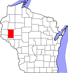 | |
| Villages | ||
| Towns | ||
| CDPs | ||
| Unincorporated communities | ||
| Ghost towns | ||
| Footnote | ‡This populated place also has portions in an adjacent county or counties | |