Elizabethtown, Pennsylvania
| Elizabethtown | |
|---|---|
| Borough | |
|
Town Square at High and Market Streets, 2013 | |
| Nickname(s): E-town | |
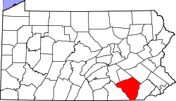
 Location of Elizabethtown in Lancaster County and Dauphin County | |
 Elizabethtown Location of Elizabethtown in Pennsylvania | |
| Coordinates: 40°9′12″N 76°36′2″W / 40.15333°N 76.60056°WCoordinates: 40°9′12″N 76°36′2″W / 40.15333°N 76.60056°W | |
| Country | United States |
| State | Pennsylvania |
| County | Lancaster and Dauphin |
| Settled | 1753 |
| Government | |
| • Mayor | Chuck Mummert |
| Area | |
| • Total | 2.6 sq mi (7 km2) |
| • Land | 2.6 sq mi (7 km2) |
| • Water | 0 sq mi (0 km2) |
| Elevation | 463 ft (141 m) |
| Population (2000) | |
| • Total | 11,887 |
| • Density | 4,600/sq mi (1,800/km2) |
| Time zone | EST (UTC-5) |
| • Summer (DST) | EDT (UTC-4) |
| ZIP code | 17022 |
| Area code(s) | 717 |
| Website |
www |

Elizabethtown (Pennsylvania Dutch: Betzischteddel) is a borough in Lancaster County, Pennsylvania and Dauphin County, Pennsylvania, 21 miles (34 km) southeast of Harrisburg. Small factories existed at the turn of the 20th century when the population in 1900 was 1,861. There was a slight increase in the next decade, with 1,970 people living in Elizabethtown in 1910. As of the 2000 census, the population of the borough was 11,887.[1] Elizabethtown is commonly referred to in south-central Pennsylvania as "E-Town."[2] This nickname is also used for the local college and high school.
History
There are two stories about the origin of the town's name. In one version it is named after Elizabeth Reeby, wife of Michael Reeby who sold the first building lots here in about 1795. Another version has it named after the wife of Captain Barnabas Hughes who purchased The Black Bear Tavern in 1750.
The officially accepted history is that, in 1753, Captain Barnabas Hughes acquired land and laid out a town, naming it for his wife, Elizabeth. The early settlers were primarily Scots-Irish and Pennsylvania Dutch.
Elizabethtown became a borough in 1827, and a railroad was built through the area in the 1830s. The town was primarily agricultural until the early 1900s, when the Klein Chocolate Company (now part of Mars, Inc.) and several shoe factories (the last of which closed in 1979) opened. Elizabethtown College was established in 1899, and the Masonic Homes (now the Masonic Village) followed in 1910.
After World War II, Elizabethtown grew rapidly, more than doubling its population between 1950 and 2000. Homes and businesses expanded into nearby farmland, making sprawl, farmland preservation, and revitalizing the downtown area important issues.[3]
The Kreider Shoe Manufacturing Company was listed on the National Register of Historic Places in 1980.[4]
Public officials
Borough Council
Elizabethtown Borough Council has six members representing three voting wards. Each council member is elected to a four-year term. They are responsible for setting policy in every aspect of the Borough, including budgeting, public works, zoning, and ordinances.
- Council members
- J. Neil Ketchum, President, Ward 2
- Phillip Clark, Vice-President, Ward 3
- Marc Hershey, Ward 3
- Jeffrey McCloud, Ward 2
- Thomas Shaud, Ward 1
- C. Dale Treese, Ward 1
- Mayor
- Chuck Mummert[5] — The mayor is elected to a four-year term and is responsible for overseeing the police department, as well as performing ceremonial duties. The mayor casts votes at Borough Council meetings only if there is a tie.
State and Federal
- State Representative: David Hickernell (R)
- State Senator: Ryan Aument (R)
- U. S. Representative: Joseph R. Pitts (R)
Geography
Elizabethtown is located at 40°9′12″N 76°36′2″W / 40.15333°N 76.60056°W (40.153207, -76.600431).[6]
The borough has a total area of 2.6 square miles (6.7 km2), of which, 2.6 square miles (6.7 km2) of it is land and 0.38% is water.
Government and infrastructure
The Pennsylvania Department of Corrections Training Academy is located in Mount Joy Township, near Elizabethtown.[7][8]
Economy
Elizabethtown is home to Continental Press, White Oak Mills (an animal feed plant), Elizabethtown College, the Masonic Village, a large Mars Chocolate North America(a division of Mars, Incorporated) plant and numerous smaller businesses.[2].
Demographics
| Historical population | |||
|---|---|---|---|
| Census | Pop. | %± | |
| 1860 | 700 | — | |
| 1870 | 858 | 22.6% | |
| 1880 | 980 | 14.2% | |
| 1890 | 1,218 | 24.3% | |
| 1900 | 1,473 | 20.9% | |
| 1910 | 2,587 | 75.6% | |
| 1920 | 3,319 | 28.3% | |
| 1930 | 3,940 | 18.7% | |
| 1940 | 4,315 | 9.5% | |
| 1950 | 5,083 | 17.8% | |
| 1960 | 6,780 | 33.4% | |
| 1970 | 8,072 | 19.1% | |
| 1980 | 8,233 | 2.0% | |
| 1990 | 9,952 | 20.9% | |
| 2000 | 11,887 | 19.4% | |
| 2010 | 11,545 | −2.9% | |
| Est. 2015 | 11,586 | [9] | 0.4% |
| Sources:[10][11][12] | |||
As of the census[11] of 2000, there were 11,887 people, 4,271 households, and 2,703 families residing in the borough. The population density was 4,567.4 people per square mile (1,765.2/km²). There were 4,483 housing units at an average density of 1,722.5 per square mile (665.7/km²). The racial makeup of the borough was 96.32% White, 0.90% Black or African American, 0.18% Native American, 1.23% Asian, 0.04% Pacific Islander, 0.45% from other races, and 0.87% from two or more races. 1.45% of the population were Hispanic or Latino of any race.
There were 4,271 households, out of which 28.5% had children under the age of 18 living with them, 51.2% were married couples living together, 8.9% had a female householder with no husband present, and 36.7% were non-families. 30.8% of all households were made up of individuals, and 12.5% had someone living alone who was 65 years of age or older. The average household size was 2.31 and the average family size was 2.88.
In the borough the population was spread out, with 19.3% under the age of 18, 18.8% from 18 to 24, 26.7% from 25 to 44, 17.1% from 45 to 64, and 18.2% who were 65 years of age or older. The median age was 34 years. For every 100 females there were 82.2 males. For every 100 females age 18 and over, there were 78.5 males.
The median income for a household in the borough was $42,752, and the median income for a family was $52,214. Males had a median income of $35,764 versus $26,316 for females. The per capita income for the borough was $18,384. About 3.3% of families and 5.2% of the population were below the poverty line, including 6.7% of those under age 18 and 3.9% of those age 65 or over.
Education
Public schools in Elizabethtown Borough are part of the Elizabethtown Area School District, though there are areas outside the borough that have Elizabethtown mailing addresses that are in neighboring school districts. Mount Calvary Christian School is also in the borough. Elizabethtown College, a private liberal arts institution, provides higher education.

Public library
- Elizabethtown Public Library , member of the Library System of Lancaster County
Public media
Town newspaper
Transportation
Elizabethtown is served by an Amtrak station, where all Keystone Service and Pennsylvanian trains stop. Bus service is provided by the Red Rose Transit Authority.
Sister city
Notable people
- Gene Garber, former relief pitcher in Major League Baseball
- Paul Gottfried, president of H.L. Mencken Club
References
- ↑ "Census 2000 Demographic Profile Highlights: Elizabethtown borough, Pennsylvania". U.S. Census Bureau. 2000. Retrieved 13 January 2011.
- ↑ http://www.etownonline.net/mainstreet.html
- ↑ MacMaster, Richard. Elizabethtown: The First Three Centuries. Elizabethtown, PA: Eliizabethtown Historical Society, 1999.
- ↑ National Park Service (2010-07-09). "National Register Information System". National Register of Historic Places. National Park Service.
- ↑ Bristol, Jason (25 December 2012). "He serves and sings: 'The Singing Mayor' of Elizabethtown". Harrisburg, PA: WHP-TV. Retrieved 16 January 2013.
- ↑ "US Gazetteer files: 2010, 2000, and 1990". United States Census Bureau. 2011-02-12. Retrieved 2011-04-23.
- ↑ "Zoning Map." (Archive) Mount Joy Township. Retrieved on 5 October 2012.
- ↑ "Pennsylvania Department of Corrections Training Academy." Pennsylvania Department of Corrections. Retrieved on 5 October 2012. "1451 North Market Street Elizabethtown, PA 17022"
- ↑ "Annual Estimates of the Resident Population for Incorporated Places: April 1, 2010 to July 1, 2015". Retrieved July 2, 2016.
- ↑ "Census of Population and Housing". U.S. Census Bureau. Retrieved 11 December 2013.
- 1 2 "American FactFinder". United States Census Bureau. Retrieved 2008-01-31.
- ↑ "Incorporated Places and Minor Civil Divisions Datasets: Subcounty Resident Population Estimates: April 1, 2010 to July 1, 2012". Population Estimates. U.S. Census Bureau. Retrieved 11 December 2013.
External links
![]() Media related to Elizabethtown, Pennsylvania at Wikimedia Commons
Media related to Elizabethtown, Pennsylvania at Wikimedia Commons