Elbow Lake, Grant County, Minnesota
| Elbow Lake, Minnesota | |
|---|---|
| City | |
|
Grant County Courthouse in Elbow Lake | |
 Location of Elbow Lake within Grant County, Minnesota | |
| Coordinates: 45°59′39″N 95°58′36″W / 45.99417°N 95.97667°W | |
| Country | United States |
| State | Minnesota |
| County | Grant |
| Area[1] | |
| • Total | 1.72 sq mi (4.46 km2) |
| • Land | 1.35 sq mi (3.50 km2) |
| • Water | 0.37 sq mi (0.96 km2) |
| Elevation | 1,220 ft (372 m) |
| Population (2010)[2] | |
| • Total | 1,176 |
| • Estimate (2012[3]) | 1,157 |
| • Density | 871.1/sq mi (336/km2) |
| Time zone | Central (CST) (UTC-6) |
| • Summer (DST) | CDT (UTC-5) |
| ZIP code | 56531 |
| Area code(s) | 218 |
| FIPS code | 27-18458[4] |
| GNIS feature ID | 0643230[5] |

Elbow Lake is a city in, and the county seat of, Grant County, Minnesota, United States.[6] The population was 1,176 at the 2010 census.[7]
History
Elbow Lake was platted in 1886.[8] The city took its name from nearby Elbow Lake.[8]
Geography
According to the United States Census Bureau, the city has a total area of 1.34 square miles (3.47 km2), all of it land.[1]
U.S. Highway 59 and Minnesota State Highways 54, 55, and 79 are four of the main routes in the city. Elbow Lake is 12 miles west of Interstate Highway 94.
Elbow Lake is located in telephone area code 218 near area code 320.
Demographics
| Historical population | |||
|---|---|---|---|
| Census | Pop. | %± | |
| 1890 | 267 | — | |
| 1900 | 625 | 134.1% | |
| 1910 | 776 | 24.2% | |
| 1920 | 867 | 11.7% | |
| 1930 | 903 | 4.2% | |
| 1940 | 1,150 | 27.4% | |
| 1950 | 1,398 | 21.6% | |
| 1960 | 1,521 | 8.8% | |
| 1970 | 1,484 | −2.4% | |
| 1980 | 1,358 | −8.5% | |
| 1990 | 1,186 | −12.7% | |
| 2000 | 1,275 | 7.5% | |
| 2010 | 1,176 | −7.8% | |
| Est. 2015 | 1,144 | [9] | −2.7% |
| U.S. Decennial Census | |||
2010 census
As of the census[2] of 2010, there were 1,176 people, 538 households, and 313 families residing in the city. The population density was 877.6 inhabitants per square mile (338.8/km2). There were 623 housing units at an average density of 464.9 per square mile (179.5/km2). The racial makeup of the city was 97.4% White, 0.2% African American, 0.3% Native American, 0.2% Asian, 0.3% from other races, and 1.7% from two or more races. Hispanic or Latino of any race were 1.2% of the population.
There were 538 households of which 27.7% had children under the age of 18 living with them, 44.8% were married couples living together, 9.9% had a female householder with no husband present, 3.5% had a male householder with no wife present, and 41.8% were non-families. 37.9% of all households were made up of individuals and 19% had someone living alone who was 65 years of age or older. The average household size was 2.16 and the average family size was 2.86.
The median age in the city was 40.9 years. 24.1% of residents were under the age of 18; 5.8% were between the ages of 18 and 24; 24.3% were from 25 to 44; 26.9% were from 45 to 64; and 18.9% were 65 years of age or older. The gender makeup of the city was 45.1% male and 54.9% female.
2000 census
As of the census[4] of 2000, there were 1,275 people, 560 households, and 348 families residing in the city. The population density was 944.9 people per square mile (364.7/km²). There were 624 housing units at an average density of 462.5 per square mile (178.5/km²). The racial makeup of the city was 97.41% White, 0.24% Native American, 0.47% Asian, 0.78% from other races, and 1.10% from two or more races. Hispanic or Latino of any race were 1.33% of the population.
There were 560 households out of which 27.9% had children under the age of 18 living with them, 51.6% were married couples living together, 8.8% had a female householder with no husband present, and 37.7% were non-families. 33.9% of all households were made up of individuals and 23.6% had someone living alone who was 65 years of age or older. The average household size was 2.26 and the average family size was 2.93.
In the city the population was spread out with 24.9% under the age of 18, 7.8% from 18 to 24, 25.2% from 25 to 44, 17.4% from 45 to 64, and 24.7% who were 65 years of age or older. The median age was 40 years. For every 100 females there were 84.5 males. For every 100 females age 18 and over, there were 82.5 males.
The median income for a household in the city was $30,441, and the median income for a family was $38,611. Males had a median income of $28,839 versus $20,515 for females. The per capita income for the city was $16,429. About 6.3% of families and 7.7% of the population were below the poverty line, including 10.7% of those under age 18 and 6.2% of those age 65 or over.
Education
Elbow Lake is part of the West Central Area School system, which also includes the communities of Barrett, Hoffman, Kensington, and Wendell, as well as many other communities. Elementary facilities are located in Elbow Lake and Kensington,while the secondary facility, which opened in the fall of 1995, is located in Barrett, 7 miles from Elbow Lake.
Parks
Elbow Lake has several parks located within city limits that offer a variety of recreational opportunities, including softball fields, a volleyball court, lighted tennis courts, an ice skating rink with a warming house, a running track, playground equipment, picnic shelters, and a bandshell for summer entertainment.
The Tipsinah Mounds Campground and park, located 4 miles east of Elbow Lake on Pomme de Terre Lake, offers a public swimming beach, playground equipment, and hiking and nature trails. There is an above ground tornado shelter located in the park. A public swimming beach is located at Fairhaven beach, also on Pomme de Terre Lake.
Libraries
Thorson Memorial Public Library[10] is located in Elbow Lake. It is the only library in Grant County, MN. The library is located in the Scofield Memorial Building,[11] built in 1933 with funding from the Public Works Administration (PWA) and donated funds. The building was placed on the National Register of Historic Places in 2016.
Thorson Memorial Library is a member of Viking Library Regional Library System.[12]
References
- 1 2 "US Gazetteer files 2010". United States Census Bureau. Retrieved 2012-11-13.
- 1 2 "American FactFinder". United States Census Bureau. Retrieved 2012-11-13.
- ↑ "Population Estimates". United States Census Bureau. Retrieved 2013-05-28.
- 1 2 "American FactFinder". United States Census Bureau. Retrieved 2008-01-31.
- ↑ "US Board on Geographic Names". United States Geological Survey. 2007-10-25. Retrieved 2008-01-31.
- ↑ "Find a County". National Association of Counties. Retrieved 2011-06-07.
- ↑ "2010 Census Redistricting Data (Public Law 94-171) Summary File". American FactFinder. United States Census Bureau. Retrieved 27 April 2011.
- 1 2 Upham, Warren (1920). Minnesota Geographic Names: Their Origin and Historic Significance. Minnesota Historical Society. p. 214.
- ↑ "Annual Estimates of the Resident Population for Incorporated Places: April 1, 2010 to July 1, 2015". Retrieved July 2, 2016.
- ↑ "Elbow Lake Public Library". Elbow Lake Public Library. Retrieved August 2, 2016.
- ↑ National Register of Historic Places listings in Minnesota
- ↑ "Viking Library System". Viking Library System. Retrieved August 2, 2016.
External links
Municipalities and communities of Grant County, Minnesota, United States | ||
|---|---|---|
| Cities | 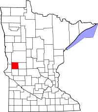 | |
| Townships | ||
| Unincorporated community | ||
| Ghost towns | ||
Coordinates: 45°59′39″N 95°58′36″W / 45.99417°N 95.97667°W