El Turbón
| El Turbón | |
|---|---|
 View of El Turbón | |
| Highest point | |
| Elevation | 2,492 m (8,176 ft) |
| Listing | List of mountains in Aragon |
| Coordinates | 42°25′N 0°30′E / 42.417°N 0.500°ECoordinates: 42°25′N 0°30′E / 42.417°N 0.500°E |
| Geography | |
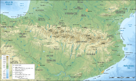 El Turbón Location in the Pre-Pyrenees area | |
| Location | Ribagorza, Aragon |
| Parent range | Pre-Pyrenees |
| Geology | |
| Mountain type | Marl (Cretaceous) |
| Climbing | |
| Easiest route | From the Merendero de la Muria, between Pont de Suert and Castejón de Sos |
El Turbón is a mountain massif of the Pre-Pyrenees, located in the province of Huesca, the most northerly province in the autonomous community of Aragon, Spain. This 6.3 km (4 mi) long mountain is aligned N - S.
It is fairly easy to climb El Turbón, but it is better not to do so in mid summer when this great expanse of naked rock can reach very high temperatures.
Geology
El Turbón has a massive rocky limestone outcrop at its centre made of Cretaceous marl. There are caves and shafts in the mountain. The Isábena River flows on the eastern side, separating El Turbón massif from the Mountains of Sis range.[1]
Features
 View of El Turbón with snow in the winter. |
 El Turbón seen from the Barasona dam |
 El Turbón seen from the north. |
See also
References
- ↑ Inst. Tecnologico Geominero de Espana, 1994, Mapa Geologico de la Peninsula Iberica, Baleares y Canarias, scale 1:1M
External links
![]() Media related to El Turbón at Wikimedia Commons
Media related to El Turbón at Wikimedia Commons
- Ascensión a el Turbon (Spanish)
This article is issued from Wikipedia - version of the 8/8/2016. The text is available under the Creative Commons Attribution/Share Alike but additional terms may apply for the media files.