Eigersund
| Eigersund kommune | |||
|---|---|---|---|
| Municipality | |||
|
View of the town of Egersund | |||
| |||
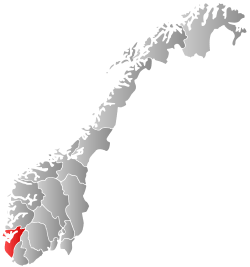
 Eigersund within Rogaland | |||
| Coordinates: 58°28′42″N 06°03′47″E / 58.47833°N 6.06306°ECoordinates: 58°28′42″N 06°03′47″E / 58.47833°N 6.06306°E | |||
| Country | Norway | ||
| County | Rogaland | ||
| District | Dalane | ||
| Administrative centre | Egersund | ||
| Government | |||
| • Mayor (2015) | Odd Stangeland (Ap) | ||
| Area | |||
| • Total | 432.48 km2 (166.98 sq mi) | ||
| • Land | 387.43 km2 (149.59 sq mi) | ||
| • Water | 45.05 km2 (17.39 sq mi) | ||
| Area rank | 229 in Norway | ||
| Population (2016) | |||
| • Total | 14,942 | ||
| • Rank | 78 in Norway | ||
| • Density | 38.6/km2 (100/sq mi) | ||
| • Change (10 years) | 11.4 % | ||
| Demonym(s) | Eigersunder[1] | ||
| Time zone | CET (UTC+1) | ||
| • Summer (DST) | CEST (UTC+2) | ||
| ISO 3166 code | NO-1101 | ||
| Official language form | Bokmål | ||
| Website |
www | ||
|
| |||


Eigersund is a municipality in Rogaland county, Norway. It is located in the traditional district of Dalane. The administrative centre of the municipality is the town of Egersund. The town was known for its pottery factory (closed in 1979) and it is among Norway's biggest fishing ports. The villages of Helleland, Hellvik, and Hestnes are also located in Eigersund.
The island of Eigerøya lies just off shore from Egersund. The island has several well-known businesses and attractions including the Eigerøy war memorial from World War II.
General information


The rural parish surrounding the town of Egersund was established as the municipality of Egersund landdisstrikt (Egersund rural district) on 1 January 1838 (see formannskapsdistrikt). In 1839, the northwestern district of Augne (population: 825) was separated to form its own municipality. On 12 December 1868, a small area of Eigersund municipality (population: 41) was transferred to neighboring Sokndal. In 1947, an area of Eigersund immediately surrounding the town of Egersund (population: 515) was transferred to the town of Egersund and another area in Sokndal (population: 7) was transferred to Eigersund.
During the 1960s, there were many municipal mergers in Norway due to the work of the Schei Committee. On 1 January 1965, the town of Egersund (population: 3,787) was merged with the surrounding municipalities of Eigersund (population: 4,664), Helleland (population: 851), and the Gyadalen and Grøsfjel areas of Heskestad (population: 114). The new municipality was also called Eigersund. On 1 January 1967, the Tjørn farm (population: 10) was transferred from Eigersund to Sokndal.[2]
Name
The Old Norse form of the name was Eikundarsund. The first element is the genitive case of the name of the island of Eikund (now Eigerøya) and the last element is sund which means "strait" or "sound". The first element in the name of the island is eik which means "oak" and the last element is the suffix -und which means "plentiful of" (i.e. "the island covered with oak trees").[3]
- "Egersund" vs. "Eigersund"
The form of the name spelled without the diphthong [ei] (Egersund) is the Danish language form of the name which is still preserved in the name of the town Egersund, but the municipality name is spelled using the Norwegian language form.
Coat-of-arms
The coat-of-arms are relatively modern; they were granted on 20 October 1972. The arms show a gold/yellow oak leaf on a green background. The arms are partly a canting since the name is supposedly derived from Eikundarsund and eik means oak. Oaks are also very common in the municipality.[4]
Churches
The Church of Norway has three parishes (sokn) within the municipality of Eigersund. It is part of the Dalane deanery in the Diocese of Stavanger.
| Parish (Sokn) | Church Name | Location of the Church | Year Built |
|---|---|---|---|
| Egersund | Egersund Church | Egersund | 1607 |
| Bakkebø Church | Egersund | 1960 | |
| Eigerøy | Eigerøy Church | Eigerøya | 1998 |
| Helleland | Helleland Church | Helleland | 1832 |
History
The place is mentioned in Snorri Sturluson's writings. Later, Christian IV set up a battery there.

Government
All municipalities in Norway, including Eigersund, are responsible for primary education (through 10th grade), outpatient health services, senior citizen services, unemployment and other social services, zoning, economic development, and municipal roads. The municipality is governed by a municipal council of elected representatives, which in turn elect a mayor.
Municipal council
The municipal council (Kommunestyre) of Eigersund is made up of 31 representatives that are elected to every four years. Currently, the party breakdown is as follows:[5]
| Party Name | Name in Norwegian | Number of representatives | |
|---|---|---|---|
| Labour Party | Arbeiderpartiet | 10 | |
| Progress Party | Fremskrittspartiet | 5 | |
| Conservative Party | Høyre | 6 | |
| Christian Democratic Party | Kristelig Folkeparti | 5 | |
| Centre Party | Senterpartiet | 3 | |
| Socialist Left Party | Sosialistisk Venstreparti | 1 | |
| Liberal Party | Venstre | 1 | |
| Total number of members: | 31 | ||
Geography
Eigersund extends from the North Sea coast to the border of Vest-Agder county. It borders the municipalities of Hå and Bjerkreim to the north and Sokndal to the south. The municipality is centered on the town of Egersund, and includes the island of Eigerøya. The landscape includes many rivers and lakes, as well as woods and several barren rocky and heather-clad moors. The lakes Grøsfjellvatnet, Eiavatnet, Nodlandsvatnet, and Teksevatnet lie in the municipality.
Eigerøya
Eigerøya is an island off the coast of Egersund. The island is connected to the mainland over Eigerøy bridge, which was completed in 1951. The island's coastline is characterized by a number of small bays, as well as Lundarviga. Eigerøya is divided almost in two of the large bay of Lundarviga. The island is surrounded by a number of small islets. Eigerøy Lighthouse and Vibberodden Lighthouse are both located along the shores of Eigerøya.
Climate
| Climate data for Eigerøya | |||||||||||||
|---|---|---|---|---|---|---|---|---|---|---|---|---|---|
| Month | Jan | Feb | Mar | Apr | May | Jun | Jul | Aug | Sep | Oct | Nov | Dec | Year |
| Average high °C (°F) | 3.0 (37.4) |
2.8 (37) |
4.3 (39.7) |
7.4 (45.3) |
12.2 (54) |
14.8 (58.6) |
16.2 (61.2) |
16.6 (61.9) |
13.6 (56.5) |
10.8 (51.4) |
7.1 (44.8) |
4.8 (40.6) |
9.5 (49.1) |
| Daily mean °C (°F) | 1.1 (34) |
0.7 (33.3) |
2.3 (36.1) |
4.8 (40.6) |
9.0 (48.2) |
12.1 (53.8) |
13.4 (56.1) |
14.1 (57.4) |
11.7 (53.1) |
9.1 (48.4) |
5.2 (41.4) |
2.7 (36.9) |
7.2 (45) |
| Average low °C (°F) | −0.5 (31.1) |
−1.0 (30.2) |
0.5 (32.9) |
2.4 (36.3) |
7.0 (44.6) |
9.6 (49.3) |
11.4 (52.5) |
12.1 (53.8) |
9.6 (49.3) |
7.0 (44.6) |
3.3 (37.9) |
1.1 (34) |
5.2 (41.4) |
| Average precipitation mm (inches) | 121 (4.76) |
80 (3.15) |
95 (3.74) |
68 (2.68) |
77 (3.03) |
76 (2.99) |
96 (3.78) |
117 (4.61) |
154 (6.06) |
168 (6.61) |
163 (6.42) |
135 (5.31) |
1,350 (53.15) |
| Average precipitation days (≥ 1 mm) | 16.2 | 10.7 | 13.1 | 10.9 | 9.9 | 9.5 | 10.3 | 11.2 | 15.9 | 17.3 | 19.3 | 17.5 | 161.8 |
| Source: Norwegian Meteorological Institute[6] | |||||||||||||
Transportation
The European route E39 highway runs through the municipality, passing the village of Helleland. The Sørlandsbanen railway line runs through the municipality, stopping at Egersund Station and Hellvik Station.
References
| Wikimedia Commons has media related to Eigersund. |
| Look up Eigersund in Wiktionary, the free dictionary. |
| Wikivoyage has a travel guide for Rogaland. |
- ↑ "Navn på steder og personer: Innbyggjarnamn" (in Norwegian). Språkrådet. Retrieved 2015-12-01.
- ↑ Jukvam, Dag (1999). "Historisk oversikt over endringer i kommune- og fylkesinndelingen" (PDF) (in Norwegian). Statistisk sentralbyrå.
- ↑ Rygh, Oluf (1915). Norske gaardnavne: Stavanger amt (in Norwegian) (10 ed.). Kristiania, Norge: W. C. Fabritius & sønners bogtrikkeri. p. 78.
- ↑ "Civic heraldry of Norway - Norske Kommunevåpen". Heraldry of the World. Retrieved 2016-07-05.
- ↑ "Table: 04813: Members of the local councils, by party/electoral list at the Municipal Council election (M)" (in Norwegian). Statistics Norway. 2015.
- ↑ "eKlima Web Portal". Norwegian Meteorological Institute.