Eglwys Brewis
| Eglwys Brewis | |
 Elm Grove, Eglwys Brewis |
|
 Eglwys Brewis |
|
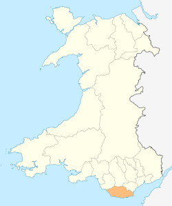
| Principal area | Vale of Glamorgan |
|---|---|
| Ceremonial county | South Glamorgan |
| Country | Wales |
| Sovereign state | United Kingdom |
| Post town | Barry |
| Postcode district | CF62 |
| Dialling code | 01446 |
| Police | South Wales |
| Fire | South Wales |
| Ambulance | Welsh |
| EU Parliament | Wales |
| UK Parliament | Vale of Glamorgan |
| Welsh Assembly | Vale of Glamorgan |
|
|
Coordinates: 51°24′49″N 3°25′45″W / 51.413635°N 3.429112°W
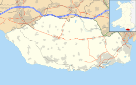
Eglwys Brewis is a village in the Vale of Glamorgan in south Wales. It is located just to the north of the village of St Athan, south of Flemingston and northeast of Llantwit Major.[1] Greenlands and St Mary Church lie to the north by road from Eglwys Brewis. The village primarily consists of residential estates which were originally built in the mid 20th century for service families stationed at nearby RAF St Athan. The estates are regularly used by driving instructors in the Vale of Glamorgan. Nant y Stepsau flows in the vicinity.
History
A Topographical Dictionary of The Dominion of Wales (1811) by Nicholas Carlisle said:
"EGLWYS BREWIS, in the Cwmwd of Maenor Glynn Ogwr, Cantref of Cron Nedd (now called the Hundred of Ogmore), County of GLAMORGAN, South Wales: a discharged Rectory, valued in the King's Books at £3..18..6 1/2: Patron, The Rev. Mr. Rickards: Church dedicated to St. Brise. The Resident Population of this Parish, in 1801, was 33. The Money raised by the Parish Rates, in 1803, was £37..19..0, at 2s. in the pound. It is 4 m. S. b. E. from Cowbridge. This Parish is all inclosed. According to the Diocesan Report, in 1809, the yearly value of this Benefice, arising from Tythes, was £73..16..4. "[2]
A Topographical Dictionary of Great Britain (1833) by John Gorton said:
"The EGLWYS BREWIS, co. Glamorgan, S.W. P. T. Cowbridge (173) 4 m. S E. Pop. 20. A very small parish in the Hundred of Cowbridge, situated upon the Bristol Channel; living, a dis. rectory in the diocese of St. David's and province of Canterbury; valued in P. R. 37/. 1!)*.; church ded.' to St. Bride; patron, — Rickards, Esq."[3]
Only a hamlet still in the early 20th century, Eglwys Brewis developed into a dormitory village with housing estates in the mid 20th century to accommodate for service families stationed at nearby RAF St Athan. Most of the houses on the estates surrounding the base were sold off.
Current
The two main areas of the village are sometimes referred to as the "Trees Estate" (northern housing estate) or West Camp/Bird's Estate (the west housing estate) due to ex-MOD sites in St Athan have a naming theme.
Streets in the Trees Estate (Northern Estate) include; Lime Grove, Chestnut Avenue, Picketstone Close, Elm Grove, Cedar Road, Sycamore Avenue and Ash Lane.
Streets in West Camp or the Bird's Estate include; Eagle Road, Wren Road, Partridge Road, Bullfinch Road, Blackbird Road, Magpie Road and Starling Road, Curlew Crescent, Kingfisher Square, Woodpecker Square and Rook Close.
There is also the near by East Camp with Explorer's names but this does not constitute part of the Eglwys Brewis village.
Notable landmarks
Eglwys Brewis contains the St Brise Parish Church of St. Brewis and Bethesda'r Fro Congregational Church. It contains one pub, Moonshine, formerly The Carpenter's Arms. The parish church, which became a Grade II listed building on May 18, 2002 is a small stone church dates to the 12th-13th century with 16th century windows. [4] It contains a square stone castellated bell-cot at the western end of the nave and a Norman tub font and inscriptions.[4] To the east is RAF St Athan Golf Club.

References
- ↑ Maps (Map). Google Maps.
- ↑ "Eglwys Brewis". GENUKI. Retrieved 12 May 2012.
- ↑ Gorton, John (1833). A topographical dictionary of Great Britain and Ireland: compiled from local information, and the most recent and official authorities. Chapman and Hall. p. 706. Retrieved 12 May 2012.
- 1 2 "Vale of Glamorgan County Treasures" (PDF). Vale of Glamorgan Council. Retrieved 12 May 2012.