Eggenfelden
| Eggenfelden | ||
|---|---|---|
|
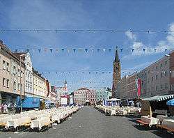
Town square | ||
| ||
 Eggenfelden | ||
Location of Eggenfelden within Rottal-Inn district  | ||
| Coordinates: 48°24′14″N 12°45′51″E / 48.40389°N 12.76417°ECoordinates: 48°24′14″N 12°45′51″E / 48.40389°N 12.76417°E | ||
| Country | Germany | |
| State | Bavaria | |
| Admin. region | Niederbayern | |
| District | Rottal-Inn | |
| Government | ||
| • Mayor | Werner Schießl (Freie Wählergruppe) | |
| Area | ||
| • Total | 44.50 km2 (17.18 sq mi) | |
| Population (2015-12-31)[1] | ||
| • Total | 13,456 | |
| • Density | 300/km2 (780/sq mi) | |
| Time zone | CET/CEST (UTC+1/+2) | |
| Postal codes | 84307 8330,8331 | |
| Dialling codes | 08721 | |
| Vehicle registration | PAN, EG, GRI, VIB | |
| Website | www.eggenfelden.de | |

Geography
Geographical location
Eggenfelden is located in the gentle valley of the Rott at the intersection of B 20 with the B 388 and the beginning of the B 588 . The city has two railway stations on the railway Passau - Neumarkt- Sankt Veit as well as an airfield (airfield Eggenfelden) . Eggenfelden is located about 56 km southeast of Landshut , 60 km south of Straubing , 70 km south-west of Passau , 84 kilometers north of Salzburg and 110 kilometers east of Munich.
Communal
The municipality Eggenfelden has 119 officially named Stadtteile:[2]
|
|
|
|
Notable people
- The ski mountaineer Konrad Lex was born in Eggenfelden.
- The German pop-singer and actor Daniel Küblböck who achieved short-lived celebrity in 2003, in the first season of Deutschland sucht den Superstar (DSDS), the German version of Pop Idol, in which he came third, was born outside of Eggenfelden and lived here until his breakthrough.
Personalities
Sons and daughters of the city
- Albert Hahl (1868-1945), German colonial officer and governor of German-New Guinea
- Richard Schimpf (1897-1972), officer of the German Army, the Reichswehr, the Wehrmacht and the Bundeswehr (last rank major general)
- Friedrich Müller (born 1938), legal scientist and author
- Joseph Vogl (born 1957), literary and media scientist
- Katrin Garfoot (born 1981), Australian cyclist
- Barbara Lechner (born 1982), shooting sports woman
Other people related to Eggenfelden
- Fritz Wiedemann (1891-1970), German officer, adjutant of Adolf Hitler and diplomat
- Daniel Küblböck (born 1985), DSDS participant and singer
References
External links
![]() Media related to Eggenfelden at Wikimedia Commons
Media related to Eggenfelden at Wikimedia Commons
This article is issued from Wikipedia - version of the 10/13/2016. The text is available under the Creative Commons Attribution/Share Alike but additional terms may apply for the media files.