Egge (range)
| Egge Hills (Eggegebirge) | |
|---|---|
 View from the Egge Tower on the Velmerstot looking south over the crest of the Egge Hills | |
| Highest point | |
| Peak | Preußische Velmerstot |
| Elevation | 468 m (1,535 ft) |
| Dimensions | |
| Length | 50 km (31 mi) |
| Geography | |
 | |
| Country | Germany |
| State/Province | Höxter, Paderborn, Lippe, North Rhine-Westphalia |
| Range coordinates | 51°44′N 8°58′E / 51.73°N 8.97°ECoordinates: 51°44′N 8°58′E / 51.73°N 8.97°E |
| Parent range | Teutoburg Forest / Egge Hills Nature Park |
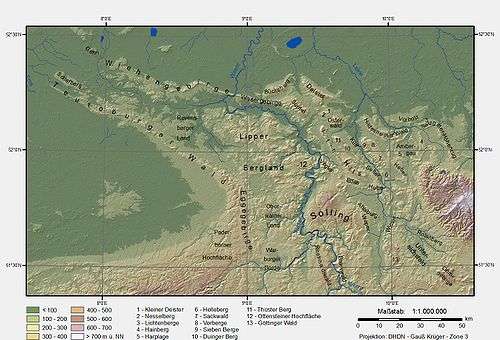
The Egge Hills (German: Eggegebirge), or just the Egge (die Egge) is a range of forested hills, up to 464 m above sea level (NN),[1] in the east of the German state of North Rhine-Westphalia.
Geography
The Egge extends from the southern tip of the Teutoburg Forest range near Horn-Bad Meinberg southwards to the northern parts of the Sauerland near Marsberg. Its highest point is the Preußischer Velmerstot at an altitude of 468m.
It also constitutes part of the watershed between the rivers Rhine and Weser.
References
External links
![]() Media related to Egge Hills at Wikimedia Commons
Media related to Egge Hills at Wikimedia Commons

This article is issued from Wikipedia - version of the 2/16/2016. The text is available under the Creative Commons Attribution/Share Alike but additional terms may apply for the media files.