Edwards, Mississippi
| Edwards, Mississippi | |
|---|---|
| Town | |
 Location of Edwards, Mississippi | |
 Edwards, Mississippi Location in the United States | |
| Coordinates: 32°19′51″N 90°36′15″W / 32.33083°N 90.60417°WCoordinates: 32°19′51″N 90°36′15″W / 32.33083°N 90.60417°W | |
| Country | United States |
| State | Mississippi |
| County | Hinds |
| Area | |
| • Total | 1.7 sq mi (4.3 km2) |
| • Land | 1.7 sq mi (4.3 km2) |
| • Water | 0.0 sq mi (0.0 km2) |
| Elevation | 236 ft (72 m) |
| Population (2000) | |
| • Total | 1,347 |
| • Density | 808.2/sq mi (312.1/km2) |
| Time zone | Central (CST) (UTC-6) |
| • Summer (DST) | CDT (UTC-5) |
| ZIP code | 39066 |
| Area code(s) | 601 |
| FIPS code | 28-21580 |
| GNIS feature ID | 0669683 |
Edwards is a town in Hinds County, Mississippi, United States. The population was 1,347 at the 2000 census. It is part of the Jackson Metropolitan Statistical Area.
History
Edwards is named for Dick Edwards, owner and proprietor of the Edwards House in Jackson, Mississippi.[1]
Edwards was originally named Amsterdam and settled in the 1830s. In 1832 it suffered from a cholera epidemic and was then bypassed by the Alabama and Vicksburg Rail Road. This happened in 1839 when R. O. Edwards plantation became a stop on the railroad known as Edwards Depot.
The depot was burned to prevent its use during the Civil War in 1863. The current site of Edwards was chosen in 1866 and was incorporated in 1871.
In 1882 the Southern Christian Institute was opened by the Christian Church (Disciples of Christ) in the town to educate African-Americans. It later became Bonner-Campbell College. In 1897 Edwards suffered an attack of yellow fever that killed many residents of the town.[2]
Geography
Edwards is located at 32°19′51″N 90°36′15″W / 32.33083°N 90.60417°W (32.330942, -90.604091).[3]
According to the United States Census Bureau, the town has a total area of 1.7 square miles (4.4 km2), all land.
Demographics
| Historical population | |||
|---|---|---|---|
| Census | Pop. | %± | |
| 1900 | 586 | — | |
| 1910 | 589 | 0.5% | |
| 1920 | 727 | 23.4% | |
| 1930 | 456 | −37.3% | |
| 1940 | 1,110 | 143.4% | |
| 1950 | 1,002 | −9.7% | |
| 1960 | 1,206 | 20.4% | |
| 1970 | 1,236 | 2.5% | |
| 1980 | 1,515 | 22.6% | |
| 1990 | 1,279 | −15.6% | |
| 2000 | 1,347 | 5.3% | |
| 2010 | 1,034 | −23.2% | |
| Est. 2015 | 1,019 | [4] | −1.5% |
As of the census[6] of 2000, there were 1,347 people, 461 households, and 335 families residing in the town. The population density was 808.2 people per square mile (311.4/km²). There were 505 housing units at an average density of 303.0 per square mile (116.8/km²). The racial makeup of the town was 78.92% African American, 20.19% White, 0.15% Asian, 0.07% from other races, and 0.67% from two or more races. Hispanic or Latino of any race were 0.97% of the population.
There were 461 households out of which 32.1% had children under the age of 18 living with them, 32.5% were married couples living together, 33.0% had a female householder with no husband present, and 27.3% were non-families. 23.0% of all households were made up of individuals and 10.2% had someone living alone who was 65 years of age or older. The average household size was 2.90 and the average family size was 3.47.
In the town the population was spread out with 29.6% under the age of 18, 9.0% from 18 to 24, 27.8% from 25 to 44, 21.1% from 45 to 64, and 12.5% who were 65 years of age or older. The median age was 34 years. For every 100 females there were 82.3 males. For every 100 females age 18 and over, there were 75.6 males.
The median income for a household in the town was $29,231, and the median income for a family was $31,786. Males had a median income of $26,094 versus $19,500 for females. The per capita income for the town was $12,308. About 19.0% of families and 22.5% of the population were below the poverty line, including 32.4% of those under age 18 and 18.7% of those age 65 or over.
Education
The Town of Edwards is served by the Hinds County School District.
Notable people
- Betty Currie - Personal secretary of Bill Clinton, moved to Waukegan, Illinois as a child.
- Otis Harris - Track & field athlete, won gold and silver medals at the 2004 Summer Olympics.
- George W. Lee - A vice-president of the Regional Council of Negro Leadership.
- Charlie Patton - Blues musician.
- Norman Francis Vandivier - Aviator.
- Johnny Fuller - Blues and Rock 'n' roll musician
References
- ↑ Gannett, Henry (1905). The Origin of Certain Place Names in the United States. Govt. Print. Off. p. 115.
- ↑ Town of Edwards, Mississippi
- ↑ "US Gazetteer files: 2010, 2000, and 1990". United States Census Bureau. 2011-02-12. Retrieved 2011-04-23.
- ↑ "Annual Estimates of the Resident Population for Incorporated Places: April 1, 2010 to July 1, 2015". Retrieved July 2, 2016.
- ↑ "Census of Population and Housing". Census.gov. Retrieved June 4, 2015.
- ↑ "American FactFinder". United States Census Bureau. Retrieved 2008-01-31.
Municipalities and communities of Hinds County, Mississippi, United States | ||
|---|---|---|
| Cities | 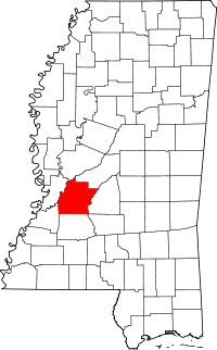 | |
| Towns | ||
| Unincorporated communities | ||
| Footnotes | ‡ This populated place also has portions in an adjacent county or counties | |