Easton, Missouri
| Easton, Missouri | |
|---|---|
| City | |
 Location of Easton, Missouri | |
| Coordinates: 39°43′22″N 94°38′23″W / 39.72278°N 94.63972°WCoordinates: 39°43′22″N 94°38′23″W / 39.72278°N 94.63972°W | |
| Country | United States |
| State | Missouri |
| County | Buchanan |
| Area[1] | |
| • Total | 0.58 sq mi (1.50 km2) |
| • Land | 0.58 sq mi (1.50 km2) |
| • Water | 0 sq mi (0 km2) |
| Elevation | 922 ft (281 m) |
| Population (2010)[2] | |
| • Total | 234 |
| • Estimate (2012[3]) | 238 |
| • Density | 403.4/sq mi (155.8/km2) |
| Time zone | Central (CST) (UTC-6) |
| • Summer (DST) | CDT (UTC-5) |
| ZIP code | 64443 |
| Area code(s) | 816 |
| FIPS code | 29-21034[4] |
| GNIS feature ID | 0717362[5] |
Easton is a city in Buchanan County, Missouri, United States. The population was 234 at the 2010 census. It is part of the St. Joseph, MO–KS Metropolitan Statistical Area.
History
Easton was platted in 1854.[6] The name Easton may be directional, for the communitity lies east of St. Joseph.[7] A post office called Easton has been in operation since 1855.[8]
Geography
Easton is located at 39°43′22″N 94°38′23″W / 39.72278°N 94.63972°W (39.722644, -94.639783).[9]
According to the United States Census Bureau, the city has a total area of 0.58 square miles (1.50 km2), all of it land.[1]
State Highway 31 runs North/South through the center of town and is used primarily as a link between US Hwy 36 to the North and US Hwy 169 to the South. The speed limit is enforced aggressively on Hwy 31 in the same fashion as Macks Creek, Missouri and Randolph, Missouri for a major source of the small community's income.
Demographics
| Historical population | |||
|---|---|---|---|
| Census | Pop. | %± | |
| 1870 | 318 | — | |
| 1880 | 201 | −36.8% | |
| 1900 | 227 | — | |
| 1910 | 225 | −0.9% | |
| 1920 | 206 | −8.4% | |
| 1930 | 214 | 3.9% | |
| 1940 | 203 | −5.1% | |
| 1950 | 173 | −14.8% | |
| 1960 | 198 | 14.5% | |
| 1970 | 183 | −7.6% | |
| 1980 | 313 | 71.0% | |
| 1990 | 232 | −25.9% | |
| 2000 | 258 | 11.2% | |
| 2010 | 234 | −9.3% | |
| Est. 2015 | 238 | [10] | 1.7% |
2010 census
As of the census[2] of 2010, there were 234 people, 103 households, and 67 families residing in the city. The population density was 403.4 inhabitants per square mile (155.8/km2). There were 110 housing units at an average density of 189.7 per square mile (73.2/km2). The racial makeup of the city was 95.3% White, 1.3% Native American, 0.4% Asian, and 3.0% from two or more races. Hispanic or Latino of any race were 4.7% of the population.
There were 103 households of which 25.2% had children under the age of 18 living with them, 49.5% were married couples living together, 10.7% had a female householder with no husband present, 4.9% had a male householder with no wife present, and 35.0% were non-families. 34.0% of all households were made up of individuals and 13.6% had someone living alone who was 65 years of age or older. The average household size was 2.27 and the average family size was 2.90.
The median age in the city was 45.7 years. 16.7% of residents were under the age of 18; 12.8% were between the ages of 18 and 24; 18.3% were from 25 to 44; 37.2% were from 45 to 64; and 15% were 65 years of age or older. The gender makeup of the city was 49.6% male and 50.4% female.
2000 census
As of the census[4] of 2000, there were 258 people, 104 households, and 66 families residing in the city. The population density was 426.3 people per square mile (163.3/km²). There were 107 housing units at an average density of 176.8 per square mile (67.7/km²). The racial makeup of the city was 93.80% White, 0.39% Native American, 0.39% Asian, and 5.43% from two or more races. Hispanic or Latino of any race were 3.88% of the population.
There were 104 households out of which 37.5% had children under the age of 18 living with them, 51.9% were married couples living together, 7.7% had a female householder with no husband present, and 36.5% were non-families. 34.6% of all households were made up of individuals and 14.4% had someone living alone who was 65 years of age or older. The average household size was 2.48 and the average family size was 3.26.
In the city the population was spread out with 29.5% under the age of 18, 5.0% from 18 to 24, 30.6% from 25 to 44, 24.0% from 45 to 64, and 10.9% who were 65 years of age or older. The median age was 36 years. For every 100 females there were 95.5 males. For every 100 females age 18 and over, there were 97.8 males.
The median income for a household in the city was $45,750, and the median income for a family was $50,000. Males had a median income of $33,125 versus $21,250 for females. The per capita income for the city was $14,865. About 4.8% of families and 4.8% of the population were below the poverty line, including 5.5% of those under the age of eighteen and none of those sixty five or over.
Notable residents
Easton is the birthplace of legendary college basketball coach Henry Iba, who coached Oklahoma State (then known as Oklahoma A&M) to consecutive NCAA titles in 1945 and 1946, becoming the first two-time winning coach in the NCAA tournament.
Easton is the home of D-II All-American runner, and the 2004 Missouri NCAA Woman of the year, Kate Hamera.
References
- 1 2 "US Gazetteer files 2010". United States Census Bureau. Retrieved 2012-07-08.
- 1 2 "American FactFinder". United States Census Bureau. Retrieved 2012-07-08.
- ↑ "Population Estimates". United States Census Bureau. Retrieved 2013-05-30.
- 1 2 "American FactFinder". United States Census Bureau. Retrieved 2008-01-31.
- ↑ "US Board on Geographic Names". United States Geological Survey. 2007-10-25. Retrieved 2008-01-31.
- ↑ Eaton, David Wolfe (1916). How Missouri Counties, Towns and Streams Were Named. The State Historical Society of Missouri. p. 264.
- ↑ "Buchanan County Place Names, 1928–1945 (archived)". The State Historical Society of Missouri. Retrieved 4 September 2016.
- ↑ "Post Offices". Jim Forte Postal History. Retrieved 1 September 2016.
- ↑ "US Gazetteer files: 2010, 2000, and 1990". United States Census Bureau. 2011-02-12. Retrieved 2011-04-23.
- ↑ "Annual Estimates of the Resident Population for Incorporated Places: April 1, 2010 to July 1, 2015". Retrieved July 2, 2016.
- ↑ "Census of Population and Housing". Census.gov. Retrieved June 4, 2015.
Municipalities and communities of Buchanan County, Missouri, United States | ||
|---|---|---|
| Cities | 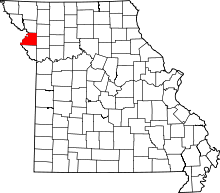 | |
| Villages | ||
| Townships | ||
| Unincorporated communities | ||
| Footnotes | ‡This populated place also has portions in an adjacent county or counties | |